Vine, Vojnik: Difference between revisions
Appearance
Content deleted Content added
v → ʋ |
JJMC89 bot (talk | contribs) Migrate {{Infobox settlement}} coordinates parameters to {{Coord}}, see Wikipedia:Coordinates in infoboxes |
||
| Line 31: | Line 31: | ||
|pushpin_label_position = bottom |
|pushpin_label_position = bottom |
||
|pushpin_map_caption = Location in Slovenia |
|pushpin_map_caption = Location in Slovenia |
||
|coordinates_display = inline,title |
|||
|coordinates_region = SI |
|||
|subdivision_type = Country |
|subdivision_type = Country |
||
|subdivision_name = [[Image:Flag of Slovenia.svg|25px]] [[Slovenia]] |
|subdivision_name = [[Image:Flag of Slovenia.svg|25px]] [[Slovenia]] |
||
| Line 97: | Line 95: | ||
|timezone_DST = |
|timezone_DST = |
||
|utc_offset_DST = |
|utc_offset_DST = |
||
|coordinates = {{coord|46|19|50.36|N|15|14|46.55|E|region:SI|display=inline,title}} |
|||
|latd= 46|latm=19 |lats=50.36 |latNS=N |
|||
|longd=15|longm= 14|longs=46.55 |longEW=E |
|||
|elevation_footnotes = |
|elevation_footnotes = |
||
|elevation_m = 429 |
|elevation_m = 429 |
||
Revision as of 16:38, 22 March 2017
Vine | |
|---|---|
| Coordinates: 46°19′50.36″N 15°14′46.55″E / 46.3306556°N 15.2462639°E | |
| Country | |
| Traditional region | Styria |
| Statistical region | Savinja |
| Municipality | Vojnik |
| Area | |
• Total | 0.84 km2 (0.32 sq mi) |
| Elevation | 429 m (1,407 ft) |
| Population (2002) | |
• Total | 76 |
| [1] | |
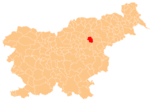
Vine (Template:IPA-sl) is a settlement in the Municipality of Vojnik in eastern Slovenia. It lies in the hills northwest of Nova Cerkev. The area was traditionally part of the Styria region. It is now included with the rest of the municipality in the Savinja Statistical Region.[2]
References
External links


