Duero, Bohol: Difference between revisions
Appearance
Content deleted Content added
Mary McAllen (talk | contribs) update wikidata; add income and electorate |
m Reverted edits by Mary McAllen (talk) to last version by Frietjes |
||
| Line 1: | Line 1: | ||
{{Infobox settlement |
{{Infobox settlement |
||
| name = Duero |
| name = Duero |
||
| settlement_type = |
| settlement_type = [[Municipalities of the Philippines|Municipality]] |
||
| image_skyline = |
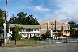
| image_skyline = Duero Bohol 2.JPG |
||
| image_caption = |
| image_caption = |
||
| image_flag = {{PH wikidata|image_flag}} |
| image_flag = {{PH wikidata|image_flag}} |
||
| flag_size = 120x80px |
| flag_size = 120x80px |
||
| Line 9: | Line 9: | ||
| image_seal = {{PH wikidata|image_seal}} |
| image_seal = {{PH wikidata|image_seal}} |
||
| seal_size = 100x80px |
| seal_size = 100x80px |
||
| nickname = |
|||
| motto = {{PH wikidata|motto}} |
| motto = {{PH wikidata|motto}} |
||
| image_map = {{PH wikidata|image_map}} |
| image_map = {{PH wikidata|image_map}} |
||
| Line 18: | Line 19: | ||
| coordinates_display = it |
| coordinates_display = it |
||
| coordinates_format = dms |
| coordinates_format = dms |
||
| coordinates_region = |
| coordinates_region = PH-BOH |
||
| subdivision_type = [[List of sovereign states|Country]] |
| subdivision_type = [[List of sovereign states|Country]] |
||
| subdivision_name = {{PH wikidata|country}} |
| subdivision_name = {{PH wikidata|country}} |
||
| Line 32: | Line 33: | ||
| parts = 21 (see § [[#Barangays|Barangays]]) |
| parts = 21 (see § [[#Barangays|Barangays]]) |
||
| government_type = {{PH wikidata|government_type}} |
| government_type = {{PH wikidata|government_type}} |
||
| government_footnotes = |
| government_footnotes = <ref name=boholgov/> |
||
| leader_party = [[Liberal Party (Philippines)|LP]] |
| leader_party = [[Liberal Party (Philippines)|LP]] |
||
| leader_title = {{PH wikidata|leader_title}} |
| leader_title = {{PH wikidata|leader_title}} |
||
| Line 49: | Line 50: | ||
| Hernes Bajao |
| Hernes Bajao |
||
}} |
}} |
||
| ⚫ | |||
| area_total_km2 = 88.90 |
| area_total_km2 = 88.90 |
||
| area_footnotes = {{PSGC detail|nscb}} |
|||
| elevation_footnotes = |
| elevation_footnotes = |
||
| elevation_m = |
| elevation_m = |
||
| |
| population_footnotes = {{PH census|current}} |
||
| |
| population_total = {{PH wikidata|population_total}} |
||
| ⚫ | |||
| population_density_km2 = auto |
| population_density_km2 = auto |
||
| population_blank1_title = |
| population_blank1_title = Languages |
||
| population_blank1 = {{PH wikidata|electorate}} |
|||
| ⚫ | |||
| population_blank2_title = Language |
|||
| population_blank2 = {{PH wikidata|language}} |
|||
| population_demonym = |
|||
| population_note = |
| population_note = |
||
| |
| population_demonym = {{PH wikidata|demonym}} |
||
| timezone = [[Philippine Standard Time|PST]] |
| timezone = [[Philippine Standard Time|PST]] |
||
| utc_offset = +8 |
| utc_offset = +8 |
||
| Line 69: | Line 68: | ||
| area_code_type = {{areacodestyle}} |
| area_code_type = {{areacodestyle}} |
||
| area_code = {{PH wikidata|area_code}} |
| area_code = {{PH wikidata|area_code}} |
||
| blank_name_sec1 = |
| blank_name_sec1 = [[Municipalities of the Philippines#Income classification|Income class]] |
||
| blank_info_sec1 = |
| blank_info_sec1 = 5th class |
||
| blank1_name_sec1 = {{PSGCstyle}} |
| blank1_name_sec1 = {{PSGCstyle}} |
||
| blank1_info_sec1 = {{PSGC detail}} |
| blank1_info_sec1 = {{PSGC detail}} |
||
| blank2_name_sec1 = [[ICAO]] |
|||
| ⚫ | |||
| blank3_name_sec1 = [[IATA]] |
|||
| blank3_info_sec1 = {{PH wikidata|iata}} |
|||
| blank2_name_sec2 = Patron Saint <!-- Patron saint --> |
|||
| blank2_info_sec2 = {{PH wikidata|patron_saint}} |
|||
| website = {{PH wikidata|website}} |
| website = {{PH wikidata|website}} |
||
| footnotes = |
| footnotes = |
||
}} |
}} |
||
'''Duero''' is a |
'''Duero''' is a fifth income class [[Philippine municipality|municipality]] in the [[Philippine province|province]] of {{PH wikidata|province}}, [[Philippines]]. According to the {{PH wikidata|population_as_of}}, it has a population of {{PH wikidata|population_total}}.{{PH census|current}} It may have been named after the [[Douro|Duero River]] in the [[Iberian peninsula]]. |
||
Roman Catholicism was introduced to the town in 1860 by a Spanish priest. Duero was established as a municipality two years later, and a convent was constructed in 1868.<ref name=boholgov/> |
Roman Catholicism was introduced to the town in 1860 by a Spanish priest. Duero was established as a municipality two years later, and a convent was constructed in 1868.<ref name=boholgov/> |
||
==Barangays== |
==Barangays== |
||
| ⚫ | |||
| ⚫ | |||
| ⚫ | |||
| ⚫ | |||
* Alejawan |
* Alejawan |
||
* Angilan |
* Angilan |
||
| Line 116: | Line 108: | ||
==Demographics== |
==Demographics== |
||
| ⚫ | |||
| ⚫ | |||
| width={{#expr:{{max|{{str len|Population census of Duero}}|20}} * 0.750 *.88}}em |
|||
| title = Population census of Duero |
| title = Population census of Duero |
||
| 1990 = 14242 |
| 1990 = 14242 |
||
| Line 127: | Line 117: | ||
| footnote = Source: National Statistics Office{{PH census|2010}}{{PH census|2007}} |
| footnote = Source: National Statistics Office{{PH census|2010}}{{PH census|2007}} |
||
}} |
}} |
||
{{PH electorate|{{PH wikidata|electorate}}|long}} |
|||
{{clear left}} |
|||
==Images== |
==Images== |
||
<gallery mode=packed heights=136px> |
<gallery mode=packed-hover heights=136px> |
||
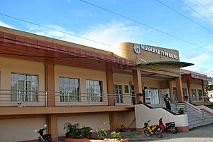
Duero Bohol 3.JPG|Duero town hall |
Duero Bohol 3.JPG|Duero town hall |
||
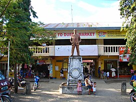
Duero Bohol 1.JPG|Public market |
Duero Bohol 1.JPG|Public market |
||
| Line 137: | Line 126: | ||
==References== |
==References== |
||
| ⚫ | |||
| ⚫ | |||
| ⚫ | |||
| ⚫ | |||
}} |
|||
| ⚫ | |||
==External links== |
==External links== |
||
{{Commons category}} |
|||
{{Commons category|{{PH wikidata|commons}}|Duero|position=left}} |
|||
* [http://www.bohol.gov.ph/duero.html Municipality of Duero] |
* [http://www.bohol.gov.ph/duero.html Municipality of Duero] |
||
| Line 160: | Line 145: | ||
[[Category:Municipalities of Bohol]] |
[[Category:Municipalities of Bohol]] |
||
[[Category:1862 establishments in the Philippines]] |
[[Category:1862 establishments in the Philippines]] |
||
{{CVisayas-geo-stub}} |
{{CVisayas-geo-stub}} |
||
Revision as of 13:19, 20 April 2016
Duero | |
|---|---|
 | |
 Map of Bohol with Duero highlighted | |
| Country | Philippines |
| Region | Central Visayas (Region VII) |
| Province | Bohol |
| District | 3rd district of Bohol |
| Founded | 1862 |
| Barangay | 21 (see § Barangays) |
| Government | |
| • Type | Sangguniang Bayan |
| • mayor of Duero[*] | Conrada Amparo (LP) |
| • Vice mayor of Duero | Ronald Felisilda |
| • Municipal Council | Members |
| Area | |
• Total | 88.90 km2 (34.32 sq mi) |
| Population (2020 census)[2] | |
• Total | 18,861 |
| • Density | 210/km2 (550/sq mi) |
| • Languages | Boholano (Binisaya) |
| Time zone | UTC+8 (PST) |
| ZIP code | 6309 |
| IDD : area code | +63 (0)38 |
| Income class | 5th class |
| PSGC | 071221000 |
Duero is a fifth income class municipality in the province of Bohol, Philippines. According to the 2020 census, it has a population of 18,861.[2] It may have been named after the Duero River in the Iberian peninsula.
Roman Catholicism was introduced to the town in 1860 by a Spanish priest. Duero was established as a municipality two years later, and a convent was constructed in 1868.[1]
Barangays
Duero is divided into 21 barangays:
- Alejawan
- Angilan
- Anibongan
- Bangwalog
- Cansuhay
- Danao
- Duay
- Guinsularan
- Itum
- Langkis
- Lobogon
- Madua Norte
- Madua Sur
- Mambool
- Mawi
- Payao
- San Antonio (Poblacion)
- San Isidro
- San Pedro
- Imelda
- Taytay
Demographics
| Year | Pop. | ±% p.a. |
|---|---|---|
| 1990 | 14,242 | — |
| 1995 | 14,299 | +0.07% |
| 2000 | 16,485 | +3.10% |
| 2007 | 17,254 | +0.63% |
| 2010 | 17,580 | +0.68% |
| Source: National Statistics Office[3][4] | ||
Images
-
Duero town hall
-
Public market
-
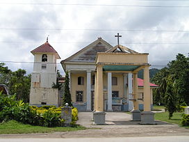
Church
References
- ^ a b c "Municipality of Duero". Retrieved 30 January 2015.
- ^ a b Census of Population (2020). "Region VII (Central Visayas)". Total Population by Province, City, Municipality and Barangay. Philippine Statistics Authority. Retrieved 8 July 2021.
- ^ Census of Population and Housing (2010). "Region VII (Central Visayas)" (PDF). Total Population by Province, City, Municipality and Barangay. National Statistics Office. Retrieved 29 June 2016.
- ^ Censuses of Population (1903–2007). "Region VII (Central Visayas)". Table 1. Population Enumerated in Various Censuses by Province/Highly Urbanized City: 1903 to 2007. National Statistics Office.
External links
Wikimedia Commons has media related to Duero, Bohol.


