Bujari: Difference between revisions
Appearance
Content deleted Content added
No edit summary |
JJMC89 bot (talk | contribs) Migrate {{Infobox settlement}} coordinates parameters to {{Coord}}, see Wikipedia:Coordinates in infoboxes |
||
| Line 37: | Line 37: | ||
|pushpin_map_caption =Location in Brazil |
|pushpin_map_caption =Location in Brazil |
||
<!-- Location ------------------> |
<!-- Location ------------------> |
||
|coordinates_region = BR |
|||
|subdivision_type = Country |
|subdivision_type = Country |
||
|subdivision_name = [[Image:Flag of Brazil.svg|25px]] [[Brazil]] |
|subdivision_name = [[Image:Flag of Brazil.svg|25px]] [[Brazil]] |
||
| Line 109: | Line 108: | ||
|timezone_DST = |
|timezone_DST = |
||
|utc_offset_DST = |
|utc_offset_DST = |
||
|coordinates = {{coord|9|49|51|S|67|57|07|W|region:BR|display=inline}} |
|||
|latd=9|latm=49 |lats=51|latNS=S |
|||
|longd=67|longm=57 |longs=07|longEW=W |
|||
|elevation_footnotes = <!--for references: use <ref> </ref> tags--> |
|elevation_footnotes = <!--for references: use <ref> </ref> tags--> |
||
|elevation_m = |
|elevation_m = |
||
Revision as of 10:04, 14 March 2017
09°49′51″S 67°57′07″W / 9.83083°S 67.95194°W
Bujari | |
|---|---|
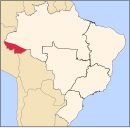
 Bujari - Acre | |
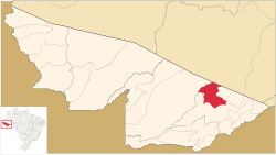
 Location of municipality in Acre State | |
| Coordinates: 9°49′51″S 67°57′07″W / 9.83083°S 67.95194°W | |
| Country | |
| State | Acre |
| Area | |
• Total | 1,339 sq mi (3,468 km2) |
| Population (2007) | |
• Total | 6,543 |
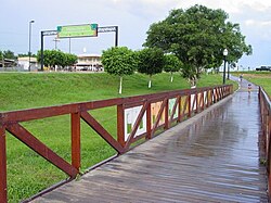
Bujari is a municipality located in the northeast of the Brazilian state of Acre. Its population is 6543 and its area is 3,468 km².
The municipality contains about 73% of the 46,064 hectares (113,830 acres) Antimary State Forest, a sustainable use conservation unit established in 1997.[1]
References
- ^ FES do Antimary (in Portuguese), ISA:Instituto Socioambiental, retrieved 2016-07-02

