Druogno: Difference between revisions
Appearance
Content deleted Content added
Automatically generated article about Italian municipality, using data from it.wikipedia.org |
m robot Adding: de, eo, fr, nap, nl, pl, pt |
||
| Line 110: | Line 110: | ||
[[Category:Cities and towns in Piedmont]] |
[[Category:Cities and towns in Piedmont]] |
||
{{Verbania-geo-stub}} |
{{Verbania-geo-stub}} |
||
[[de:Druogno]] |
|||
[[eo:Druogno]] |
|||
[[fr:Druogno]] |
|||
[[it:Druogno]] |
[[it:Druogno]] |
||
[[nl:Druogno]] |
|||
[[nap:Druogno]] |
|||
[[pl:Druogno]] |
|||
[[pt:Druogno]] |
|||
Revision as of 23:06, 28 September 2006
Druogno | |
|---|---|
| Comune di Druogno | |
| Coordinates: 46°8′N 8°28′E / 46.133°N 8.467°E | |
| Country | Italy |
| Region | Piedmont |
| Province | Province of Verbano-Cusio-Ossola (VB) |
| Area | |
• Total | 29.61 km2 (11.43 sq mi) |
| Population (Dec. 2004)[2] | |
• Total | 1,032 |
| Time zone | UTC+1 (CET) |
| • Summer (DST) | UTC+2 (CEST) |
| Postal code | 28030 |
| Dialing code | 0324 |
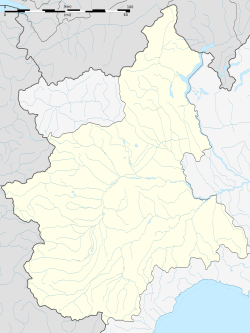
Druogno is a comune (municipality) in the Province of Verbano-Cusio-Ossola in the Italian region Piedmont, located about 130 km northeast of Turin and about 25 km north of Verbania. As of 31 December 2004, it had a population of 955 and an area of 29.0 km2.[3]
Druogno borders the following municipalities: Masera, Santa Maria Maggiore, Trontano.
Demographic evolution

References
- ^ "Superficie di Comuni Province e Regioni italiane al 9 ottobre 2011". Italian National Institute of Statistics. Retrieved 16 March 2019.
- ^ "Popolazione Residente al 1° Gennaio 2018". Italian National Institute of Statistics. Retrieved 16 March 2019.
- ^ All demographics and other statistics: Italian statistical institute Istat.


