Uppalaguptam: Difference between revisions
Appearance
Content deleted Content added
Counties like India needn't to be linked Tags: Mobile edit Mobile app edit |
JJMC89 bot (talk | contribs) Migrate {{Infobox settlement}} coordinates parameters to {{Coord}}, see Wikipedia:Coordinates in infoboxes |
||
| Line 13: | Line 13: | ||
| pushpin_map_alt = |
| pushpin_map_alt = |
||
| pushpin_map_caption = Location in Andhra Pradesh, India |
| pushpin_map_caption = Location in Andhra Pradesh, India |
||
| |
| coordinates = {{coord|16.5667|N|82.1000|E|display=inline,title}} |
||
| latm = |
|||
| lats = |
|||
| latNS = N |
|||
| longd = 82.1000 |
|||
| longm = |
|||
| longs = |
|||
| longEW = E |
|||
| coordinates_display = inline,title |
|||
| subdivision_type = Country |
| subdivision_type = Country |
||
| subdivision_name = {{flag|India}} |
| subdivision_name = {{flag|India}} |
||
Revision as of 06:14, 23 March 2017
Uppalaguptam
ఉప్పలగుప్తం | |
|---|---|
village | |
 | |
| Coordinates: 16°34′00″N 82°06′00″E / 16.5667°N 82.1000°E | |
| Country | |
| State | Andhra Pradesh |
| District | East Godavari |
| Talukas | Uppalaguptam |
| Elevation | 0 m (0 ft) |
| Languages | |
| • Official | Telugu |
| Time zone | UTC+5:30 (IST) |
| Vehicle registration | AP |
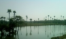
Uppala-guptam is a village in East Godavari district in the state of Andhra Pradesh in India.[1]
Geography
Uppalaguptam is located at .[2] It has an average elevation of 0 meters (3 feet).
References
- ^ "Mandal wise list of villages in Srikakulam district" (PDF). Chief Commissioner of Land Administration. National Informatics Centre. Archived from the original (PDF) on 21 January 2015. Retrieved 7 March 2016.
- ^ Falling Rain Genomics.Uppalaguptam


