Stražica, Vojnik: Difference between revisions
Appearance
Content deleted Content added
JJMC89 bot (talk | contribs) Migrate {{Infobox settlement}} coordinates parameters to {{Coord}}, see Wikipedia:Coordinates in infoboxes |
→External links: updated link |
||
| Line 115: | Line 115: | ||
==External links== |
==External links== |
||
*[ |
*[https://www.geopedia.world/#T12_L362_F2473:1518_x1704131.6530407304_y5833471.6774665145_s15_b2345 Stražica on Geopedia] |
||
{{Vojnik}} |
{{Vojnik}} |
||
Revision as of 03:06, 30 August 2023
Stražica | |
|---|---|
| Coordinates: 46°19′51.44″N 15°18′26.32″E / 46.3309556°N 15.3073111°E | |
| Country | |
| Traditional region | Styria |
| Statistical region | Savinja |
| Municipality | Vojnik |
| Area | |
• Total | 1.02 km2 (0.39 sq mi) |
| Elevation | 427.3 m (1,401.9 ft) |
| Population (2002) | |
• Total | 158 |
| [1] | |
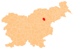
Stražica (pronounced [ˈstɾaːʒitsa]) is a settlement in the Municipality of Vojnik in eastern Slovenia. It lies in the hills northwest of Frankolovo off the main road from Vojnik to Slovenske Konjice. The area is part of the traditional region of Styria. It is now included with the rest of the municipality in the Savinja Statistical Region.[2]
References
External links


