Krishnarampur: Difference between revisions
Appearance
Content deleted Content added
rm non-English unref ("by Virus") |
Chandan Guha (talk | contribs) Removed Indic script as per Wikipedia:INDICSCRIPT policy |
||
| Line 3: | Line 3: | ||
{{Infobox settlement |
{{Infobox settlement |
||
| name = Krishnarampur |
| name = Krishnarampur |
||
| native_name = |
| native_name = |
||
| native_name_lang = |
| native_name_lang = |
||
| other_name = |
| other_name = |
||
| nickname = |
| nickname = |
||
| Line 21: | Line 21: | ||
| subdivision_name1 = [[West Bengal]] |
| subdivision_name1 = [[West Bengal]] |
||
| subdivision_type2 = [[List of districts of India|District]] |
| subdivision_type2 = [[List of districts of India|District]] |
||
| subdivision_name2 = [[Hooghly |
| subdivision_name2 = [[Hooghly district|Hooghly]] |
||
| established_title = <!-- Established --> |
| established_title = <!-- Established --> |
||
| established_date = |
| established_date = |
||
| Line 57: | Line 57: | ||
| iso_code = [[ISO 3166-2:IN|IN-WB]] |
| iso_code = [[ISO 3166-2:IN|IN-WB]] |
||
| footnotes = |
| footnotes = |
||
}} |
}} |
||
''' Krishnarampur ''' |
''' Krishnarampur ''' is a [[village]] and a [[gram panchayat]] in [[Chanditala I]] community development block in [[Srirampore subdivision]] of [[Hooghly district]] in the state of [[West Bengal]], India. It is under [[Chanditala]] police station.<ref>{{cite web|url= http://banglarbhumi.gov.in/banglarbhumi/(S(34prhyngb4rxzrx25wan0tst))/ASP%20PAGES/info_block.aspx?distcode=06&bcode=10 |title= banglarbhumi.gov.in | mouza information = |publisher= WEST BENGAL ->HUGLI(হুগলী) ->CHANDITALA-I (চণ্ডীতলা-১) Mouza Information }}</ref> |
||
==Geography== |
==Geography== |
||
Krishnarampur is located at |
Krishnarampur is located at {{coord|22.721831|N|88.216765|E| source:itwiki_region:IN}}. |
||
==References== |
==References== |
||
| Line 71: | Line 70: | ||
[[Category:Towns & Villages in Chanditala–I block]] |
[[Category:Towns & Villages in Chanditala–I block]] |
||
[[Category:Villages in Hooghly district]] |
[[Category:Villages in Hooghly district]] |
||
{{WestBengal-geo-stub}} |
{{WestBengal-geo-stub}} |
||
Revision as of 01:37, 10 October 2018
Krishnarampur | |
|---|---|
Village | |
 | |
| Coordinates: 22°43′19″N 88°13′00″E / 22.721831°N 88.216765°E | |
| Country india | |
| State | West Bengal |
| District | Hooghly |
| Government | |
| • Type | Panchayati raj (India) |
| • Body | [village] |
| Population (2011) | |
• Total | 10,044 |
| Languages | |
| • Official | Bengali, English |
| Time zone | UTC+5:30 (IST) |
| ISO 3166 code | IN-WB |
| Vehicle registration | WB |
| Lok Sabha constituency | Serampore |
| Vidhan Sabha constituency | Chanditala |
| Website | wb |
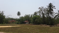
Krishnarampur is a village and a gram panchayat in Chanditala I community development block in Srirampore subdivision of Hooghly district in the state of West Bengal, India. It is under Chanditala police station.[1]
Geography
Krishnarampur is located at 22°43′19″N 88°13′00″E / 22.721831°N 88.216765°E.
References
- ^ "banglarbhumi.gov.in". WEST BENGAL ->HUGLI(হুগলী) ->CHANDITALA-I (চণ্ডীতলা-১) Mouza Information.
{{cite web}}: Cite has empty unknown parameter:|mouza information=(help)


