Tadipatri: Difference between revisions
Fixed typo Tags: canned edit summary Mobile edit Mobile web edit |
m spelling |
||
| Line 58: | Line 58: | ||
== Geography == |
== Geography == |
||
Tadipatri is located at {{Coord|14.92|N|78.02|E|}}.<ref>[http://www.fallingrain.com/world/IN/02/Tadpatri.html Falling Rain Genomics, Inc – Tadpatri]</ref> Its average elevation is 223 metres or 731 feet. Tadipatri lies on the southern bank of [[Penner River|Pennar River]]. Due to [[MPR Dam|Mid Pennar Dam]] constructed upstream, the section of river in Tadipatri is usually dry throughout the year. Tadipatri is rich in cement grade limestone deposits. The |
Tadipatri is located at {{Coord|14.92|N|78.02|E|}}.<ref>[http://www.fallingrain.com/world/IN/02/Tadpatri.html Falling Rain Genomics, Inc – Tadpatri]</ref> Its average elevation is 223 metres or 731 feet. Tadipatri lies on the southern bank of [[Penner River|Pennar River]]. Due to [[MPR Dam|Mid Pennar Dam]] constructed upstream, the section of river in Tadipatri is usually dry throughout the year. Tadipatri is rich in cement grade limestone deposits. The limestone reserves are extending in a triangle from Tadipatri in Anantapur district to Kamalapuram in Kadapa district and Bethamcherla in Kurnool district. |
||
The rocks in Tadipatri area are part of the Lower Cuddapah Supergroup. It consists of dolomite, limestone and shale.<ref>{{cite news |
The rocks in Tadipatri area are part of the Lower Cuddapah Supergroup. It consists of dolomite, limestone and shale.<ref>{{cite news |
||
Revision as of 12:52, 7 May 2019
Tadipatri | |
|---|---|
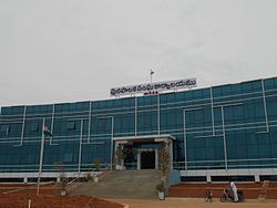
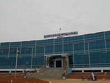
 Tadipatri Municipal Building | |
| Nickname: Tadpatri | |
| Coordinates: 14°55′N 78°01′E / 14.92°N 78.02°E | |
| Country | India |
| State | Andhra Pradesh |
| District | Anantapur |
| Area | |
• Total | 7.46 km2 (2.88 sq mi) |
| Elevation | 229 m (751 ft) |
| Population (2011)[1] | |
• Total | 108,171 |
| • Density | 15,000/km2 (38,000/sq mi) |
| Languages | |
| • Official | Telugu |
| Time zone | UTC+5:30 (IST) |
| PIN | 515411 |
| ISO 3166 code | IN-AP |
| Vehicle registration | AP - 02 |
| Website | tadipatri |
Tadipatri or Tadpatri is a town in Anantapur district of the Indian state of Andhra Pradesh. It is the mandal headquarters of Tadipatri mandal in Anantapur revenue division.[2] It is located at the border of Kurnool district and Kadapa district. The ancient world-famous Chintala Venkataramana Temple sprawling over five acre area is located in Tadipatri. From Tadipatri town at a distance of 1 kilometre, overlooking the Penna River, the Bugga Ramalingeswara Temple is located which is remarkable for a Lingam seated on a pedestal that is perpetually filled with water from a small spring.[3]
Etymology
This section is empty. You can help by adding to it. (January 2017) |
Geography
Tadipatri is located at 14°55′N 78°01′E / 14.92°N 78.02°E.[4] Its average elevation is 223 metres or 731 feet. Tadipatri lies on the southern bank of Pennar River. Due to Mid Pennar Dam constructed upstream, the section of river in Tadipatri is usually dry throughout the year. Tadipatri is rich in cement grade limestone deposits. The limestone reserves are extending in a triangle from Tadipatri in Anantapur district to Kamalapuram in Kadapa district and Bethamcherla in Kurnool district.
The rocks in Tadipatri area are part of the Lower Cuddapah Supergroup. It consists of dolomite, limestone and shale.[5]
Demographics
As of 2011[update] Census of India, Tadpatri had a population of 108,171.[1]
Governance
Civic Administration

Tadipatri municipality is the civic body of the city. It is a First grade municipality, constituted in the year 1920 and is spread over an area of 7.46 km2 (2.88 sq mi) and has 34 election wards.[6]
The municipality of the town oversees the civic needs like, water supply, sewage, garbage collection etc. It also implements strict ban on the use of plastic.[7] In 2015, S.Shiva Ram Krishna was awarded Green Leaf Awards 2015 in the category of Best Municipal Commissioner, which was organised by NGO Sukuki Exnora.[8]
Population
As of the 2001 India census,[9] Tadipatri had a population of 86,641. Males constitute 51% of the population and females 49%. Tadipatri has an average literacy rate of 56%, lower than the national average of 59.5%: male literacy is 67%, and female literacy is 44%. In Tadipatri, 13% of the population is under 6 years of age.
Economy
On 10 September 1976, an industrial estate was established under APIIC in 9.09 acres (3.68 ha).[10]
Transport


The Andhra Pradesh State Road Transport Corporation operates bus services from Tadipatri bus station.[11] State Highway 30 passes through Tadipatri, which connects Anantapur and Bugga.[12] Tadipatri railway station is classified as a D–category station in the Guntakal railway division of South Central Railway zone.[13]
Culture
Art and architecture
Some of the finest carvings of the early Vijayanagara period are from Tadipatri, a treasure-house of fine Vijayanagara sculpture.[14]
Education
The primary and secondary school education is imparted by government, aided and private schools, under the School Education Department of the state.[15][16] The medium of instruction followed by different schools are English, Telugu
Notable personalities
- Moola Narayana Swamy – He founded Vauhini Studios, which was supposed to be the largest cine studio in Asia during 1940's.
- Kadiri Venkata Reddy (K.V.Reddy) - A prominent film director that had films like Bhakta Potana, Yogi Vemana, Patala Bhairavi and Maya Bazaar.
See also
References
- ^ a b c "Municipalities, Municipal Corporations & UDAs" (PDF). Directorate of Town and Country Planning. Government of Andhra Pradesh. Archived from the original (PDF) on 7 June 2016. Retrieved 29 January 2016.
- ^ "Anantapur District Mandals" (PDF). Census of India. p. 378. Retrieved 6 June 2017.
- ^ http://www.anantapuramu.ap.gov.in/touristPlacesReport.apo
- ^ Falling Rain Genomics, Inc – Tadpatri
- ^ "Geological Excursion to Belum Caves & adjoining places, Kurnool District, Andhra Pradesh, India" (PDF). P.R.C Phani, Earth Science India. Andhra Pradesh, India. 1999.
- ^ "Municipalities, Municipal Corporations & UDAs" (PDF). Directorate of Town and Country Planning. Government of Andhra Pradesh. Retrieved 23 June 2016.
- ^ "Tadipatri sets a real example". The Hindu. Andhra Pradesh, India. 25 March 2006.
- ^ "TS and AP NGOs sweep Green Leaf awards". The Hans India. 8 June 2015. Retrieved 13 March 2016.
- ^ "Census of India 2001: Data from the 2001 Census, including cities, villages and towns (Provisional)". Census Commission of India. Archived from the original on 16 June 2004. Retrieved 1 November 2008.
- ^ Narasaiah, M. Lakshmi (1 January 1999). Growth And Performance Of Small Scale Industry. Discovery Publishing House. p. 50. ISBN 9788171414680.
- ^ "Bus Stations in Districts". Andhra Pradesh State Road Transport Corporation. Archived from the original on 22 March 2016. Retrieved 9 March 2016.
{{cite web}}: Unknown parameter|deadurl=ignored (|url-status=suggested) (help) - ^ "Brief of Roads". Roads and Buildings Department. Government of Andhra Pradesh. Archived from the original on 10 March 2016. Retrieved 22 February 2016.
{{cite web}}: Unknown parameter|deadurl=ignored (|url-status=suggested) (help) - ^ "Category of Stations over Guntakal Division". South Central Railway zone. Portal of Indian Railways. Archived from the original on 15 March 2016. Retrieved 22 February 2016.
{{cite web}}: Unknown parameter|deadurl=ignored (|url-status=suggested) (help) - ^ "History and culture of the Andhras". Modali Nāgabhūṣaṇaśarma, Mudigonda Veerabhadra Sastry, Cīmakurti Śēṣagirirāvu, Telugu University (Hyderabad, India). Komarraju Venkata Lakshmana Rau Vijnana Sarvaswa Sakha. Andhra Pradesh, India. 1995.
- ^ "School Education Department" (PDF). School Education Department, Government of Andhra Pradesh. Archived from the original (PDF) on 27 December 2015. Retrieved 7 November 2016.
{{cite web}}: Unknown parameter|deadurl=ignored (|url-status=suggested) (help) - ^ "The Department of School Education - Official AP State Government Portal | AP State Portal". www.ap.gov.in. Archived from the original on 7 November 2016. Retrieved 7 November 2016.
{{cite web}}: Unknown parameter|deadurl=ignored (|url-status=suggested) (help)

