Las Mercedes Municipality: Difference between revisions
Appearance
Content deleted Content added
No edit summary |
m →External links: Task 15: language icon template(s) replaced (1×); |
||
| Line 68: | Line 68: | ||
==External links== |
==External links== |
||
*[http://lasmercedes-guarico.gob.ve/portal-alcaldias/ lasmercedes-guarico.gob.ve]{{dead link|date=December 2017 |bot=InternetArchiveBot |fix-attempted=yes }} {{ |
*[http://lasmercedes-guarico.gob.ve/portal-alcaldias/ lasmercedes-guarico.gob.ve]{{dead link|date=December 2017 |bot=InternetArchiveBot |fix-attempted=yes }} {{in lang|es}} |
||
{{DEFAULTSORT:Las Mercedes Municipality}} |
{{DEFAULTSORT:Las Mercedes Municipality}} |
||
Revision as of 20:24, 5 January 2020
Las Mercedes Municipality
Municipio Las Mercedes | |
|---|---|
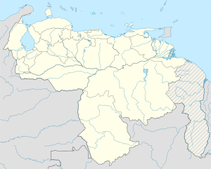
 Location in Guárico | |
| Coordinates: 8°30′37″N 66°30′11″W / 8.5103°N 66.5031°W | |
| Country | |
| State | Guárico |
| Area | |
• Total | 8,056.1 km2 (3,110.5 sq mi) |
| Population (2010) | |
• Total | 31,825 |
| • Density | 4.0/km2 (10/sq mi) |
| Time zone | UTC−04:00 (VET) |
| Area code(s) | 0238 |
| Website | Official website |
The Las Mercedes Municipality is one of the 15 municipalities (municipios) that makes up the central Venezuelan state of Guárico and, according to a 2010 population estimate by the National Institute of Statistics of Venezuela, the municipality has a population of 31,825.[1]
Overview
The town of Las Mercedes del Llano is the shire town of the Las Mercedes Municipality.[2]
The Municipality includes the 4.8 km Third Orinoco River Crossing, between Cabruta and Caicara del Orinoco in Bolívar.
See also
References
External links
- lasmercedes-guarico.gob.ve[permanent dead link] (in Spanish)


