Vestre Toten: Difference between revisions
No edit summary |
m clean up |
||
| Line 15: | Line 15: | ||
| coatofarms = Vestre Toten komm.png |
| coatofarms = Vestre Toten komm.png |
||
| munwebpage = www.vestre-toten.kommune.no |
| munwebpage = www.vestre-toten.kommune.no |
||
| mayor = Leif Waarum<ref>{{Cite web |url=http://www.vestre-toten.kommune.no/artikler/ordforeren-2 |title=Archived copy |access-date=2014-10-13 |archive-url=https://web.archive.org/web/20141017010206/http://www.vestre-toten.kommune.no/artikler/ordforeren-2 |archive-date=2014-10-17 | |
| mayor = Leif Waarum<ref>{{Cite web |url=http://www.vestre-toten.kommune.no/artikler/ordforeren-2 |title=Archived copy |access-date=2014-10-13 |archive-url=https://web.archive.org/web/20141017010206/http://www.vestre-toten.kommune.no/artikler/ordforeren-2 |archive-date=2014-10-17 |url-status = dead|df= }}</ref> |
||
| mayor_party = [[Norwegian Labour Party|Ap]] |
| mayor_party = [[Norwegian Labour Party|Ap]] |
||
| mayor_as_of = 2011 |
| mayor_as_of = 2011 |
||
| Line 39: | Line 39: | ||
===Coat-of-arms=== |
===Coat-of-arms=== |
||
The [[coat of arms]] were granted on 3 May 1991. The arms show two silver knives on a green background. They are a typical type of [[knife]] from the area (the special "Toten-knives"). It symbolizes the long tradition of [[wood carving]]. The arms were designed by Inge Rotevatn.<ref>{{cite web|author=Norske Kommunevåpen|date=1990|title=Nye kommunevåbener i Norden|url=http://www.ngw.nl/int/nor/v/vestreto.htm|accessdate=2009-01-01|archive-url=https://web.archive.org/web/20070715085150/http://www.ngw.nl/int/nor/v/vestreto.htm|archive-date=2007-07-15| |
The [[coat of arms]] were granted on 3 May 1991. The arms show two silver knives on a green background. They are a typical type of [[knife]] from the area (the special "Toten-knives"). It symbolizes the long tradition of [[wood carving]]. The arms were designed by Inge Rotevatn.<ref>{{cite web|author=Norske Kommunevåpen|date=1990|title=Nye kommunevåbener i Norden|url=http://www.ngw.nl/int/nor/v/vestreto.htm|accessdate=2009-01-01|archive-url=https://web.archive.org/web/20070715085150/http://www.ngw.nl/int/nor/v/vestreto.htm|archive-date=2007-07-15|url-status = dead|df=}}</ref><ref>{{cite web|url=http://www.vestre-toten.kommune.no/internett/vt.nsf/id/BDE5F8F8B8C17ACEC12573800042EBEA?OpenDocument|title=Kommunevåpen|publisher=Vestre Toten kommune|accessdate=2009-01-01}} {{Dead link|date=September 2010|bot=H3llBot}} {{no icon}}</ref> {{See also2|Coat-of-arms of [[Gjerstad]]}} |
||
{| style="float: center;" class="wikitable" |
{| style="float: center;" class="wikitable" |
||
|+ '''Number of minorities (1st and 2nd generation) in Vestre Toten by country of origin in 2017'''<ref>{{cite web|url=https://www.ssb.no/statistikkbanken/selectvarval/Define.asp?subjectcode=&ProductId=&MainTable=FolkInnvkatLand&nvl=&PLanguage=1&nyTmpVar=true&CMSSubjectArea=befolkning&KortNavnWeb=innvbef&StatVariant=&checked=true |title=Immigrants and Norwegian-born to immigrant parents, by immigration category, country background and percentages of the population |language=English |publisher=ssb.no |accessdate=29 June 2015 | |
|+ '''Number of minorities (1st and 2nd generation) in Vestre Toten by country of origin in 2017'''<ref>{{cite web|url=https://www.ssb.no/statistikkbanken/selectvarval/Define.asp?subjectcode=&ProductId=&MainTable=FolkInnvkatLand&nvl=&PLanguage=1&nyTmpVar=true&CMSSubjectArea=befolkning&KortNavnWeb=innvbef&StatVariant=&checked=true |title=Immigrants and Norwegian-born to immigrant parents, by immigration category, country background and percentages of the population |language=English |publisher=ssb.no |accessdate=29 June 2015 |url-status = dead|archiveurl=https://web.archive.org/web/20150702101705/https://www.ssb.no/statistikkbanken/selectvarval/Define.asp?subjectcode=&ProductId=&MainTable=FolkInnvkatLand&nvl=&PLanguage=1&nyTmpVar=true&CMSSubjectArea=befolkning&KortNavnWeb=innvbef&StatVariant=&checked=true |archivedate=2 July 2015 }}</ref> |
||
|- |
|- |
||
| Line 84: | Line 84: | ||
The municipal center is [[Raufoss]]. Other smaller towns in the municipality include [[Eina]], [[Reinsvoll]], and [[Bøverbru]]. |
The municipal center is [[Raufoss]]. Other smaller towns in the municipality include [[Eina]], [[Reinsvoll]], and [[Bøverbru]]. |
||
Vestre Toten borders on [[Østre Toten]] to the east, [[Gjøvik]] to the north, [[Gran, Norway|Gran]] to the south and [[Søndre Land]] to the west. |
Vestre Toten borders on [[Østre Toten]] to the east, [[Gjøvik]] to the north, [[Gran, Norway|Gran]] to the south and [[Søndre Land]] to the west. |
||
The highest point is Lauvhøgda with a height of {{convert|722|m|ft}}. The Hunnselva river begins in the [[Einavatnet]] lake and ends in the [[Mjøsa]] at Gjøvik. |
The highest point is Lauvhøgda with a height of {{convert|722|m|ft}}. The Hunnselva river begins in the [[Einavatnet]] lake and ends in the [[Mjøsa]] at Gjøvik. |
||
| Line 95: | Line 95: | ||
==External links== |
==External links== |
||
{{ |
{{Commons category|Vestre Toten}} |
||
{{wiktionary|Vestre Toten}} |
{{wiktionary|Vestre Toten}} |
||
*[https://web.archive.org/web/20070930235319/http://www.ssb.no/english/municipalities/0529 Municipal fact sheet] from [[Statistics Norway]] |
*[https://web.archive.org/web/20070930235319/http://www.ssb.no/english/municipalities/0529 Municipal fact sheet] from [[Statistics Norway]] |
||
Revision as of 17:17, 11 September 2019
Vestre Toten Municipality
Vestre Toten kommune | |
|---|---|
 | |
|
| |
 Oppland within Norway | |
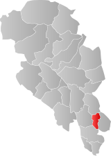
 Vestre Toten within Oppland | |
| Coordinates: 60°39′10″N 10°35′46″E / 60.65278°N 10.59611°E | |
| Country | Norway |
| County | Oppland |
| District | Toten |
| Administrative centre | Raufoss |
| Government | |
| • Mayor (2011) | Leif Waarum[1] (Ap) |
| Area | |
• Total | 249 km2 (96 sq mi) |
| • Land | 231 km2 (89 sq mi) |
| • Rank | #303 in Norway |
| Population (2004) | |
• Total | 12,597 |
| • Rank | #86 in Norway |
| • Density | 54/km2 (140/sq mi) |
| • Change (10 years) | |
| Demonym | Vestretotning[2] |
| Official language | |
| • Norwegian form | Bokmål |
| Time zone | UTC+01:00 (CET) |
| • Summer (DST) | UTC+02:00 (CEST) |
| ISO 3166 code | NO-0529[4] |
| Website | Official website |
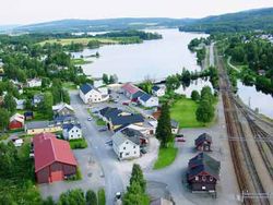
Vestre Toten is a municipality in Oppland county, Norway. It is part of the traditional region of Toten. The administrative centre of the municipality is the small town of Raufoss.
General information
Name
The name comes from the Old Norse word Þótn. The meaning of Toten is unknown (maybe "the pleasant district").[5] The meaning of the name Vestre Toten is "(the) western (part of) Toten". (The parish of Toten was divided in 1825.)[6]
Coat-of-arms
The coat of arms were granted on 3 May 1991. The arms show two silver knives on a green background. They are a typical type of knife from the area (the special "Toten-knives"). It symbolizes the long tradition of wood carving. The arms were designed by Inge Rotevatn.[7][8]
| Ancestry | Number |
|---|---|
| 139 | |
| 104 | |
| 67 | |
| 61 | |
| 58 | |
| 52 | |
| 49 | |
| 44 | |
| 37 | |
| 36 |
History
According to the sagas, Halfdan Hvitbeinn (Whiteleg) was the first Yngling in Norway. He conquered Romerike, part of Hedmark, part of Vestfold, and Toten. He was killed in Toten around the year 740.[10]
In 1021, according to saga, King Olaf (reigned 1015-1028) converted Toten to Christianity. Also, King Håkon IV (reigned 1217–1263) came to Toten around the year 1226 to settle local unrest.[10]
Christian II (1481-1559) was a Danish monarch and King of Denmark, Norway (1513-1523), and Sweden (1520-1521), under the Kalmar Union. Prior to becoming king, Duke Christian was sent to Norway in 1506 by John II (also called Hans), King of Norway (1483 – 1513) to take charge of the kingdom. In 1507, he became aware of a revolt in Hedmark. In early 1508, he took a force there, routing the rebellion. He then rowed across lake Mjøsa to Toten, capturing residents, imprisoning them in the vaulted cellar of the rectory in Østre Toten and torturing them there. As a result, he determined that Bishop Karl of Hamar had been behind the rebellion. With Bishop Karl as his captive, he was able to suppress the unrest.[10]
Toten was a part of Akershus county until 1756, when it was reassigned to Oppland county. Lauritz Weideman, Corporal Peder Balke, and Nels Dyhren from Toten attended the 1814 constitutional convention at Eidsvold.[10]
Vestre Toten was established as a municipality on 1 January 1838 (see formannskapsdistrikt). The areas of Kolbu and Eina were separated from Vestre Toten on 1 January 1908. Eina was, however, merged back into the municipality of Vestre Toten on 1 January 1964 (and Kolbu was merged into Østre Toten at this time also).
Geography

The municipal center is Raufoss. Other smaller towns in the municipality include Eina, Reinsvoll, and Bøverbru.
Vestre Toten borders on Østre Toten to the east, Gjøvik to the north, Gran to the south and Søndre Land to the west.
The highest point is Lauvhøgda with a height of 722 metres (2,369 ft). The Hunnselva river begins in the Einavatnet lake and ends in the Mjøsa at Gjøvik.
Economy
Farming and industry are important. Raufoss Aluminum is a major employer in the community. The Gjøvikbanen train line passes through the community.
References
- ^ "Archived copy". Archived from the original on 2014-10-17. Retrieved 2014-10-13.
{{cite web}}: CS1 maint: archived copy as title (link) - ^ "Navn på steder og personer: Innbyggjarnamn" (in Norwegian). Språkrådet.
- ^ "Forskrift om målvedtak i kommunar og fylkeskommunar" (in Norwegian). Lovdata.no.
- ^ Bolstad, Erik; Thorsnæs, Geir, eds. (2023-01-26). "Kommunenummer". Store norske leksikon (in Norwegian). Kunnskapsforlaget.
- ^ "Toten". snl.no. Retrieved 22 June 2015.
- ^ Rygh, Oluf (1900). Norske gaardnavne: Kristians amt (Anden halvdel) (in Norwegian) (4 ed.). Kristiania, Norge: W. C. Fabritius & sønners bogtrikkeri. p. 49.
- ^ Norske Kommunevåpen (1990). "Nye kommunevåbener i Norden". Archived from the original on 2007-07-15. Retrieved 2009-01-01.
- ^ "Kommunevåpen". Vestre Toten kommune. Retrieved 2009-01-01. [dead link] Template:No icon
- ^ "Immigrants and Norwegian-born to immigrant parents, by immigration category, country background and percentages of the population". ssb.no. Archived from the original on 2 July 2015. Retrieved 29 June 2015.
- ^ a b c d Stagg, Frank Noel (1956). East Norway and its Frontier. George Allen & Unwin, Ltd.
External links
- Municipal fact sheet from Statistics Norway
 Oppland travel guide from Wikivoyage


