Vlašić (Serbia): Difference between revisions
Appearance
Content deleted Content added
Corrected information Tags: Visual edit Mobile edit Mobile web edit |
If there's a mountain of the same name in Bosnia, make a separate article for it |
||
| Line 4: | Line 4: | ||
| photo_caption = |
| photo_caption = |
||
| elevation_m = 474 |
| elevation_m = 474 |
||
| elevation_ref = <ref name=katalog>{{cite web|url=http://www.psd-kopaonik.org.rs/03KatalogplaninaSrbije.html|title=Katalog planina |
| elevation_ref = <ref name=katalog>{{cite web|url=http://www.psd-kopaonik.org.rs/03KatalogplaninaSrbije.html|title=Katalog planina Srbije|publisher=PSD Kopaonik Beograd|author=Jovan Đokić|access-date=2011-05-18|archive-url=https://web.archive.org/web/20110518143835/http://www.psd-kopaonik.org.rs/03KatalogplaninaSrbije.html|archive-date=2011-05-18|url-status=dead}}</ref> |
||
| map = Serbia |
| map = Serbia |
||
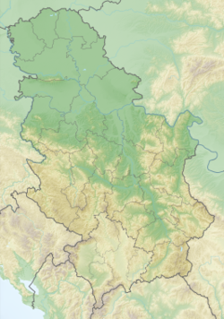
| map_caption = Location in |
| map_caption = Location in Serbia |
||
| map_size = 250 |
| map_size = 250 |
||
| location = Western [[ |
| location = Western [[Serbia]] |
||
| range = |
| range = |
||
| coordinates = {{coord|44|22|45|N|19|48|22|E|type:mountain_scale:100000|format=dms|display=inline,title}} |
| coordinates = {{coord|44|22|45|N|19|48|22|E|type:mountain_scale:100000|format=dms|display=inline,title}} |
||
| Line 16: | Line 16: | ||
| easiest_route = |
| easiest_route = |
||
}} |
}} |
||
'''Vlašić''' {{IPA-sh|ʋlâʃitɕ|pron}}) is a low [[mountains of |
'''Vlašić''' ({{lang-sr-cyr|Влашић}}, {{IPA-sh|ʋlâʃitɕ|pron}}) is a low [[mountains of Serbia|mountain]] in western [[Serbia]], between towns of [[Osečina]] and [[Koceljeva]]. Its highest peak has an elevation of 474 meters or 1555 feet above sea level. |
||
==References== |
==References== |
||
| Line 22: | Line 22: | ||
{{DEFAULTSORT:Vlasic (Serbia)}} |
{{DEFAULTSORT:Vlasic (Serbia)}} |
||
[[Category:Mountains of |
[[Category:Mountains of Serbia]] |
||
{{ |
{{Serbia-geo-stub}} |
||
Revision as of 08:21, 3 March 2020
| Vlašić | |
|---|---|
| Highest point | |
| Elevation | 474 m (1,555 ft)[1] |
| Coordinates | 44°22′45″N 19°48′22″E / 44.37917°N 19.80611°E |
| Geography | |
| Location | Western Serbia |
Vlašić (Serbian Cyrillic: Влашић, Template:IPA-sh) is a low mountain in western Serbia, between towns of Osečina and Koceljeva. Its highest peak has an elevation of 474 meters or 1555 feet above sea level.
References
- ^ Jovan Đokić. "Katalog planina Srbije". PSD Kopaonik Beograd. Archived from the original on 2011-05-18. Retrieved 2011-05-18.

