Haverigg: Difference between revisions
Devokewater (talk | contribs) Spelling/grammar/punctuation/typographical correction |
→top: add another map |
||
| Line 19: | Line 19: | ||
|dial_code= 01229 |
|dial_code= 01229 |
||
|os_grid_reference= SD160787 |
|os_grid_reference= SD160787 |
||
|pushpin_map = United Kingdom Copeland |
|||
|pushpin_map_caption = Location in Copeland Borough |
|||
}} |
}} |
||
'''Haverigg''' is a village on the south-west coast of [[Cumbria]], England, historically part of the county of [[Cumberland]]. In 2001 it had a population of 1,791 in 548 households,<ref>{{Cite web |title=Haverigg (Ward) |url=http://www.neighbourhood.statistics.gov.uk/dissemination/LeadKeyFigures.do?a=7&b=6177731&c=millom&d=16&e=15&g=432482&i=1001x1003x1004&o=1&m=0&r=1&s=1295810038461&enc=1 |access-date=23 January 2011 |website=Neighbourhood Statistics |publisher=Office for National Statistics}}</ref> increasing in 2011 to a population of 1,849 in 549 Households.<ref>{{Cite web |title=Millom ward population 2011 |url=http://www.neighbourhood.statistics.gov.uk/dissemination/LeadKeyFigures.do?a=7&b=13691194&c=Haverigg&d=14&e=62&g=6411940&i=1001x1003x1032x1004&m=0&r=1&s=1434381038115&enc=1 |access-date=15 June 2015}}</ref> |
'''Haverigg''' is a village on the south-west coast of [[Cumbria]], England, historically part of the county of [[Cumberland]]. In 2001 it had a population of 1,791 in 548 households,<ref>{{Cite web |title=Haverigg (Ward) |url=http://www.neighbourhood.statistics.gov.uk/dissemination/LeadKeyFigures.do?a=7&b=6177731&c=millom&d=16&e=15&g=432482&i=1001x1003x1004&o=1&m=0&r=1&s=1295810038461&enc=1 |access-date=23 January 2011 |website=Neighbourhood Statistics |publisher=Office for National Statistics}}</ref> increasing in 2011 to a population of 1,849 in 549 Households.<ref>{{Cite web |title=Millom ward population 2011 |url=http://www.neighbourhood.statistics.gov.uk/dissemination/LeadKeyFigures.do?a=7&b=13691194&c=Haverigg&d=14&e=62&g=6411940&i=1001x1003x1032x1004&m=0&r=1&s=1434381038115&enc=1 |access-date=15 June 2015}}</ref> |
||
Revision as of 14:24, 29 January 2021
| Haverigg | |
|---|---|
 The Harbour Hotel, Haverigg | |
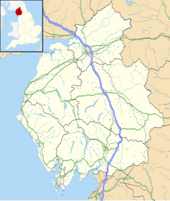
Location within Cumbria | |
| Population | 1,841 (2011.Ward) |
| OS grid reference | SD160787 |
| Civil parish | |
| District | |
| Shire county | |
| Region | |
| Country | England |
| Sovereign state | United Kingdom |
| Post town | Millom |
| Postcode district | LA18 |
| Dialling code | 01229 |
| Police | Cumbria |
| Fire | Cumbria |
| Ambulance | North West |
| UK Parliament | |
Haverigg is a village on the south-west coast of Cumbria, England, historically part of the county of Cumberland. In 2001 it had a population of 1,791 in 548 households,[1] increasing in 2011 to a population of 1,849 in 549 Households.[2]
The name Haverigg derives from the Old Norse and can be translated as "the hill where oats are grown".[3]
Haverigg is at the mouth of the Duddon Estuary, a protected area important for birds and other wildlife. Haverigg has an extensive, quiet Blue Flag beach. There is also access to a seawall with a lighthouse which protects Hodbarrow Lagoon, part of Hodbarrow RSPB Reserve. Haverigg Pool, a small river, flows through Haverigg and joins the estuary of the River Duddon here.[4]
Haverigg is 31.9 miles (51.3 km) to the south of Whitehaven, 24.4 miles (39.3 km) to the north of Barrow-in-Furness (by road via the estuary) and 1.3 miles (2.1 km) to the west of Millom.
An independent lifeboat station, Haverigg Inshore Rescue Team, has been based in the village since 1973 assisting those in difficulty around the Duddon coastline.[5]
In 2020, the Lakes first Aqua Park opened in Haverigg, situated on the lagoon, it features an inflatable obstacle course plus other attractions.[6]
Governance
Haverigg is in the parliamentary constituency of Copeland, Trudy Harrison is the Member of Parliament.[7]
Before Brexit, its residents were covered by the North West England European Parliamentary Constituency.
For Local Government purposes it is in the Black Combe + Scafell Ward of the Borough of Copeland and the Millom Without Ward of Cumbria County Council.
The village does not have its own Parish Council; instead the Haverigg Ward is governed by Millom Town Council.[8]
Haverigg Prison
The village is home to the Category C Haverigg Prison,[9] a low security prison for males from all over the North of England.
Gallery
-
Haverigg Pool
-
Duddon sands
-
Duddon Estuary and restored lighthouse
-
Horses on the beach
References
- ^ "Haverigg (Ward)". Neighbourhood Statistics. Office for National Statistics. Retrieved 23 January 2011.
- ^ "Millom ward population 2011". Retrieved 15 June 2015.
- ^ A.D.Mills (2003). Oxford Dictionary of British Place Names. Oxford University Press. p. 232. ISBN 978-0-19-852758-9.
- ^ "Haverigg | Co-Curate". co-curate.ncl.ac.uk. Retrieved 28 April 2020.
- ^ "Haverigg Inshore Rescue". Haverigg Inshore Rescue. Retrieved 6 November 2013.
- ^ "Cumbria's first ever aqua park set to open in Haverigg".
- ^ "Copeland".
- ^ "Millom Town Council".
- ^ "Haverigg Prison".


