Dayton, Virginia: Difference between revisions
Modified historical population, infobox (via CenPop script) |
m replaced: km² → km<sup>2</sup> (3), individuals → individuals, |
||
| Line 82: | Line 82: | ||
Dayton is located at {{coord|38|24|59|N|78|56|22|W|type:city}} (38.416323, -78.939440).<ref name="GR1">{{cite web|url=https://www.census.gov/geographies/reference-files/time-series/geo/gazetteer-files.html|publisher=[[United States Census Bureau]]|accessdate=2011-04-23|date=2011-02-12|title=US Gazetteer files: 2010, 2000, and 1990}}</ref> The town is approximately two miles southwest of [[Harrisonburg, Virginia|Harrisonburg]] and two miles northeast of [[Bridgewater, Virginia|Bridgewater]]. |
Dayton is located at {{coord|38|24|59|N|78|56|22|W|type:city}} (38.416323, -78.939440).<ref name="GR1">{{cite web|url=https://www.census.gov/geographies/reference-files/time-series/geo/gazetteer-files.html|publisher=[[United States Census Bureau]]|accessdate=2011-04-23|date=2011-02-12|title=US Gazetteer files: 2010, 2000, and 1990}}</ref> The town is approximately two miles southwest of [[Harrisonburg, Virginia|Harrisonburg]] and two miles northeast of [[Bridgewater, Virginia|Bridgewater]]. |
||
According to the [[United States Census Bureau]], the town has a total area of 0.8 square miles (2.1 km |
According to the [[United States Census Bureau]], the town has a total area of 0.8 square miles (2.1 km<sup>2</sup>), all of it land. |
||
==History== |
==History== |
||
| Line 119: | Line 119: | ||
|footnote=U.S. Decennial Census<ref name="DecennialCensus">{{cite web|url=https://www.census.gov/programs-surveys/decennial-census.html|title=Census of Population and Housing|publisher=Census.gov|accessdate=June 4, 2015}}</ref> |
|footnote=U.S. Decennial Census<ref name="DecennialCensus">{{cite web|url=https://www.census.gov/programs-surveys/decennial-census.html|title=Census of Population and Housing|publisher=Census.gov|accessdate=June 4, 2015}}</ref> |
||
}} |
}} |
||
As of the [[census]]<ref name="GR2" /> of 2000, 1,344 people, 542 households, and 383 families resided in the town. The [[population density]] was 1,657.2 people per square mile (640.6/km |
As of the [[census]]<ref name="GR2" /> of 2000, 1,344 people, 542 households, and 383 families resided in the town. The [[population density]] was 1,657.2 people per square mile (640.6/km<sup>2</sup>). There were 565 housing units at an average density of 696.6 per square mile (269.3/km<sup>2</sup>). The racial makeup of the town was 94.20% [[White (U.S. Census)|White]], 0.67% [[African American (U.S. Census)|African American]], 0.37% [[Asian (U.S. Census)|Asian]], 2.90% from [[Race (United States Census)|other races]], and 1.86% from two or more races. [[Hispanic (U.S. Census)|Hispanic]] or [[Latino (U.S. Census)|Latino]] of any race were 6.62% of the population. |
||
Of 542 households, 31.5% had children under the age of 18 living with them, 57.6% were married couples living together, 7.7% had a female householder with no husband present, and 29.2% were not families. About 24.9% of all households were made up of individuals and 9.8% had someone living alone who was 65 years of age or older. The average household size was 2.48 and the average family size was 2.97. |
Of 542 households, 31.5% had children under the age of 18 living with them, 57.6% were married couples living together, 7.7% had a female householder with no husband present, and 29.2% were not families. About 24.9% of all households were made up of individuals, and 9.8% had someone living alone who was 65 years of age or older. The average household size was 2.48 and the average family size was 2.97. |
||
In the town, the population was distributed as 24.1% under the age of 18, 6.8% from 18 to 24, 33.6% from 25 to 44, 19.9% from 45 to 64, and 15.6% who were 65 years of age or older. The median age was 37 years. For every 100 females, there were 98.2 males. For every 100 females age 18 and over, there were 96.5 males. |
In the town, the population was distributed as 24.1% under the age of 18, 6.8% from 18 to 24, 33.6% from 25 to 44, 19.9% from 45 to 64, and 15.6% who were 65 years of age or older. The median age was 37 years. For every 100 females, there were 98.2 males. For every 100 females age 18 and over, there were 96.5 males. |
||
Revision as of 16:43, 24 August 2020
Dayton, Virginia | |
|---|---|
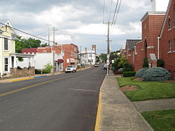
 Main Street, Dayton | |
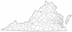
 Location of Dayton, Virginia | |
| Coordinates: 38°24′59″N 78°56′22″W / 38.41639°N 78.93944°W | |
| Country | United States |
| State | Virginia |
| County | Rockingham |
| Incorporated | 1879 |
| Government | |
| • Type | Mayor and Town Council |
| • Mayor | Sam Lee |
| • Vice Mayor | Jeff Daly |
| Area | |
• Total | 1.03 sq mi (2.67 km2) |
| • Land | 1.03 sq mi (2.67 km2) |
| • Water | 0.00 sq mi (0.00 km2) |
| Elevation | 1,204 ft (367 m) |
| Population (2010) | |
• Total | 1,530 |
• Estimate (2019)[2] | 1,637 |
| • Density | 1,587.78/sq mi (612.82/km2) |
| Time zone | UTC-5 (Eastern (EST)) |
| • Summer (DST) | UTC-4 (EDT) |
| ZIP code | 22821 |
| Area code | 540 |
| FIPS code | 51-21648[3] |
| GNIS feature ID | 1492844[4] |
| Website | www.daytonva.us/ |
Dayton is a town in Rockingham County, Virginia, United States. The population is 1,530 as of the 2010 census. It is included in the Harrisonburg, Virginia Metropolitan Statistical Area.
Geography
Dayton is located at 38°24′59″N 78°56′22″W / 38.41639°N 78.93944°W (38.416323, -78.939440).[5] The town is approximately two miles southwest of Harrisonburg and two miles northeast of Bridgewater.
According to the United States Census Bureau, the town has a total area of 0.8 square miles (2.1 km2), all of it land.
History
The town of Dayton is one of the oldest settled communities in Rockingham County, and is the county's second oldest incorporated town, after Bridgewater. The first settler in Dayton was Daniel Harrison (c. 1702-1770), whose family settled along Cooks Creek, north of downtown. Daniel was the eldest son of Isaiah Harrison and second wife Abigail and was born in Oyster Bay, Long Island, New York. Daniel's brother Thomas Harrison founded Harrisonburg several miles to the northeast. They and their three brothers had migrated from New York to Delaware and then to Orange County Virginia before settling in the Shenandoah Valley.[6]
The family homestead, a two-story stone house, has been owned and maintained since 1977 by a private, non-profit organization, Fort Harrison, Inc.[7] The town was known as Rifeville or Rifetown[8] until 1833.[9]
Shenandoah University has its roots in Dayton, when it was known as the Shenandoah College and Conservatory of Music. The college was organized in 1875 under the leadership of Rev. A.P. Funkhouser. This was a major institution in Dayton until 1960, when it moved to Winchester. College Street was named after the school and many of the street's buildings served as part of the campus.[9]
The Dayton Historic District, Daniel Harrison House, and Peter Paul House are listed on the National Register of Historic Places.[10]
In 2018, a series of strikes and protests were held at the town's Cargill plant.[11][12]

Transportation
Primary road access to Dayton is provided by Virginia State Route 42, which runs southwest to Bridgewater and northeast to Harrisonburg, where it connects with U.S. Route 33. Virginia State Route 257 also serves Dayton. SR 257 runs concurrently with SR 42 from Dayton southwest to Bridgewater, but heads westward from Dayton into the rural areas of southwestern Rockingham County. Virginia State Route 42 Business and Virginia State Route 290 also serve as primary roadways within Dayton.
Demographics
| Census | Pop. | Note | %± |
|---|---|---|---|
| 1880 | 258 | — | |
| 1900 | 425 | — | |
| 1910 | 516 | 21.4% | |
| 1920 | 482 | −6.6% | |
| 1930 | 537 | 11.4% | |
| 1940 | 632 | 17.7% | |
| 1950 | 788 | 24.7% | |
| 1960 | 930 | 18.0% | |
| 1970 | 978 | 5.2% | |
| 1980 | 1,017 | 4.0% | |
| 1990 | 921 | −9.4% | |
| 2000 | 1,344 | 45.9% | |
| 2010 | 1,530 | 13.8% | |
| 2019 (est.) | 1,637 | [2] | 7.0% |
| U.S. Decennial Census[13] | |||
As of the census[3] of 2000, 1,344 people, 542 households, and 383 families resided in the town. The population density was 1,657.2 people per square mile (640.6/km2). There were 565 housing units at an average density of 696.6 per square mile (269.3/km2). The racial makeup of the town was 94.20% White, 0.67% African American, 0.37% Asian, 2.90% from other races, and 1.86% from two or more races. Hispanic or Latino of any race were 6.62% of the population.
Of 542 households, 31.5% had children under the age of 18 living with them, 57.6% were married couples living together, 7.7% had a female householder with no husband present, and 29.2% were not families. About 24.9% of all households were made up of individuals, and 9.8% had someone living alone who was 65 years of age or older. The average household size was 2.48 and the average family size was 2.97.
In the town, the population was distributed as 24.1% under the age of 18, 6.8% from 18 to 24, 33.6% from 25 to 44, 19.9% from 45 to 64, and 15.6% who were 65 years of age or older. The median age was 37 years. For every 100 females, there were 98.2 males. For every 100 females age 18 and over, there were 96.5 males.
The median income for a household in the town was $35,958, and the median income for a family was $44,732. Males had a median income of $30,109 versus $23,906 for females. The per capita income for the town was $17,600. About 3.5% of families and 8.1% of the population were below the poverty line, including 9.7% of those under age 18 and 7.5% of those age 65 or over.
Old Order Mennonites
There are two different groups of Old Order Mennonites who live around Dayton: members of the Virginia Old Order Mennonite Conference and of the John Dan Wenger Mennonites. The latter are the more conservative ones. The two groups separated from each other in 1952/3. The total population of these two groups in the area is around 1,000 people.
Climate
The climate in this area is characterized by hot, humid summers and generally mild to cool winters. According to the Köppen Climate Classification system, Dayton has a humid subtropical climate, abbreviated "Cfa" on climate maps.[14]
In popular culture
The city is a setting in the music video for "Cheer Up" by the Korean pop group Twice.[15] The video depicts a member of the group performing outside of Dayton while dressed as a cowgirl.
References
- ^ "2019 U.S. Gazetteer Files". United States Census Bureau. Retrieved August 7, 2020.
- ^ a b "Population and Housing Unit Estimates". United States Census Bureau. May 24, 2020. Retrieved May 27, 2020.
- ^ a b "U.S. Census website". United States Census Bureau. Retrieved 2008-01-31.
- ^ "US Board on Geographic Names". United States Geological Survey. 2007-10-25. Retrieved 2008-01-31.
- ^ "US Gazetteer files: 2010, 2000, and 1990". United States Census Bureau. 2011-02-12. Retrieved 2011-04-23.
- ^ Harrison, J. Houston (1975), Settlers by the Long Grey Trail, Genealogical Publ. Co.
- ^ "Archived copy". Archived from the original on 2011-01-06. Retrieved 2011-03-10.
{{cite web}}: CS1 maint: archived copy as title (link) - ^ James-Henderson, Yvonne. "VA Towns and Cities". Retrieved 21 April 2017.
- ^ a b "Archived copy". Archived from the original on 2011-05-04. Retrieved 2011-03-10.
{{cite web}}: CS1 maint: archived copy as title (link) - ^ "National Register Information System". National Register of Historic Places. National Park Service. July 9, 2010.
- ^ Barnett, Marina (November 21, 2017). "Community Solidarity with Poultry Workers call for changes at Cargill". WHSV-TV. Gray Television. Retrieved May 13, 2018.
- ^ Wood, Victoria (April 5, 2018). "Nine protesters arrested outside Cargill in Dayton". WHSV-TV. Gray Television. Retrieved May 12, 2018.
- ^ "Census of Population and Housing". Census.gov. Retrieved June 4, 2015.
- ^ "Dayton, Virginia Köppen Climate Classification (Weatherbase)". Retrieved 21 April 2017.
- ^ jypentertainment (24 April 2016). "TWICE "CHEER UP" M/V". Retrieved 21 April 2017 – via YouTube.


