Wright Creek (Nanticoke River tributary): Difference between revisions
Appearance
Content deleted Content added
added Category:Tributaries of the Nanticoke River using HotCat |
Veg Mapper (talk | contribs) corrected progression and added link |
||
| Line 49: | Line 49: | ||
| mouth_coordinates = {{coord|38|36|43|N|075|41|35|W|display=inline,title}}<ref name="GNIS">{{cite web |title=GNIS Detail - Wright Creek |url=https://geonames.usgs.gov/apex/f?p=138:3:0::NO:3:P3_FID,P3_TITLE:214884,Wright%20Creek |website=geonames.usgs.gov |publisher=US Geological Survey |accessdate=7 August 2019}}</ref> |
| mouth_coordinates = {{coord|38|36|43|N|075|41|35|W|display=inline,title}}<ref name="GNIS">{{cite web |title=GNIS Detail - Wright Creek |url=https://geonames.usgs.gov/apex/f?p=138:3:0::NO:3:P3_FID,P3_TITLE:214884,Wright%20Creek |website=geonames.usgs.gov |publisher=US Geological Survey |accessdate=7 August 2019}}</ref> |
||
| mouth_elevation = {{convert|0|ft|abbr=on}}<ref name="Topozone">{{cite web |title=Cod Creek Topo Map, Sussex County DE (Sharptown Area) |url=https://www.topozone.com/delaware/sussex-de/stream/cod-creek/ |website=TopoZone |publisher=Locality, LLC |accessdate=7 August 2019 |language=en}}</ref> |
| mouth_elevation = {{convert|0|ft|abbr=on}}<ref name="Topozone">{{cite web |title=Cod Creek Topo Map, Sussex County DE (Sharptown Area) |url=https://www.topozone.com/delaware/sussex-de/stream/cod-creek/ |website=TopoZone |publisher=Locality, LLC |accessdate=7 August 2019 |language=en}}</ref> |
||
| progression = |
| progression = [[Nanticoke River]] → [[Chesapeake Bay]] → [[Atlantic Ocean]] |
||
| river_system = [[Nanticoke River]] |
| river_system = [[Nanticoke River]] |
||
| basin_size = {{convert|5.25|sqmi}}<ref name="watershed">{{cite web |title=Wright Creek Watershed Report |url=https://watersgeo.epa.gov/watershedreport/?comid=8392804 |website=Waters Geoviewer |publisher=US EPA |accessdate=7 August 2019}}</ref> |
| basin_size = {{convert|5.25|sqmi}}<ref name="watershed">{{cite web |title=Wright Creek Watershed Report |url=https://watersgeo.epa.gov/watershedreport/?comid=8392804 |website=Waters Geoviewer |publisher=US EPA |accessdate=7 August 2019}}</ref> |
||
| Line 61: | Line 61: | ||
}} |
}} |
||
'''Wright Creek''' is a {{convert|5.25|mi|km|abbr=on}} long tributary to Nanticoke River that rises in western [[Sussex County, Delaware]]. The creek straddles the [[Delaware]] state line for most of its course and is tidal for about half of its length. |
'''Wright Creek''' is a {{convert|5.25|mi|km|abbr=on}} long tributary to the [[Nanticoke River]] that rises in western [[Sussex County, Delaware]]. The creek straddles the [[Delaware]] state line for most of its course and is tidal for about half of its length. |
||
==See also== |
==See also== |
||
Latest revision as of 13:04, 26 May 2021
| Wright Creek Tributary to Nanticoke River | |
|---|---|
 Wright Creek from Nanticoke Wildlife Area | |
| Location | |
| Country | United States |
| State | Maryland Delaware |
| Counties | Sussex Dorchester |
| Physical characteristics | |
| Source | divide between Wright Creek and Turtle Branch |
| • location | about 3 miles west of Woodland, Delaware[2] |
| • coordinates | 38°33′42″N 075°42′04″W / 38.56167°N 75.70111°W[1] |
| • elevation | 34 ft (10 m)[2] |
| Mouth | Nanticoke River |
• location | about 1 mile east of Galestown, Maryland[2] |
• coordinates | 38°36′43″N 075°41′35″W / 38.61194°N 75.69306°W[1] |
• elevation | 0 ft (0 m)[2] |
| Length | 4.07 mi (6.55 km)[3] |
| Basin size | 5.25 square miles (13.6 km2)[4] |
| Discharge | |
| • location | Nanticoke River |
| • average | 6.04 cu ft/s (0.171 m3/s) at mouth with Nanticoke River[4] |
| Basin features | |
| Progression | Nanticoke River → Chesapeake Bay → Atlantic Ocean |
| River system | Nanticoke River |
| Tributaries | |
| • left | unnamed tributaries |
| • right | unnamed tributaries |
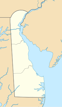
Wright Creek is a 5.25 mi (8.45 km) long tributary to the Nanticoke River that rises in western Sussex County, Delaware. The creek straddles the Delaware state line for most of its course and is tidal for about half of its length.
See also
[edit]References
[edit]- ^ a b "GNIS Detail - Wright Creek". geonames.usgs.gov. US Geological Survey. Retrieved 7 August 2019.
- ^ a b c d "Cod Creek Topo Map, Sussex County DE (Sharptown Area)". TopoZone. Locality, LLC. Retrieved 7 August 2019.
- ^ "ArcGIS Web Application". epa.maps.arcgis.com. US EPA. Retrieved 7 August 2019.
- ^ a b "Wright Creek Watershed Report". Waters Geoviewer. US EPA. Retrieved 7 August 2019.


