Coventry Hills, Calgary: Difference between revisions
CorrectBotx (talk | contribs) |
m Task 18 (cosmetic): eval 4 templates: hyphenate params (4×); |
||
| Line 53: | Line 53: | ||
==Demographics== |
==Demographics== |
||
In the City of Calgary's 2012 municipal census, Coventry Hills had a population of {{nts|15969}} living in {{nts|5322}} dwellings, a 1.6% increase from its 2011 population of {{nts|15722}}.<ref name=2012censusreport>{{cite web | url=http://www.calgary.ca/CA/city-clerks/Documents/Election-and-information-services/Census2012/Final%202012%20Census%20Results%20book.pdf | title=2012 Civic Census Results | publisher=City of Calgary | year=2012 | |
In the City of Calgary's 2012 municipal census, Coventry Hills had a population of {{nts|15969}} living in {{nts|5322}} dwellings, a 1.6% increase from its 2011 population of {{nts|15722}}.<ref name=2012censusreport>{{cite web | url=http://www.calgary.ca/CA/city-clerks/Documents/Election-and-information-services/Census2012/Final%202012%20Census%20Results%20book.pdf | title=2012 Civic Census Results | publisher=City of Calgary | year=2012 | access-date=February 4, 2013}}</ref> With a land area of {{convert|4.1|km2|sqmi|abbr=on}}, it had a population density of {{Pop density|15969|4.1|km2|sqmi}} in 2012.<ref name=2012censusreport/><ref name=opendatacommunities>{{cite web | url=https://cityonline.calgary.ca/Pages/Product.aspx?category=PDCAdministrativeBoundaries&cat=CITYonlineDefault&id=PDC0-99999-99999-00005-P | title=Community Boundaries | publisher=City of Calgary | format=[[Esri]] [[shapefile]] | access-date=February 5, 2013}}</ref> |
||
Residents in this community had a [[median household income]] of [[Canadian dollar|$]]70,096 in 2000, and there were 6% low income residents living in the neighbourhood.<ref name=ward>{{Cite web| url=http://www.calgary.ca/docgallery/bu/cns/community_social_statistics/ward_3_profile.pdf| archive-url=https://web.archive.org/web/20060628001227/http://www.calgary.ca/docgallery/bu/cns/community_social_statistics/ward_3_profile.pdf| url-status=dead| archive-date=2006-06-28| title=Ward 3 Profile| author=City of Calgary| year=2004| |
Residents in this community had a [[median household income]] of [[Canadian dollar|$]]70,096 in 2000, and there were 6% low income residents living in the neighbourhood.<ref name=ward>{{Cite web| url=http://www.calgary.ca/docgallery/bu/cns/community_social_statistics/ward_3_profile.pdf| archive-url=https://web.archive.org/web/20060628001227/http://www.calgary.ca/docgallery/bu/cns/community_social_statistics/ward_3_profile.pdf| url-status=dead| archive-date=2006-06-28| title=Ward 3 Profile| author=City of Calgary| year=2004| access-date=2007-05-13}}</ref> As of 2000, 12.9% of the residents were [[immigrant]]s. All buildings were [[single-family detached home]]s, and 3.9% of the housing was used for [[renting]].<ref name=city>{{Cite web| url= http://www.calgary.ca/docgallery/bu/cns/community_social_statistics/coventry_hills.pdf| archive-url= https://web.archive.org/web/20070930201711/http://www.calgary.ca/docgallery/bu/cns/community_social_statistics/coventry_hills.pdf| url-status= dead| archive-date= 2007-09-30| title= Coventry Hills Community Statistics| author= City of Calgary| year= 2006| access-date= 2007-05-13}}</ref> |
||
==Education== |
==Education== |
||
Revision as of 04:33, 22 January 2021
Coventry Hills | |
|---|---|
Neighbourhood | |
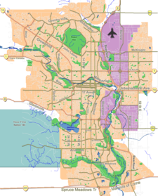
Location of Coventry Hills in Calgary | |
| Coordinates: 51°09′38″N 114°03′00″W / 51.16056°N 114.05000°W | |
| Country | |
| Province | |
| City | |
| Quadrant | NE |
| Ward | 3 |
| Established | 1991 |
| Government | |
| • Mayor | Jyoti Gondek |
| • Administrative body | Calgary City Council |
| • Councillor | Jasmine Mian |
| Elevation | 1,080 m (3,540 ft) |
| Population (2006)[2] | |
• Total | 12,601 |
| • Average Income | $70,096 |
| Website | Northern Hills Community Association |
Coventry Hills is a suburban residential neighbourhood in the northeast quadrant of Calgary, Alberta. It is at the northern edge of the city and is bounded by Stoney Trail to the north, Deerfoot Trail and the Nose Creek to the east, Country Hills Boulevard to the south, and Harvest Hills Boulevard to the west.
Coventry Hills was established as a neighbourhood in 1991. It is represented in the Calgary City Council by the Ward 3 councillor.[1]
Demographics
In the City of Calgary's 2012 municipal census, Coventry Hills had a population of 15,969 living in 5,322 dwellings, a 1.6% increase from its 2011 population of 15,722.[3] With a land area of 4.1 km2 (1.6 sq mi), it had a population density of 3,890/km2 (10,090/sq mi) in 2012.[3][4]
Residents in this community had a median household income of $70,096 in 2000, and there were 6% low income residents living in the neighbourhood.[5] As of 2000, 12.9% of the residents were immigrants. All buildings were single-family detached homes, and 3.9% of the housing was used for renting.[2]
Education
Coventry Hills has two public schools, Coventry Hills Elementary School (K-3) and Nose Creek School (4-9), and two separate schools, St. Clare Catholic Elementary School (K-6) and Notre Dame Catholic High School (10-12) which is located nearby in Country Hills Village.[citation needed]
There are also 2 new schools being built in the community, An elementary school called Northern Lights School located on Coventry Dr NE that is set to open in 2020, and the future North Calgary High School which will be located at the current Coventry Hills Park in the NW corner of the community near Harvest Hills Blvd, Construction details are not yet available.
See also
References
- ^ a b "Calgary Elections". City of Calgary. 2017. Retrieved November 12, 2017.
- ^ a b City of Calgary (2006). "Coventry Hills Community Statistics" (PDF). Archived from the original (PDF) on 2007-09-30. Retrieved 2007-05-13.
- ^ a b "2012 Civic Census Results" (PDF). City of Calgary. 2012. Retrieved February 4, 2013.
- ^ "Community Boundaries" (Esri shapefile). City of Calgary. Retrieved February 5, 2013.
- ^ City of Calgary (2004). "Ward 3 Profile" (PDF). Archived from the original (PDF) on 2006-06-28. Retrieved 2007-05-13.
External links
- Northern Hills (Cinnamon Hills - Country Hills - Coventry Hills - Harvest Hills - Panorama Hills Community Association
- Northern Hills Community Association - Dedicated to providing community sports programs such as soccer, schools, events, recreation, Planning and Development projects, community enhancement, and much more.

