Jaugiliai: Difference between revisions
Appearance
Content deleted Content added
stub sort |
m Task 18 (cosmetic): eval 1 template: hyphenate params (1×); |
||
| Line 42: | Line 42: | ||
==References== |
==References== |
||
{{reflist|refs= |
{{reflist|refs= |
||
<ref name=census> {{cite web|url=http://statistics.bookdesign.lt/table_125_02.htm?lang=en|title=2011 census|publisher=Statistikos Departamentas (Lithuania)| |
<ref name=census> {{cite web|url=http://statistics.bookdesign.lt/table_125_02.htm?lang=en|title=2011 census|publisher=Statistikos Departamentas (Lithuania)|access-date=August 21, 2017}}</ref> |
||
<ref name=SGKP> {{SgKP|15b|14|Jawgiele}}</ref> |
<ref name=SGKP> {{SgKP|15b|14|Jawgiele}}</ref> |
||
}} |
}} |
||
Revision as of 13:15, 27 January 2021
Jaugiliai | |
|---|---|
Village | |
 | |
| Coordinates: 55°26′38″N 23°44′31″E / 55.44389°N 23.74194°E | |
| Country | |
| County | |
| Municipality | Kėdainiai district municipality |
| Eldership | Krakės Eldership |
| Population (2011) | |
• Total | 57 |
| Time zone | UTC+2 (EET) |
| • Summer (DST) | UTC+3 (EEST) |
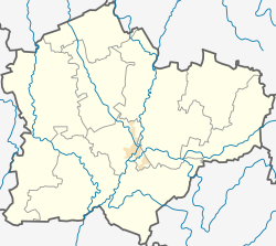
Jaugiliai (Template:Lang-pl,[1] Template:Lang-ru) is a village in Kėdainiai district municipality, in Kaunas County, in central Lithuania. According to the 2011 census, the village had a population of 57 people.[2] It is located 4 kilometres (2.5 mi) from Krakės, by the Krakės-Gudžiūnai road. It is located on the shore of the Jaugiliai Lake, by the Jaugila river.
At the beginning of the 20th century Jaugiliai was an estate and okolica, a property of the Malinavičiai, Valatkos ir Savičiai and Liudkevičiai families.[1]
Demography
|
| ||||||||||||||||||||||||||||||
| Source: 1902, 1923, 1959 & 1970, 1979, 1989, 2001, 2011 | |||||||||||||||||||||||||||||||

References
- ^ a b "Jawgiele". Geographical Dictionary of the Kingdom of Poland (in Polish). 15 pt. 2. Warszawa: Kasa im. Józefa Mianowskiego. 1902. p. 14.
- ^ "2011 census". Statistikos Departamentas (Lithuania). Retrieved August 21, 2017.


