Rasulpur newada: Difference between revisions
Appearance
Content deleted Content added
No edit summary Tags: Mobile edit Mobile web edit Advanced mobile edit |
No edit summary Tags: Mobile edit Mobile web edit Advanced mobile edit |
||
| Line 11: | Line 11: | ||
| pushpin_map_alt = |
| pushpin_map_alt = |
||
| pushpin_map_caption = Location of Rasupur Newada in Uttar Pradesh |
| pushpin_map_caption = Location of Rasupur Newada in Uttar Pradesh |
||
|coordinates |
|||
= 25.3737362, 83.6324100, |
|||
| subdivision_type = Country |
| subdivision_type = Country |
||
| subdivision_name = {{Flag|India}} |
| subdivision_name = {{Flag|India}} |
||
Revision as of 14:32, 6 February 2021
Rasulpur
Rasulpur, Mahmudpur, Dewaitha Khurd | |
|---|---|
Village | |
| Rasulpur Newada | |
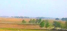
 Frams of Rasulpur Newada | |
| Lua error in Module:Location_map at line 411: Malformed coordinates value. | |
| Coordinates: 25.3737362, 83.6324100, | |
| Country | |
| State | Uttar Pradesh |
| District | Ghazipur |
| Established | 1650 |
| Founded by | Zamindar Mahmud Khan |
| Government | |
| • Type | Gram panchayat |
| • Body | Sarpanch |
| Area | |
• Total | 263.03 ha (649.96 acres) |
| Elevation | 72 m (236 ft) |
| Population (2011) | |
• Total | 1,181 [1] |
| Languages | |
| • Official | Hindi/Urdu |
| Time zone | UTC+5:30 (IST) |
| PIN | 232326 to** (** area code) |
| Vehicle registration | UP 61 |
| Sex ratio | 926 (2011) ♂/♀ |
| Climate | BW (Köppen) |
Rasulpur newada is a village of Kamsaar in Ghazipur district, Uttar Pradesh, India.[1][2][3] As of 2011 census the main population of Rasulpur lived in an area of 7.5 acres.[4]
References
- ^ "Rasulpur newada, Ghazipur".
{{cite web}}: CS1 maint: url-status (link) - ^ "List of Villages in Ghazipur, Uttar Pradesh".
{{cite web}}: CS1 maint: url-status (link) - ^ "Villages in Ghazipur district, Uttar Pradesh".
{{cite web}}: CS1 maint: url-status (link) - ^ "Bhulekh".
{{cite web}}: CS1 maint: url-status (link)
