1674 Ambon earthquake and megatsunami: Difference between revisions
No edit summary |
No edit summary |
||
| Line 23: | Line 23: | ||
The '''1674 Ambon earthquake''' occurred on February 17 at between 19:30 and 20:00 local time somewhere in the Maluku Islands. The resulting tsunami reached heights of up to 100 meters at Ambon Island killing over 2,000 individuals. It was the first detailed documentation of a tsunami in Indonesia and one of the worst tsunamis in the country. |
The '''1674 Ambon earthquake''' occurred on February 17 at between 19:30 and 20:00 local time somewhere in the Maluku Islands. The resulting tsunami reached heights of up to 100 meters at Ambon Island killing over 2,000 individuals. It was the first detailed documentation of a tsunami in Indonesia and one of the worst tsunamis in the country. |
||
==Tectonic setting== |
|||
==Earthquake== |
|||
The tectonics of the North Maluku Islands is dominated by complex collision, subduction and strike-slip elements. Intermediate to deep focus earthquakes with focal depth of 60 km or greater is immediately ruled out as the souce because no known historical events of the same kind has generated a large tsunami. The 1938 Banda Sea earthquake, an intermediate depth magnitude 8.5 event only caused a minor tsunami. |
The tectonics of the North Maluku Islands is dominated by complex collision, subduction and strike-slip elements. Intermediate to deep focus earthquakes with focal depth of 60 km or greater is immediately ruled out as the souce because no known historical events of the same kind has generated a large tsunami. The 1938 Banda Sea earthquake, an intermediate depth magnitude 8.5 event only caused a minor tsunami. |
||
The Seram Trough is a zone of complex convergence between the Pacific, Australian, Sunda and numerous micro tectonic plates. This megathrust fault is located north of Seram Island. While it has generated large tsunamigenic earthquakes in the past such as that in 1899 and 1629, the fault is situated too far from Ambon to have caused huge tsunami run-ups. |
The Seram Trough is a zone of complex convergence between the Pacific, Australian, Sunda and numerous micro tectonic plates. This megathrust fault is located north of Seram Island. While it has generated large tsunamigenic earthquakes in the past such as that in 1899 and 1629, the fault is situated too far from Ambon to have caused huge tsunami run-ups. |
||
==Tsunami== |
|||
==Historical accounts== |
|||
==See also== |
|||
==References== |
|||
{{Reflist}} |
|||
*[https://www.researchgate.net/publication/250074909_Surface_Ruptures_Associated_with_the_1937_M_75_Tuosuo_Lake_and_the_1963_M_70_Alake_Lake_Earthquakes_and_the_Paleoseismicity_along_the_Tuosuo_Lake_Segment_of_the_Kunlun_Fault_Northern_Tibet Surface Ruptures Associated with the 1937 M 7.5 Tuosuo Lake and the 1963 M 7.0 Alake Lake Earthquakes and the Paleoseismicity along the Tuosuo Lake Segment of the Kunlun Fault, Northern Tibet] |
|||
*[https://agupubs.onlinelibrary.wiley.com/doi/10.1029/2019GL081940 Slip Rate Variation Along the Kunlun Fault (Tibet): Results From New GPS Observations and a Viscoelastic Earthquake‐Cycle Deformation Model] |
|||
*[https://www.sciencedirect.com/science/article/pii/S0040195109004107?casa_token=Nm7PY0ao3e4AAAAA:jVyfhvWFq1Ok-WjVIXuSwHRJXEnLJr4l2AiN8QQWX7crSJihGhJPL4nm3tF5C5Tse9RVtNijQw Stress transfer and its implication for earthquake hazard on the Kunlun Fault, Tibet] |
|||
*[https://www.researchgate.net/publication/248125183_Paleo-earthquake_studies_on_the_Eastern_section_of_the_Kunlun_fault Paleo-earthquake studies on the Eastern section of the Kunlun fault] |
|||
*[https://www.ngdc.noaa.gov/hazel/view/hazards/earthquake/event-more-info/3589 Significant Earthquake Information CHINA: QINGHAI PROVINCE] |
|||
Revision as of 04:51, 15 May 2021
| Local date | February 17, 1674 |
|---|---|
| Local time | 19:30 to 20:00 EIT |
| Magnitude | Unk. |
| Epicenter | 3°45′00″S 127°45′00″E / 3.750°S 127.750°E |
| Areas affected | Banda Sea, Indonesia |
| Tsunami | 100 m |
| Casualties | 2,347 dead |
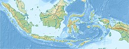
The 1674 Ambon earthquake occurred on February 17 at between 19:30 and 20:00 local time somewhere in the Maluku Islands. The resulting tsunami reached heights of up to 100 meters at Ambon Island killing over 2,000 individuals. It was the first detailed documentation of a tsunami in Indonesia and one of the worst tsunamis in the country.
Tectonic setting
The tectonics of the North Maluku Islands is dominated by complex collision, subduction and strike-slip elements. Intermediate to deep focus earthquakes with focal depth of 60 km or greater is immediately ruled out as the souce because no known historical events of the same kind has generated a large tsunami. The 1938 Banda Sea earthquake, an intermediate depth magnitude 8.5 event only caused a minor tsunami.
The Seram Trough is a zone of complex convergence between the Pacific, Australian, Sunda and numerous micro tectonic plates. This megathrust fault is located north of Seram Island. While it has generated large tsunamigenic earthquakes in the past such as that in 1899 and 1629, the fault is situated too far from Ambon to have caused huge tsunami run-ups.

