Apavatn: Difference between revisions
Appearance
Content deleted Content added
No edit summary |
No edit summary |
||
| Line 33: | Line 33: | ||
| reference = |
| reference = |
||
}} |
}} |
||
'''Apavatn''' ({{IPA-is| |
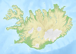
'''Apavatn''' ({{IPA-is|ˈaːpaˌvahtn̥}}) is a [[lake]] in southwest [[Iceland]]. With a surface area of around 13 km² it is much larger than the neighbouring lake of [[Laugarvatn]], which lies to the north of Apavatn. |
||
Apavatn is renowned for its good fishing, especially [[trout]]. |
Apavatn is renowned for its good fishing, especially [[trout]]. |
||
Revision as of 04:26, 16 May 2021
This article includes a list of references, related reading, or external links, but its sources remain unclear because it lacks inline citations. (April 2021) |
| Apavatn | |
|---|---|
 The lakes Laugarvatn and Apavatn from mount Laugarvatnsfjall. In the background Mount Hekla. | |
| Location | southwest Iceland |
| Coordinates | 64°10′N 20°40′W / 64.167°N 20.667°W |
| Basin countries | Iceland |
| Surface area | 13 km2 (5.0 sq mi) |
Apavatn (Icelandic pronunciation: [ˈaːpaˌvahtn̥]) is a lake in southwest Iceland. With a surface area of around 13 km² it is much larger than the neighbouring lake of Laugarvatn, which lies to the north of Apavatn.
Apavatn is renowned for its good fishing, especially trout.

