Paczków: Difference between revisions
Marcin 303 (talk | contribs) No edit summary |
No edit summary |
||
| Line 2: | Line 2: | ||
{{Infobox settlement |
{{Infobox settlement |
||
| name = Paczków |
| name = Paczków |
||
| image_skyline = |
| image_skyline = Paczkow 01.jpg |
||
| image_caption = Paczków |
| image_caption = Paczków Town Hall |
||
| image_flag = POL Paczków flag.svg |
| image_flag = POL Paczków flag.svg |
||
| image_shield = POL Paczków COA.svg |
| image_shield = POL Paczków COA.svg |
||
| Line 57: | Line 57: | ||
The first fortifications of Paczków were built in the mid-14th century upon the order of the Bishop of [[Wrocław]], [[Preczlaw of Pogarell|Przecław of Pogorzela]].<ref name="miasta.gazeta.pl"/> In the mid 15th century, Paczków had three [[City gate|gates]] - Wrocław Gate (''Brama Wrocławska'', eastern), Kłodzko Gate (''Brama Kłodzka'', western), and [[Zabkowice Slaskie]] Gate (''Brama Ząbkowicka'', southern). In the second half of the 16th century, the northern Nysa Gate (''Brama Nyska'') was added. Vertical, 9-metre walls made from stone still surround the historical centre of the town today. Altogether, the fortifications are around 1200 metres long,<ref>[http://www.cartablanca.pl/odwiedzznami/article/Paczkow?art_id=184 Carta Blanca Publishing House, Paczkow]</ref> and apart from four gates, there originally were 24 [[wall tower]]s, out of which 19 have been preserved. Along the defensive walls, there was a [[moat]], which has been turned into a recreational park. |
The first fortifications of Paczków were built in the mid-14th century upon the order of the Bishop of [[Wrocław]], [[Preczlaw of Pogarell|Przecław of Pogorzela]].<ref name="miasta.gazeta.pl"/> In the mid 15th century, Paczków had three [[City gate|gates]] - Wrocław Gate (''Brama Wrocławska'', eastern), Kłodzko Gate (''Brama Kłodzka'', western), and [[Zabkowice Slaskie]] Gate (''Brama Ząbkowicka'', southern). In the second half of the 16th century, the northern Nysa Gate (''Brama Nyska'') was added. Vertical, 9-metre walls made from stone still surround the historical centre of the town today. Altogether, the fortifications are around 1200 metres long,<ref>[http://www.cartablanca.pl/odwiedzznami/article/Paczkow?art_id=184 Carta Blanca Publishing House, Paczkow]</ref> and apart from four gates, there originally were 24 [[wall tower]]s, out of which 19 have been preserved. Along the defensive walls, there was a [[moat]], which has been turned into a recreational park. |
||
[[File:Paczkow 01.jpg|thumb|220px|[[Paczków Town Hall]]]] |
|||
Besides its fortifications, Paczków is famous for [[renaissance]], [[baroque]], and [[Neoclassicism|neoclassic]] [[tenement house]]s, which surround the [[town square]]. The oldest of these buildings date back to around 1500,<ref name="miasta.gazeta.pl"/> with the most visible being the so-called "House of the [[Executioner]]". Also, in the centre of Paczków, there is the [[town hall]], with a {{convert|48|m|ft|adj=mid|-high}} tower. |
Besides its fortifications, Paczków is famous for [[renaissance]], [[baroque]], and [[Neoclassicism|neoclassic]] [[tenement house]]s, which surround the [[town square]]. The oldest of these buildings date back to around 1500,<ref name="miasta.gazeta.pl"/> with the most visible being the so-called "House of the [[Executioner]]". Also, in the centre of Paczków, there is the [[town hall]], with a {{convert|48|m|ft|adj=mid|-high}} tower. |
||
Revision as of 09:01, 21 June 2021
Paczków | |
|---|---|
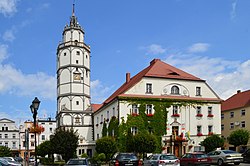 Paczków Town Hall | |
| Coordinates: 50°27′N 17°0′E / 50.450°N 17.000°E | |
| Country | |
| Voivodeship | |
| County | Nysa |
| Gmina | Paczków |
| Founded | 1254 |
| Town rights | 1254 |
| Government | |
| • Mayor | Artur Rolka |
| Area | |
• Total | 6.6 km2 (2.5 sq mi) |
| Population (2019-06-30[1]) | |
• Total | 7,460 |
| • Density | 1,156.2/km2 (2,995/sq mi) |
| Time zone | UTC+1 (CET) |
| • Summer (DST) | UTC+2 (CEST) |
| Postal code | 48-370 |
| Car plates | ONY |
| Website | http://www.paczkow.pl |
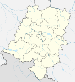
Paczków [ˈpat͡ʂkuf] (Template:Lang-de) is a town in Nysa County, Opole Voivodeship, Poland, with 7,460 inhabitants (2019). It is one of the few towns in Europe in which medieval fortifications have been almost completely preserved.[2] Located in the southeastern outskirts of the historical province of Lower Silesia, along the medieval road from Lesser Poland to Klodzko Valley and Prague, Paczków is called "Polish Carcassonne", thanks to its well-preserved medieval fortifications.[3][4] However, while the famous French Carcassonne is a 19th-century reconstruction, all historic buildings of Paczków are authentic.[5]
The old town and its medieval fortifications are listed as one of Poland's official national Historic Monuments (Pomnik historii), as designated November 13, 2012. Its listing is maintained by the National Heritage Board of Poland.
History

Paczków was officially founded and granted town rights on March 8, 1254,[3] when the Polish Bishop of Wrocław, Tomasz I gave permission to two Flemings Henryk and Wilhelm,[6] for the location of a new town Bogunów (mentioned under the Latinized name Bogunov) to be settled by German immigrants.[7] The new town was placed near the ancient village of Paczków and took its name, and henceforth, the name of the village was changed to Stary Paczków ("Old Paczków"). The name Paczków itself comes from the Old Polish male name Pakosław.[6] Paczków, mentioned in medieval documents under the Latinized Old Polish names Paczkaw (Liber fundationis episcopatus Vratislaviensis) and Patzkow (Book of Henryków), quickly grew, becoming not only a market town, but also a stronghold, guarding southwestern borders of the ecclesiastical Duchy of Nysa of fragmented Poland.[8] It was granted the so-called Flemish rights, based on Magdeburg rights. The new town received several privileges, such as the right to brew beer, and its early inhabitants were mostly craftsmen, such as bakers, butchers and shoemakers.
In the Late Middle Ages and subsequent periods, Paczków shared the stormy fate of other towns of Silesia, with frequent disasters, such as hunger (1325), floods (1333, 1501, 1539, 1560, 1598, 1602), fires (1565, 1634), as well as epidemics - Black Death (1349), and cholera (1603–1607, 1633). The town also suffered during the Hussite Wars, when it was captured by the Hussites on March 17, 1428.[8] The period of religious wars did not end until the late 15th century, and only then did Paczków begin to flourish again. With the financial support of the dukes of Nysa, new fortifications were constructed, with a wall and towers.
In 1526 Paczków, under the Germanized name Patschkau, together with the Duchy of Nysa, passed under the suzerainty of the Austrian Habsburg dynasty. The town blossomed, as a major centre of trade, with several manufacturers of textiles. The end of prosperity came during the Thirty Years' War, when warring armies destroyed Patschkau and adjacent areas.[8] In 1742, after the Silesian Wars, Patschkau was annexed by the Kingdom of Prussia, and it subsequently became part of the German Empire in 1871. It was secularized in 1810.[6] The town was spared from serious destruction during World War I and II.[6] During World War II, the Germans established five working parties (E158, E164, E274, E504, E534) of the Stalag VIII-B/344 prisoner-of-war camp in the town.[9] In the final stages of the war, the town was captured by the Soviet Red Army in May 1945.[6] Its German population was largely evacuated or expelled. After the war, following the Potsdam Agreement, it became again part of Poland, and its Polish name was restored.
The town was repopulated by Polish settlers from war-devastated Central Poland and expellees from former eastern Poland annexed by the Soviet Union, mostly from areas of Lwów, Tarnopol, and Volhynia (current western Ukraine).[10]
Monuments

Unlike nearby Nysa, World War II spared Paczków, and most of its monuments have been preserved. Called "The Polish Carcassonne" (or, before the town was reintegrated with Poland, "the Silesian Carcassonne"), as early as in the 15th century, it was surrounded by double ring of defensive walls. Initially, the fortifications were made of dirt and wood, but later they were replaced by mightier stone walls.
The first fortifications of Paczków were built in the mid-14th century upon the order of the Bishop of Wrocław, Przecław of Pogorzela.[2] In the mid 15th century, Paczków had three gates - Wrocław Gate (Brama Wrocławska, eastern), Kłodzko Gate (Brama Kłodzka, western), and Zabkowice Slaskie Gate (Brama Ząbkowicka, southern). In the second half of the 16th century, the northern Nysa Gate (Brama Nyska) was added. Vertical, 9-metre walls made from stone still surround the historical centre of the town today. Altogether, the fortifications are around 1200 metres long,[11] and apart from four gates, there originally were 24 wall towers, out of which 19 have been preserved. Along the defensive walls, there was a moat, which has been turned into a recreational park.
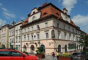
Besides its fortifications, Paczków is famous for renaissance, baroque, and neoclassic tenement houses, which surround the town square. The oldest of these buildings date back to around 1500,[2] with the most visible being the so-called "House of the Executioner". Also, in the centre of Paczków, there is the town hall, with a 48-metre-high (157 ft) tower.
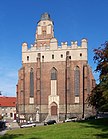
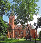
Another interesting monument of "Polish Carcassonne" is the Church of John the Evangelist, which is considered to be one of the most impressive fortified churches in Poland.[2] Its construction began in 1350, and lasted for 30 years. The unique Gothic church, which is made of stone and bricks displays a renaissance attic, and its mighty structure has been incorporated into the town's fortifications.[3] The church stands out because of its immense size, and inside there are sculptures attributed to Wit Stwosz. Next to the complex there is the so-called Tatar well. According to a legend, a Tatar warrior (see Mongol invasion of Poland) was thrown into the well, after he had captured the daughter of a wealthy inhabitant of Paczków.
Economy

The characteristics of the town of Paczków's economic dependence is similar to that of the Gmina Paczków and the whole of the Opole Voivodeship, agriculture. The gmina, under the local authority of the town has a total of 6193 ha used for agriculture (80% of its land), with the main crop being canola.[12]
To the west of Paczków, the Paczkowski Lake, while predominantly performing the role of protecting the locality from flooding, is also home to a small fishing industry. Apart from food production, Paczków is home to numerous heavy industry complexes, including the "EMSTEEL" steel plant by Robotnicza Street (ul. Robotnicza) and the "Pollena Paczków" chemicals manufacturing plant by Henryk Sienkiewicz Street (ul. Henryka Sienkiewicza).[13] Withal, in 2015 the service industry (including manual labour) provided 31.6% (11.7 million złoty) to the city's budget.[14]
Notable people
- Joseph Schröter (1837–1894), German scientist
- Lucyna Matuszna (born 1961), Polish female field hockey player
- Izabela Zatorska (born 1962), Polish retired female mountain runner
- Paweł Kukiz (born 1963), Polish politician, singer and actor
- Krzysztof Maksel (born 1991), Polish male cyclist
Twin towns – sister cities
See twin towns of Gmina Paczków.
Gallery
-
Town centre
-
Kłodzko Gate
-
Historic townhouses
-
Wrocław Gate
-
Market square
-
Church of Our Lady of Perpetual Help
-
Executioner's house, 18th century
References
- ^ "Population. Size and structure and vital statistics in Poland by territorial divison in 2019. As of 30th June". stat.gov.pl. Statistics Poland. 2019-10-15. Retrieved 2020-02-14.
- ^ a b c d Gazeta Wyborcza. Piotr Walczak, Odwiedz polskie Carcassonne (Visit Polish Carcassone) Archived 2008-09-15 at the Wayback Machine retrieved on April 21, 2009
- ^ a b c Panorama of Polish cities. Silesian Carcassone Archived 2007-10-16 at the Wayback Machine
- ^ Poland’s Official Travel Website, Paczkow - Polish Carcassone
- ^ Castles.info, Silesia and Opolskie
- ^ a b c d e "Historia miasta". Paczków - oficjalna strona internetowa (in Polish). Retrieved 22 March 2020.
- ^ Hans-Georg Mohr, Leo Schiller (Hrsg.): 1254–2004. 750 Jahre Patschkau. Die Geschichte der Stadt Patschkau in Schlesien. Dohlenverlag, Osnabrück 2004, S. 19: German text of the founding document
- ^ a b c History of Paczkow at portal paczkow info Archived 2009-02-27 at the Wayback Machine
- ^ "Working Parties". Stalag VIIIB 344 Lamsdorf. Retrieved 22 March 2020.
- ^ Official webpage of town and commune of Paczkow Archived 2009-04-17 at the Wayback Machine
- ^ Carta Blanca Publishing House, Paczkow
- ^ "Infrastruktura". paczkow.pl (in Polish). Retrieved 31 January 2017.
- ^ "Start - Pollena Paczków". Pollena Paczków (in Polish). 23 June 2014. Retrieved 31 January 2017.
- ^ "Paczków". www.polskawliczbach.pl (in Polish). Retrieved 31 January 2017.
External links
- Official webpage of the town
- Photo gallery of Paczkow
- Jewish Community in Paczków on Virtual Shtetl


