Dorposz Szlachecki: Difference between revisions
m WP:AWB cleanup, replaced: → |
Marcin 303 (talk | contribs) No edit summary |
||
| Line 3: | Line 3: | ||
| settlement_type = Village |
| settlement_type = Village |
||
|image_skyline = Dorposz Szlachecki Manor hause.jpg |
|image_skyline = Dorposz Szlachecki Manor hause.jpg |
||
|image_caption = |
|image_caption = Old manor house in Dorposz Szlachecki |
||
| image_flag = |
| image_flag = |
||
| image_shield = |
| image_shield = |
||
| Line 16: | Line 16: | ||
| subdivision_name3 = [[Gmina Kijewo Królewskie|Kijewo Królewskie]] |
| subdivision_name3 = [[Gmina Kijewo Królewskie|Kijewo Królewskie]] |
||
| coordinates = {{coord|53|17|27|N|18|25|55|E|region:PL|display=inline,title}} |
| coordinates = {{coord|53|17|27|N|18|25|55|E|region:PL|display=inline,title}} |
||
| pushpin_map = Poland |
| pushpin_map = Poland#Poland Kuyavian-Pomeranian Voivodeship |
||
| timezone = [[Central European Time|CET]] |
|||
| utc_offset = +1 |
|||
| timezone_DST = [[Central European Summer Time|CEST]] |
|||
| utc_offset_DST = +2 |
|||
| elevation_m = |
| elevation_m = |
||
| population_total = |
| population_total = |
||
| registration_plate = CCH |
|||
| website = }} |
| website = }} |
||
'''Dorposz Szlachecki''' ({{IPA-pl|ˈdɔrpɔʂ ʂlaˈxɛtskʲi}}; {{lang-de|Hönsdorf}}) is a village in the administrative district of [[Gmina Kijewo Królewskie]], within [[Chełmno County]], [[Kuyavian-Pomeranian Voivodeship]], in north-central Poland.<ref name="TERYT">{{cite web|url=http://www.stat.gov.pl/broker/access/prefile/listPreFiles.jspa|title=Central Statistical Office (GUS) - TERYT (National Register of Territorial Land Apportionment Journal)|date=2008-06-01|language=Polish}}</ref> It lies {{convert|9|km|mi|0}} south of [[Chełmno]], {{convert|32|km|mi|0|abbr=on}} north-west of Toruń, and {{convert|35|km|mi|0|abbr=on}} north-east of Bydgoszcz. |
'''Dorposz Szlachecki''' ({{IPA-pl|ˈdɔrpɔʂ ʂlaˈxɛtskʲi}}; {{lang-de|Hönsdorf}}) is a village in the administrative district of [[Gmina Kijewo Królewskie]], within [[Chełmno County]], [[Kuyavian-Pomeranian Voivodeship]], in north-central Poland.<ref name="TERYT">{{cite web|url=http://www.stat.gov.pl/broker/access/prefile/listPreFiles.jspa|title=Central Statistical Office (GUS) - TERYT (National Register of Territorial Land Apportionment Journal)|date=2008-06-01|language=Polish}}</ref> It lies {{convert|9|km|mi|0}} south of [[Chełmno]], {{convert|32|km|mi|0|abbr=on}} north-west of [[Toruń]], and {{convert|35|km|mi|0|abbr=on}} north-east of [[Bydgoszcz]]. It is located in the [[Chełmno Land]] in the historic region of [[Pomerania]]. |
||
==History== |
|||
During the [[Occupation of Poland (1939–1945)|German occupation]] ([[World War II]]), in 1939, the German ''[[Selbstschutz]]'' established a jail for [[Poles]] from the region in the local pre-war Polish police station.<ref name=mw>{{cite book|last=Wardzyńska|first=Maria|year=2009|title=Był rok 1939. Operacja niemieckiej policji bezpieczeństwa w Polsce. Intelligenzaktion|language=pl|location=Warszawa|publisher=[[Institute of National Remembrance|IPN]]|page=165}}</ref> Around 400 Poles were imprisoned and then massacred in nearby [[Małe Czyste]] as part of the ''[[Intelligenzaktion]]''.<ref>Wardzyńska (2009), p. 166</ref> Polish teachers from Dorposz Szlachecki were murdered by the Germans in a massacre of Poles committed in nearby [[Klamry]], also as part of the ''Intelligenzaktion''.<ref name=mw/> In 1941, the occupiers also carried out [[Expulsion of Poles by Nazi Germany|expulsions of Poles]], whose farms were then handed over to [[Germans|German]] colonists as part of the ''[[Lebensraum]]'' policy.<ref>{{cite book|last=Wardzyńska|first=Maria|year=2017|title=Wysiedlenia ludności polskiej z okupowanych ziem polskich włączonych do III Rzeszy w latach 1939-1945|language=pl|location=Warszawa|publisher=IPN|page=98|isbn=978-83-8098-174-4}}</ref> |
|||
==References== |
==References== |
||
Revision as of 08:35, 22 August 2021
Dorposz Szlachecki | |
|---|---|
Village | |
 Old manor house in Dorposz Szlachecki | |
| Coordinates: 53°17′27″N 18°25′55″E / 53.29083°N 18.43194°E | |
| Country | |
| Voivodeship | Kuyavian-Pomeranian |
| County | Chełmno |
| Gmina | Kijewo Królewskie |
| Time zone | UTC+1 (CET) |
| • Summer (DST) | UTC+2 (CEST) |
| Vehicle registration | CCH |
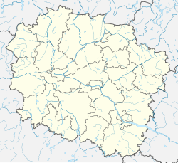
Dorposz Szlachecki (Polish pronunciation: [ˈdɔrpɔʂ ʂlaˈxɛtskʲi]; Template:Lang-de) is a village in the administrative district of Gmina Kijewo Królewskie, within Chełmno County, Kuyavian-Pomeranian Voivodeship, in north-central Poland.[1] It lies 9 kilometres (6 mi) south of Chełmno, 32 km (20 mi) north-west of Toruń, and 35 km (22 mi) north-east of Bydgoszcz. It is located in the Chełmno Land in the historic region of Pomerania.
History
During the German occupation (World War II), in 1939, the German Selbstschutz established a jail for Poles from the region in the local pre-war Polish police station.[2] Around 400 Poles were imprisoned and then massacred in nearby Małe Czyste as part of the Intelligenzaktion.[3] Polish teachers from Dorposz Szlachecki were murdered by the Germans in a massacre of Poles committed in nearby Klamry, also as part of the Intelligenzaktion.[2] In 1941, the occupiers also carried out expulsions of Poles, whose farms were then handed over to German colonists as part of the Lebensraum policy.[4]
References
- ^ "Central Statistical Office (GUS) - TERYT (National Register of Territorial Land Apportionment Journal)" (in Polish). 2008-06-01.
- ^ a b Wardzyńska, Maria (2009). Był rok 1939. Operacja niemieckiej policji bezpieczeństwa w Polsce. Intelligenzaktion (in Polish). Warszawa: IPN. p. 165.
- ^ Wardzyńska (2009), p. 166
- ^ Wardzyńska, Maria (2017). Wysiedlenia ludności polskiej z okupowanych ziem polskich włączonych do III Rzeszy w latach 1939-1945 (in Polish). Warszawa: IPN. p. 98. ISBN 978-83-8098-174-4.


