Pailin municipality: Difference between revisions
Appearance
Content deleted Content added
Tom.Reding (talk | contribs) m +{{Authority control}} (2 IDs from Wikidata), WP:GenFixes on |
No edit summary Tags: Mobile edit Mobile web edit Advanced mobile edit |
||
| Line 7: | Line 7: | ||
|native_name_lang = km |
|native_name_lang = km |
||
|nickname = |
|nickname = |
||
|settlement_type = [[List of |
|settlement_type = [[List of districts in Cambodia|Municipality]] |
||
<!-- images and maps -----------> |
<!-- images and maps -----------> |
||
|image_skyline = パイリン州にあるHUGS Agrico 運営の農地 450ha.JPG |
|image_skyline = パイリン州にあるHUGS Agrico 運営の農地 450ha.JPG |
||
| Line 15: | Line 15: | ||
|mapsize = |
|mapsize = |
||
|map_caption = |
|map_caption = |
||
|pushpin_map =Cambodia<!-- the name of a location map as per http://en.wikipedia.org/wiki/Template:Location_map --> |
|pushpin_map = Cambodia<!-- the name of a location map as per http://en.wikipedia.org/wiki/Template:Location_map --> |
||
|pushpin_label_position =bottom |
|pushpin_label_position =bottom |
||
|pushpin_mapsize = |
|pushpin_mapsize = |
||
|pushpin_map_caption =Location in Cambodia |
|pushpin_map_caption = Location in Cambodia |
||
<!-- Location ------------------> |
<!-- Location ------------------> |
||
|subdivision_type = Country |
|subdivision_type = Country |
||
|subdivision_name = Cambodia |
|subdivision_name = {{flag|Cambodia}} |
||
|subdivision_type1 = [[Provinces of Cambodia|Province]] |
|subdivision_type1 = [[Provinces of Cambodia|Province]] |
||
|subdivision_name1 = [[Pailin Province|Pailin]] |
|subdivision_name1 = [[Pailin Province|Pailin]] |
||
|subdivision_type2 = |
|subdivision_type2 = |
||
|subdivision_name2 = |
|subdivision_name2 = |
||
|subdivision_type3 = |
|subdivision_type3 = |
||
|subdivision_name3 = |
|subdivision_name3 = |
||
|<!-- Politics -----------------> |
|<!-- Politics -----------------> |
||
|government_footnotes = |
|government_footnotes = |
||
|government_type = City |
|government_type = City Municipality |
||
|leader_title = Mayor |
|leader_title = Mayor |
||
|leader_name = |
|leader_name = |
||
| Line 57: | Line 57: | ||
|area_code = |
|area_code = |
||
|website = |
|website = |
||
|blank_name = |
|blank_name = |
||
|blank_info = |
|blank_info = |
||
|footnotes = |
|footnotes = |
||
}} |
}} |
||
{{Contains special characters|Khmer}} |
{{Contains special characters|Khmer}} |
||
'''Pailin Municipality''' ({{lang-km|ក្រុងប៉ៃលិន}} |
'''Pailin Municipality''' ({{lang-km|ក្រុងប៉ៃលិន}}) is a municipality (''[[krong]]'') in the centre of [[Pailin Province]] in north-western Cambodia. The municipality is subdivided into 4 communes (''sangkat'') and 36 villages (''phum''). According to the 1998/2008 census of Cambodia, the 575 km2 city had a population of 15,800 and 36,354 respectively.<ref>{{Cite web | title = General Population Census of Cambodia 1998, Final Census Results| publisher = National Institute of Statistics, Ministry of Planning, Cambodia| date = August 2002 | url = http://www.nis.gov.kh/nis/uploadFile/pdf/CensusResult98.pdf| access-date = 2010-11-25}} See page 296.</ref><ref>All districts, communes and villages in Pailin, National Institute of Statistics, http://www.bridgeinternational.biz/download/villages/Pailin.pdf {{Webarchive|url=https://web.archive.org/web/20120704024118/http://bridgeinternational.biz/download/villages/Pailin.pdf |date=2012-07-04 }}</ref> |
||
{| class="wikitable" |
{| class="wikitable" |
||
|- |
|- |
||
! |
! Communes (''Sangkat'') !! Villages (''Phum'')<ref>All districts, communes and villages in Pailin, National Institute of Statistics, http://www.bridgeinternational.biz/download/villages/Pailin.pdf {{Webarchive|url=https://web.archive.org/web/20120704024118/http://bridgeinternational.biz/download/villages/Pailin.pdf |date=2012-07-04 }}</ref> |
||
|- |
|- |
||
|'''Pailin''' || |
|'''Pailin''' || Ou Tapuk Loeu, O Ta Prang, Soun Am Pao Khang Lech, Suon Ampov Khang Koet, Wat, Toek Thla, Ta Gen Loeu, Ba Den Neiv, Toul Kheiv, Pa Hi Tboang, Pa Hi Choeng |
||
|- |
|- |
||
|'''Ou Ta Vau''' || Khlong, Koun Phnum, Ou Tavau, Kbal Pralean, Die Kra Hom, Kra Chab, Ou Proes |
|'''Ou Ta Vau''' || Khlong, Koun Phnum, Ou Tavau, Kbal Pralean, Die Kra Hom, Kra Chab, Ou Proes |
||
Revision as of 11:43, 28 August 2021
Pailin Municipality
ក្រុងប៉ៃលិន | |
|---|---|
 | |
| Coordinates: 12°51′16″N 102°36′23″E / 12.85444°N 102.60639°E | |
| Country | |
| Province | Pailin |
| Government | |
| • Type | City Municipality |
| Area | |
• Total | 575 km2 (222 sq mi) |
| Population (2019)[1] | |
• Total | 37,393 |
| Time zone | UTC+7 (ICT) |
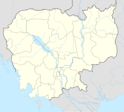
Pailin Municipality (Template:Lang-km) is a municipality (krong) in the centre of Pailin Province in north-western Cambodia. The municipality is subdivided into 4 communes (sangkat) and 36 villages (phum). According to the 1998/2008 census of Cambodia, the 575 km2 city had a population of 15,800 and 36,354 respectively.[2][3]
| Communes (Sangkat) | Villages (Phum)[4] |
|---|---|
| Pailin | Ou Tapuk Loeu, O Ta Prang, Soun Am Pao Khang Lech, Suon Ampov Khang Koet, Wat, Toek Thla, Ta Gen Loeu, Ba Den Neiv, Toul Kheiv, Pa Hi Tboang, Pa Hi Choeng |
| Ou Ta Vau | Khlong, Koun Phnum, Ou Tavau, Kbal Pralean, Die Kra Hom, Kra Chab, Ou Proes |
| Tuol Lvea | Tuol Lvea, Chamkar Kaphe, Ou Chra Kandal, Ou Chra Khang Kaeut, Ou Chra Leu, Ou Ta Puk Kraom, Ou Peut, Tuol Sralau, Tuol Nimit, Viel Vong, Thmey |
| Bar Yakha | Ou Chra Lech, Ou Snguot, Roung Chak Tuek Kak, Ba Yakha, Ba Tangsu, Bahuy Khmaer Cheung, Bahuy Khmaer Tboung |
References
- ^ "General Population Census of the Kingdom of Cambodia 2019 – Final Results" (PDF). National Institute of Statistics. Ministry of Planning. 26 January 2021. Retrieved 4 February 2021.
- ^ "General Population Census of Cambodia 1998, Final Census Results" (PDF). National Institute of Statistics, Ministry of Planning, Cambodia. August 2002. Retrieved 2010-11-25. See page 296.
- ^ All districts, communes and villages in Pailin, National Institute of Statistics, http://www.bridgeinternational.biz/download/villages/Pailin.pdf Archived 2012-07-04 at the Wayback Machine
- ^ All districts, communes and villages in Pailin, National Institute of Statistics, http://www.bridgeinternational.biz/download/villages/Pailin.pdf Archived 2012-07-04 at the Wayback Machine
Relevant Links
Official Pailin Tourism The Official Cambodian Ministry of Tourism website for the city of Pailin featuring tourist attractions, hotels and resorts, restaurants, useful information for travellers and more.
12°50′56″N 102°36′33″E / 12.8489°N 102.6092°E


