Madapurachal: Difference between revisions
Appearance
Content deleted Content added
No edit summary |
No edit summary |
||
| Line 17: | Line 17: | ||
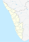
| pushpin_map_caption = Location in Kerala |
| pushpin_map_caption = Location in Kerala |
||
| image_skyline = Madapurachal church 11.jpg |
| image_skyline = Madapurachal church 11.jpg |
||
| imagesize = 100 |
|||
| image_caption = Madapurachal Velankanni church |
|||
}} |
}} |
||
Revision as of 04:47, 14 September 2021
Madapurachal | |
|---|---|
 Madapurachal Velankanni church | |
| Coordinates: 11°55′27.3″N 75°44′38.5″E / 11.924250°N 75.744028°E | |
| Country | India |
| State | Kerala |
| District | Kannur |
| Taluk | Iritty |
| Panchayath | Peravoor |
Madapurachal is a locality near Manathana in Peravoor panchayath[1], Kannur district, Kerala, India. State highway 59 passes through Madapurachal[2]. Madapurachal is situated 50 km away from Kannur. Iritty is the nearest town which is 13 km from Madapurachal.
- ^ "Madapurachal". www.wikidata.org. Retrieved 2021-09-14.
- ^ "Hill Highway in Kerala; DPR ready for just 79 kms". Mathrubhumi. Retrieved 2021-09-14.

