Green's Harbour: Difference between revisions
Appearance
Content deleted Content added
→References: +navbox |
add infobox |
||
| Line 1: | Line 1: | ||
{{Use Canadian English|date=December 2021}} |
{{Use Canadian English|date=December 2021}} |
||
{{Use mdy dates|date=December 2021}} |
{{Use mdy dates|date=December 2021}} |
||
{{Infobox settlement |
|||
|name = Green's Harbour |
|||
|other_name = |
|||
|native_name = |
|||
|nickname = |
|||
|settlement_type = [[Designated place]] |
|||
|image_skyline = |
|||
|imagesize = |
|||
|image_caption = |
|||
|pushpin_relief = yes |
|||
|pushpin_map = Canada Newfoundland and Labrador#Canada |
|||
|pushpin_label_position = <!-- the position of the pushpin label: left, right, top, bottom, none --> |
|||
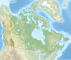
|pushpin_map_caption = Location of Green's Harbour |
|||
|subdivision_type = Country |
|||
|subdivision_name = Canada |
|||
|subdivision_type1 = [[Provinces and territories of Canada|Province]] |
|||
|subdivision_name1 = [[Newfoundland and Labrador]] |
|||
|subdivision_type2 = [[List of regions of Canada#Alberta|Region]] |
|||
|subdivision_name2 = [[Newfoundland (island)|Newfoundland]] |
|||
|subdivision_type3 = [[List of census divisions of Newfoundland and Labrador|Census division]] |
|||
|subdivision_name3 = [[Division No. 1, Newfoundland and Labrador|1]] |
|||
|subdivision_type4 = [[Census subdivision]] |
|||
|subdivision_name4 = [[Division No. 1, Subdivision E, Newfoundland and Labrador|E]] |
|||
|government_footnotes = |
|||
|government_type = [[Municipal incorporation|Unincorporated]] |
|||
|leader_title = |
|||
|leader_name = |
|||
|leader_title1 = Governing body |
|||
|leader_name1 = |
|||
|established_title = Established |
|||
|established_date = |
|||
|established_title2 = |
|||
|established_date2 = |
|||
|established_title3 = |
|||
|established_date3 = |
|||
|area_footnotes = <ref name=2016census/> |
|||
|area_land_km2 = 6.13 |
|||
|population_as_of = 2016 |
|||
|population_footnotes = <ref name=2016census/> |
|||
|population_note = |
|||
|population_total = 642 |
|||
|population_density_km2 = |
|||
|timezone = [[Newfoundland Time Zone|NST]] |
|||
|utc_offset = −03:30 |
|||
|timezone_DST = NDT |
|||
|utc_offset_DST = −02:30 |
|||
|coordinates = {{coord|47.638|N|53.508|W|region:CA-NL|display=inline,title}} |
|||
|elevation_footnotes = |
|||
|elevation_m = |
|||
|postal_code_type = [[List of A postal codes of Canada|Postal code]] |
|||
|postal_code = |
|||
|area_code = [[Area code 709|709]] |
|||
|blank_name = [[List of Newfoundland and Labrador highways|Highways]] |
|||
|blank_info = |
|||
|blank1_name = Waterways |
|||
|blank1_info = |
|||
|footnotes = |
|||
}} |
|||
'''Green's Harbour''' is a [[designated place]] in the [[Provinces and territories of Canada|Canadian province]] of [[Newfoundland and Labrador]]. |
'''Green's Harbour''' is a [[designated place]] in the [[Provinces and territories of Canada|Canadian province]] of [[Newfoundland and Labrador]]. |
||
Revision as of 04:00, 29 December 2021
Green's Harbour | |
|---|---|
| Coordinates: 47°38′17″N 53°30′29″W / 47.638°N 53.508°W | |
| Country | Canada |
| Province | Newfoundland and Labrador |
| Region | Newfoundland |
| Census division | 1 |
| Census subdivision | E |
| Government | |
| • Type | Unincorporated |
| Area | |
| • Land | 6.13 km2 (2.37 sq mi) |
| Population (2016)[1] | |
• Total | 642 |
| Time zone | UTC−03:30 (NST) |
| • Summer (DST) | UTC−02:30 (NDT) |
| Area code | 709 |
Green's Harbour is a designated place in the Canadian province of Newfoundland and Labrador.
Geography
Green's Harbour is in Newfoundland within Subdivision E of Division No. 1.[2]
Demographics
As a designated place in the 2016 Census of Population conducted by Statistics Canada, Green's Harbour recorded a population of 642 living in 277 of its 371 total private dwellings, a change of 20.2% from its 2011 population of 534. With a land area of 6.13 km2 (2.37 sq mi), it had a population density of 104.7/km2 (271.3/sq mi) in 2016.[1]
See also
- List of communities in Newfoundland and Labrador
- List of designated places in Newfoundland and Labrador
References
- ^ a b c "Population and dwelling counts, for Canada, provinces and territories, and designated places, 2016 and 2011 censuses – 100% data (Newfoundland and Labrador)". Statistics Canada. February 7, 2018. Retrieved December 22, 2021.
- ^ "Population and dwelling counts, for Canada, provinces and territories, census divisions, census subdivisions (municipalities) and designated places, 2016 and 2011 censuses – 100% data (Newfoundland and Labrador)". Statistics Canada. February 7, 2018. Retrieved December 23, 2021.


