Bushiri: Difference between revisions
Appearance
Content deleted Content added
Added two categories |
fixed typo |
||
| Line 1: | Line 1: | ||
{{Short description|Ward in |
{{Short description|Ward in Pangani District, Tanga Region}} |
||
{{Infobox settlement |
{{Infobox settlement |
||
<!--See Template:Infobox Settlement for additional fields that may be available--> |
<!--See Template:Infobox Settlement for additional fields that may be available--> |
||
Revision as of 14:25, 2 January 2022
Bushiri Ward
Kata ya Bushiri (Swahili) | |
|---|---|
| Kata ya Bushiri, Wilaya ya Pangani | |
| Coordinates: 5°20′24.72″S 38°56′17.16″E / 5.3402000°S 38.9381000°E | |
| Country | |
| Region | Tanga Region |
| District | Pangani District |
| Area | |
• Total | 249 km2 (96 sq mi) |
| Elevation | 55 m (180 ft) |
| Population (2012) | |
• Total | 4,750 |
| • Density | 19/km2 (49/sq mi) |
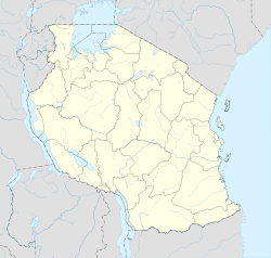
Bushiri is an administrative ward in Pangani District of Tanga Region in Tanzania. The ward covers an area of 249 km2 (96 sq mi),[1] and has an average elevation of 55 m (180 ft).[2] According to the 2012 census, the ward has a total population of 4,750.[3] The Ward is anmed after a famous Swahili revolt in German occupied East Africa in 1888.[4]
See Also
References
- ^ "Tanzania: Northern Tanzania(Districts and Wards) - Population Statistics, Charts and Map".
- ^ "Bushiri Elevation".
- ^ "2012 Population and Housing Census General Report" (PDF). Government of Tanzania. Retrieved 2021-12-31.
- ^ Pike, Charles. “History and Imagination: Swahili Literature and Resistance to German Language Imperialism in Tanzania, 1885-1910.” The International Journal of African Historical Studies, vol. 19, no. 2, Boston University African Studies Center, 1986, pp. 201–33, https://doi.org/10.2307/219426.

