Đại Hóa: Difference between revisions
Appearance
Content deleted Content added
m Moving Category:Communes of Bắc Giang Province to Category:Communes of Bắc Giang province per Wikipedia:Categories for discussion/Speedy |
|||
| Line 93: | Line 93: | ||
{{DEFAULTSORT:Dai Hoa}} |
{{DEFAULTSORT:Dai Hoa}} |
||
[[Category:Populated places in Bắc Giang province]] |
[[Category:Populated places in Bắc Giang province]] |
||
[[Category:Communes of Bắc Giang |
[[Category:Communes of Bắc Giang province]] |
||
Latest revision as of 15:25, 3 January 2022
Dai Hoa
Xã Đại Hóa | |
|---|---|
Commune and village | |
 | |
| Country | |
| Province | Bắc Giang |
| District | Tân Yên |
| Time zone | UTC+07:00 |
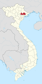
Đại Hóa is a commune (xã) and village in Tân Yên District, Bắc Giang Province, in northeastern Vietnam.[1]
References
[edit]21°26′00″N 106°03′30″E / 21.43333°N 106.05833°E

