San Vincenzo Valle Roveto: Difference between revisions
Appearance
Content deleted Content added
MrKeefeJohn (talk | contribs) No edit summary Tag: Disambiguation links added |
MrKeefeJohn (talk | contribs) No edit summary |
||
| Line 46: | Line 46: | ||
== History == |
== History == |
||
The medieval village, dating back to around the year one thousand, developed near the church dedicated to [[ |
The medieval village, dating back to around the year one thousand, developed near the church dedicated to [[Vincent of Saragossa|St. Vincent martyr]], patron saint of the town.<ref>[http://www.valleroveto.eu/san-vincenzo-valle-roveto/ San Vincenzo Valle Roveto. Borghi e storia della Valle Roveto], valleroveto.eu</ref> The church already depended in the 11th-12th centuries on the [[Casamari]] abbey, in the neighboring [[Latin Valley]]. The history of the town has always been linked to that of the nearby and more important medieval castle of Morrea, most likely already present in ancient documents dating back to the year 702 with the toponym of Horrea.<ref>[http://www.portaleabruzzo.com/nav/tabcomuni.asp?id=6454 San Vincenzo Valle Roveto], Il Portale d'Abruzzo</ref> |
||
== References == |
== References == |
||
Revision as of 19:37, 5 February 2022
San Vincenzo Valle Roveto | |
|---|---|
| Comune di San Vincenzo Valle Roveto | |
 | |
| Coordinates: 41°50′47″N 13°32′12″E / 41.84639°N 13.53667°E | |
| Country | Italy |
| Region | Abruzzo |
| Province | L'Aquila (AQ) |
| Frazioni | Castronovo, Morrea, Roccavivi, Rosce, San Giovanni Nuovo, San Giovanni Vecchio, San Vincenzo Superiore, Santa Restituta, Velarde |
| Government | |
| • Mayor | Giulio Lancia |
| Area | |
• Total | 46.04 km2 (17.78 sq mi) |
| Elevation | 388 m (1,273 ft) |
| Population (31 October 2017)[2] | |
• Total | 2,302 |
| • Density | 50/km2 (130/sq mi) |
| Demonym | Sanvincenzesi |
| Time zone | UTC+1 (CET) |
| • Summer (DST) | UTC+2 (CEST) |
| Postal code | 67050 |
| Dialing code | 0863 |
| Saint day | January 22 |
| Website | Official website |
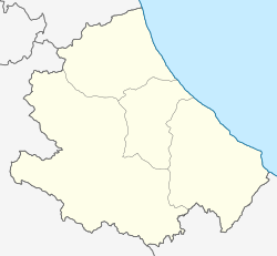
San Vincenzo Valle Roveto is a comune and town in the province of L'Aquila in the Abruzzo region of Italy.
Geography
The town is located at an altitude of 388 meters above sea level, along the Roveto valley, in Marsica.
History
The medieval village, dating back to around the year one thousand, developed near the church dedicated to St. Vincent martyr, patron saint of the town.[3] The church already depended in the 11th-12th centuries on the Casamari abbey, in the neighboring Latin Valley. The history of the town has always been linked to that of the nearby and more important medieval castle of Morrea, most likely already present in ancient documents dating back to the year 702 with the toponym of Horrea.[4]
References
- ^ "Superficie di Comuni Province e Regioni italiane al 9 ottobre 2011". Italian National Institute of Statistics. Retrieved 16 March 2019.
- ^ "Popolazione Residente al 1° Gennaio 2018". Italian National Institute of Statistics. Retrieved 16 March 2019.
- ^ San Vincenzo Valle Roveto. Borghi e storia della Valle Roveto, valleroveto.eu
- ^ San Vincenzo Valle Roveto, Il Portale d'Abruzzo


