Stepnogorsk: Difference between revisions
Appearance
Content deleted Content added
mNo edit summary Tag: Reverted |
No edit summary Tags: Manual revert Reverted |
||
| Line 3: | Line 3: | ||
<!-- Basic info ---------------->| official_name = Stepnogorsk |
<!-- Basic info ---------------->| official_name = Stepnogorsk |
||
| other_name = |
| other_name = |
||
| native_name = |
| native_name = Степногорск |
||
| nickname = |
| nickname = |
||
| settlement_type = <!--For Town or Village (Leave blank for the default City)--> |
| settlement_type = <!--For Town or Village (Leave blank for the default City)--> |
||
| Line 116: | Line 116: | ||
}} |
}} |
||
'''Stepnogorsk''' ({{lang-kk|Степногорск |
'''Stepnogorsk''' ({{lang-kk|Степногорск|translit=Stepnogorsk}}; {{lang-ru|Степногорск}}) is a town in [[Akmola Region]], [[Kazakhstan]]. It was established in 1959, and has been a town since 1964. It is located about 200 km North-East of [[Nur-Sultan]]. It began as a [[closed town]] with code names Tselinograd-25 ({{lang-ru|Целиноград-25}}), Makinsk-2 ({{lang-ru|Макинск-2}}). The town is known as a nuclear and biochemical site.<ref>[https://www.nytimes.com/2003/01/12/magazine/anthrax-island.html?sec=&spon=&partner=permalink&exprod=permalink Report includes interview with a microbiologist who "ran a huge bioweapons production plant in Stepnogorsk"]</ref> Population: {{Kz-census2009|46,712|punct=;}} {{Kz-census1999|47,372|punct=.}} |
||
==See also== |
==See also== |
||
Revision as of 13:17, 21 February 2022
Stepnogorsk
Степногорск | |
|---|---|
 | |
| Coordinates: 52°20′59″N 71°53′24″E / 52.34972°N 71.89000°E | |
| Country | Kazakhstan |
| Region | Akmola Region |
| Government | |
| • Type | Mayor-council government |
| • Mayor | Anuar Michael Kumpekeyev |
| Population (2009) | |
• Total | 46,712 |
| Time zone | UTC+6 (Omsk Time) |
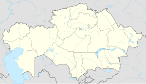
Stepnogorsk (Template:Lang-kk; Template:Lang-ru) is a town in Akmola Region, Kazakhstan. It was established in 1959, and has been a town since 1964. It is located about 200 km North-East of Nur-Sultan. It began as a closed town with code names Tselinograd-25 (Template:Lang-ru), Makinsk-2 (Template:Lang-ru). The town is known as a nuclear and biochemical site.[1] Population: 46,712 (2009 Census results);[2] 47,372 (1999 Census results).[2]
See also
References
Wikimedia Commons has media related to Stepnogorsk.
- ^ Report includes interview with a microbiologist who "ran a huge bioweapons production plant in Stepnogorsk"
- ^ a b "Население Республики Казахстан" [Population of the Republic of Kazakhstan] (in Russian). Департамент социальной и демографической статистики. Retrieved 8 December 2013.
External links
- STEPNOGORSK Online - Unofficial web site since 1999 mirror (in Russian)
- Advertising and Information Portal town Stepnogorsk Kazakhstan (in Russian)
52°20′59″N 71°53′24″E / 52.34972°N 71.89000°E


