Hoskote: Difference between revisions
BOT--Reverting link addition(s) by 122.172.197.90 to revision 1067570614 (www.youtube.com/watch?v=wRd8Yzxq2Gg&t=134s [\byoutube\.com]) |
|||
| Line 65: | Line 65: | ||
[[Category:Cities and towns in Bangalore Rural district]] |
[[Category:Cities and towns in Bangalore Rural district]] |
||
https://en.wikipedia.org/wiki/Hoskote |
|||
Revision as of 05:08, 25 February 2022
This article needs additional citations for verification. (July 2012) |
This article possibly contains original research. (February 2018) |
Hoskote | |
|---|---|
taluk | |
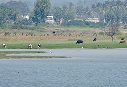
 Hoskote Lake | |
| Coordinates: 13°04′N 77°48′E / 13.07°N 77.8°E | |
| Country | |
| State | Karnataka |
| District | Bangalore Rural |
| Elevation | 891 m (2,923 ft) |
| Population (2011) | |
• Total | 56,980 |
| Languages | |
| • Official | Kannada |
| Time zone | UTC+5:30 (IST) |
| PIN | 562114 |
| Telephone code | 91-80 |
| Vehicle registration | KA-53 |
Hoskote (historically known as Ooscota or Ooscata) is a taluk in Bangalore Rural District, India. Headquartered at the Hosakote town, it consists of five hoblis - Anugondanahalli, Jadigenahalli, Kasaba, Nandagudi and Sulibele.
History
Hoskote was a Jagir of Maratha warrior Shahaji Raje for around 50 years and also part of Swarajya of Shivaji. The Battle of Ooscata in the First British-Mysore War, on the night of 22-23 August 1768 took place here.
Demographics
As of 2011[update] India census,[1] Hoskote had a population of 56980. Males constitute 52% of the population and females 48%. Hoskote has an average literacy rate of 86.22%, higher than the state average of 75.36%: male literacy is 89.58%, and female literacy is 82.68%. Hoskote has 11.98% of its population under 6 years of age.
References
- ^ "Census of India 2011: Data from the 2011 Census, including cities, villages and towns (Provisional)". Census Commission of India. Archived from the original on 16 June 2004. Retrieved 1 November 2008.

