Urszulin, Ryki County: Difference between revisions
Appearance
Content deleted Content added
m v2.04b - Bot T20 CW#61 - Fix errors for CW project (Reference before punctuation) |
Better wording. Tags: Mobile edit Mobile web edit |
||
| Line 30: | Line 30: | ||
'''Urszulin''' ({{IPA-pl|urˈʂulin}}) is a [[village]] in the administrative district of [[Gmina Nowodwór]], within [[Ryki County]], [[Lublin Voivodeship]], in eastern Poland. It lies approximately {{convert|14|km|mi|0}} north-east of [[Ryki]] and {{convert|58|km|mi|0|abbr=on}} north-west of the regional capital [[Lublin]].<ref name="TERYT">{{cite web |url=http://www.stat.gov.pl/broker/access/prefile/listPreFiles.jspa |title=Central Statistical Office (GUS) – TERYT (National Register of Territorial Land Apportionment Journal) |date=2008-06-01 |language=Polish}}</ref> As of 2009, the village had a population of 131.<ref>{{Cite web|date=2009|title=Bank Danych Lokalnych|url=https://bdl.stat.gov.pl/BDL/start|url-status=live|access-date=2022-01-31}}</ref> |
'''Urszulin''' ({{IPA-pl|urˈʂulin}}) is a [[village]] in the administrative district of [[Gmina Nowodwór]], within [[Ryki County]], [[Lublin Voivodeship]], in eastern Poland. It lies approximately {{convert|14|km|mi|0}} north-east of [[Ryki]] and {{convert|58|km|mi|0|abbr=on}} north-west of the regional capital [[Lublin]].<ref name="TERYT">{{cite web |url=http://www.stat.gov.pl/broker/access/prefile/listPreFiles.jspa |title=Central Statistical Office (GUS) – TERYT (National Register of Territorial Land Apportionment Journal) |date=2008-06-01 |language=Polish}}</ref> As of 2009, the village had a population of 131.<ref>{{Cite web|date=2009|title=Bank Danych Lokalnych|url=https://bdl.stat.gov.pl/BDL/start|url-status=live|access-date=2022-01-31}}</ref> |
||
In 1827, as a part of the [[Drążgów]] goods, it had 5 houses and 29 inhabitants. In 1872 |
In 1827, as a part of the [[Drążgów]] goods, it had 5 houses and 29 inhabitants. In 1872 it was detached from Drążgów together with [[Zawitała]], and in 1885 it was separated from Zawitała.<ref>{{Cite book|url=http://dir.icm.edu.pl/pl/Slownik_geograficzny/Tom_XIV/497|title=Słownik geograficzny Królestwa Polskiego i innych krajów słowiańskich, Tom XIV|publisher=Kasa im. Józefa Mianowskiego|year=1892|location=Warszawa|pages=497|language=pl}}</ref> At the end of the 19th century it had 4 houses and 47 inhabitants.<ref>{{Cite book|url=http://dir.icm.edu.pl/pl/Slownik_geograficzny/Tom_XII/820|title=Słownik geograficzny Królestwa Polskiego i innych krajów słowiańskich, Tom XII|publisher=Kasa im. Józefa Mianowskiego|year=1892|location=Warszawa|pages=820|language=pl}}</ref> |
||
==References== |
==References== |
||
Revision as of 13:31, 12 March 2022
Urszulin | |
|---|---|
Village | |
| Coordinates: 51°41′N 22°7′E / 51.683°N 22.117°E | |
| Country | |
| Voivodeship | Lublin |
| County | Ryki |
| Gmina | Nowodwór |
| Population (2009) | 131 |
| Time zone | UTC+1 (CET) |
| • Summer (DST) | UTC+2 (CEST) |
| Postal code | 08-503 |
| Area code | +48 81 |
| Car plates | LRY |
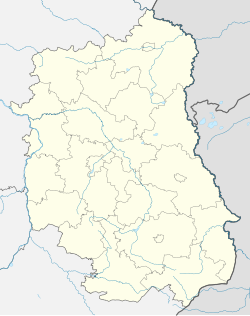
Urszulin (Polish pronunciation: [urˈʂulin]) is a village in the administrative district of Gmina Nowodwór, within Ryki County, Lublin Voivodeship, in eastern Poland. It lies approximately 14 kilometres (9 mi) north-east of Ryki and 58 km (36 mi) north-west of the regional capital Lublin.[1] As of 2009, the village had a population of 131.[2]
In 1827, as a part of the Drążgów goods, it had 5 houses and 29 inhabitants. In 1872 it was detached from Drążgów together with Zawitała, and in 1885 it was separated from Zawitała.[3] At the end of the 19th century it had 4 houses and 47 inhabitants.[4]
References
- ^ "Central Statistical Office (GUS) – TERYT (National Register of Territorial Land Apportionment Journal)" (in Polish). 2008-06-01.
- ^ "Bank Danych Lokalnych". 2009. Retrieved 2022-01-31.
{{cite web}}: CS1 maint: url-status (link) - ^ Słownik geograficzny Królestwa Polskiego i innych krajów słowiańskich, Tom XIV (in Polish). Warszawa: Kasa im. Józefa Mianowskiego. 1892. p. 497.
- ^ Słownik geograficzny Królestwa Polskiego i innych krajów słowiańskich, Tom XII (in Polish). Warszawa: Kasa im. Józefa Mianowskiego. 1892. p. 820.


