Moskva District, Kyrgyzstan: Difference between revisions
Appearance
Content deleted Content added
mNo edit summary |
|||
| Line 161: | Line 161: | ||
{{coord|42.829006|N|74.123346|E|type:adm2nd_source:itwiki|display=title}} |
{{coord|42.829006|N|74.123346|E|type:adm2nd_source:itwiki|display=title}} |
||
[[Category:Districts of |
[[Category:Districts of Chüy Region]] |
||
Revision as of 03:49, 22 March 2022
Moskva
Москва району | |
|---|---|
 | |
 | |
| Country | Kyrgyzstan |
| Region | Chüy Region |
| Stalin District | 1930 |
| Area | |
• Total | 2,056 km2 (794 sq mi) |
| Population (2021)[1] | |
• Total | 103,007 |
| • Density | 50/km2 (130/sq mi) |
| Time zone | UTC+6 |
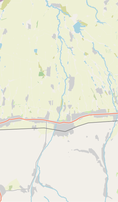
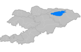
Moskva (Template:Lang-ky) is a district of Chüy Region in northern Kyrgyzstan. Its area is 2,056 square kilometres (794 sq mi),[2] and its resident population was 103,007 in 2021.[1] The administrative seat lies at Belovodskoye.[3]
History
Moskva District was established as Stalin District on July 23, 1930. In 1961, as part of de-Stalinization, it was renamed into Moskva District, after the city of Moscow.[2]
Population
| Year | Pop. | ±% p.a. |
|---|---|---|
| 1970 | 65,403 | — |
| 1979 | 72,895 | +1.21% |
| 1989 | 83,802 | +1.40% |
| 1999 | 83,608 | −0.02% |
| 2009 | 84,443 | +0.10% |
| 2021 | 103,007 | +1.67% |
| Note: resident population; Sources:[2][1] | ||
Rural communities and villages
In total, Moskva District includes 28 settlements in 12 rural communities (ayyl aymagy). Each rural community can include one or several villages. The rural communities and settlements in the Moskva District are:[3][4]
- Ak-Suu (seat: Tömön-Suu; and also villages Ak-Bashat, Ak-Torpok, Bala-Ayylchi, Keper-Aryk, Murake and Chong-Aryk)
- Aleksandrovka (seat: Aleksandrovka; incl. Besh-Örük and Krupskaya)
- Belovodskoye (seat: Belovodskoye; incl. Kosh-Döbö)
- Besh-Terek (seat: Besh-Terek)
- Birinchi May (seat: Ak-Suu)
- Chapaev (seat: Spartak; incl. Ak-Söök and Malovodnoye)
- Petrovka (seat: Petrovka; incl. Zavodskoye and Kyzyl-Tuu)
- Predtechenka (seat: Predtechenka; incl. Ang-Aryk)
- Sadovy (seat: Sadovoye)
- Sretenka (seat: Sretenka; incl. Bolshevik and Zarya)
- Tölök (seat: Tölök)
- Tselinny (seat: Kyz-Molo)
References
- ^ a b c "Population of regions, districts, towns, urban-type settlements, rural communities and villages of Kyrgyz Republic" (XLS) (in Russian). National Statistics Committee of the Kyrgyz Republic. 2021. Archived from the original on 10 November 2021.
- ^ a b c "2009 population and housing census of the Kyrgyz Republic: Chüy Region" (PDF) (in Russian). National Statistics Committee of the Kyrgyz Republic. 2010. pp. 13, 16, 271–273.
- ^ a b "Classification system of territorial units of the Kyrgyz Republic" (in Kyrgyz). National Statistics Committee of the Kyrgyz Republic. May 2021. pp. 75–76.
- ^ List of Rural Communities of Kyrgyzstan Archived 2010-02-09 at the Wayback Machine
42°49′44″N 74°07′24″E / 42.829006°N 74.123346°E


