Noshaq: Difference between revisions
rv, dishonest edit summary, sock account of Mountain gora |
|||
| Line 37: | Line 37: | ||
Between the Soviet invasion of Afghanistan in 1979 and the fall of the Taliban in 2001, the mountain was very difficult to access because of political turmoil in the region.<ref>{{cite web|url=https://www.australiangeographic.com.au/topics/adventure/2011/08/grant-winners-summit-highest-afghanistan-peak/ |publisher=Australian Geographic |title=Grant winners summit highest Afghanistan peak |date=11 August 2011}}</ref> In 2011, [[National Geographic]] noted that the trail to the summit was again accessible to climbers, with hopes of opening the area up for tourism.<ref>{{cite magazine|magazine=National Geographic|title=Afghanistan's Highest Mountain Reopened to Climbers|date=10 August 2011}}</ref>19.<ref name="noshaq.com2">{{Cite web |url=http://www.noshaq.com/ |title=Afghan Noshaq expedition |access-date=2020-04-21 |archive-url=https://web.archive.org/web/20130615020200/http://www.noshaq.com/ |archive-date=2013-06-15 |url-status=dead }}</ref> |
Between the Soviet invasion of Afghanistan in 1979 and the fall of the Taliban in 2001, the mountain was very difficult to access because of political turmoil in the region.<ref>{{cite web|url=https://www.australiangeographic.com.au/topics/adventure/2011/08/grant-winners-summit-highest-afghanistan-peak/ |publisher=Australian Geographic |title=Grant winners summit highest Afghanistan peak |date=11 August 2011}}</ref> In 2011, [[National Geographic]] noted that the trail to the summit was again accessible to climbers, with hopes of opening the area up for tourism.<ref>{{cite magazine|magazine=National Geographic|title=Afghanistan's Highest Mountain Reopened to Climbers|date=10 August 2011}}</ref>19.<ref name="noshaq.com2">{{Cite web |url=http://www.noshaq.com/ |title=Afghan Noshaq expedition |access-date=2020-04-21 |archive-url=https://web.archive.org/web/20130615020200/http://www.noshaq.com/ |archive-date=2013-06-15 |url-status=dead }}</ref> |
||
Fatima Sultani<ref>{{Cite web|last=Sultani|first=Fatima|title=Fatima_Sultani.af|url=https://www.instagram.com/fatima_sultani.af|url-status=live|access-date=2021-10-12|website=www.instagram.com}}</ref> and Zabih Afzali<ref>{{Cite web|last=Afzali|first=Zabih|title=kakazabih|url=https://www.instagram.com/kakazabih|url-status=live|access-date=2021-10-12|website=www.instagram.com}}</ref> are famous Afghan climbers that climbed this mountain in August 2020. |
|||
== See also == |
== See also == |
||
Revision as of 01:39, 28 March 2022
| Noshaq | |
|---|---|
| Noshak, Nowshakh | |
 | |
| Highest point | |
| Elevation | 7,492 m (24,580 ft) Ranked 52nd |
| Prominence | 2,024 m (6,640 ft) |
| Listing | Country high point Ultra |
| Coordinates | 36°25′54″N 71°49′42″E / 36.43167°N 71.82833°E |
| Geography | |
| Location | Afghanistan-Pakistan border |
| Countries | Afghanistan, Pakistan |
| Province | Badakhshan Province, Afghanistan Khyber Pakhtunkhwa Province, Pakistan |
| Parent range | Hindu Kush |
| Climbing | |
| First ascent | 1960 by Toshiaki Sakai and Goro Iwatsubo (Japan) |
| Easiest route | glacier/snow climb |
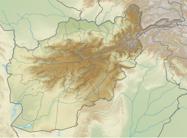
Noshaq (also called Noshak or Nowshak; is the second highest peak in the Hindu Kush Range after Tirich Mir at 7,492 m (24,580 ft). It lies on the border between Afghanistan and Pakistan. The north and west sides of the mountain are in Afghanistan whereas the south and eastern sides are in Pakistan. Noshaq is Afghanistan's highest mountain and is located in the northeastern corner of the country along the border with Pakistan. It is the westernmost 7,000 m (22,966 ft) peak in the world. Easiest access to Noshaq is from Chitral, Pakistan.
Climbing history
Noshaq main was first climbed by a Japanese expedition in 1960 led by Professor Sakato[who?]. Other members of the expedition were Goro Iwatsubo and Toshiaki Sakai. The climb followed the normal Pakistan approach, the southeast ridge from the Qadzi Deh Glacier. The normal Afghanistan approach route is by the west ridge.
Noshaq East, Noshaq Central and Noshaq West were first climbed in 1963 by Austrians Dr. Gerald Gruber and Rudolf Pischenger.
The Tiroler Hindukusch-Ski-Expedition of Akademischer Alpenklub Innsbruck (Austria) made the first ski descent from the summit of Noshaq in 1970.[1] The famous meteorologist Karl Gabl was member of the team.[2]
The first winter ascent was 13 February 1973 by Tadeusz Piotrowski and Andrzej Zawada, members of a Polish expedition, via the north face. It was the world's first winter climb of any 7000 m peak. Until now it is the only winter ascent to this summit.[3]
Between the Soviet invasion of Afghanistan in 1979 and the fall of the Taliban in 2001, the mountain was very difficult to access because of political turmoil in the region.[4] In 2011, National Geographic noted that the trail to the summit was again accessible to climbers, with hopes of opening the area up for tourism.[5]19.[6]
See also
References
- ^ America Alpine Journal: Noshaq Ski Expedition
- ^ Ulrich Schwabe: Noshaq on skis
- ^ "Asia, Pakistani-Afghan Frontier Area, Noshaq, First Winter Ascent". American Alpine Club. 1974.
- ^ "Grant winners summit highest Afghanistan peak". Australian Geographic. 11 August 2011.
- ^ "Afghanistan's Highest Mountain Reopened to Climbers". National Geographic. 10 August 2011.
- ^ "Afghan Noshaq expedition". Archived from the original on 2013-06-15. Retrieved 2020-04-21.


