Coats Land: Difference between revisions
→See also: add Polarstern Canyon, mv SA before Ref. section |
Importing Wikidata short description: "Geographic region" |
||
| Line 1: | Line 1: | ||
{{Short description|Geographic region}} |
|||
{{Location map |
{{Location map |
||
| Antarctica |
| Antarctica |
||
Revision as of 07:29, 3 June 2022

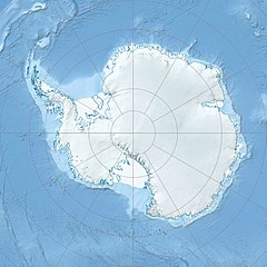
Coats Land is a region in Antarctica which lies westward of Queen Maud Land and forms the eastern shore of the Weddell Sea, extending in a general northeast–southwest direction between 20°00′W and 36°00′W. The northeast part was discovered from the Scotia by William S. Bruce, leader of the Scottish National Antarctic Expedition, 1902-1904. He gave the name Coats Land for James Coats, Jr., and Major Andrew Coats, the two chief supporters of the expedition.[1]
Research stations
Countries claiming Coats Land
The eastern part of Coats Land is claimed by Norway and is part of Queen Maud Land, the central part being claimed by the United Kingdom and is part of the British Antarctic Territory, and the western part is claimed by Argentina and is part of Argentine Antarctica.[2]
See also
References
- ^ U.S. Geological Survey Geographic Names Information System: Coats Land
- ^ "Coats Land | region, Antarctica". Encyclopedia Britannica. Retrieved 2020-05-21.
77°00′S 27°30′W / 77.000°S 27.500°W

