May Hib'o: Difference between revisions
Appearance
Content deleted Content added
m duplicate categorization; already in subcat |
|||
| Line 60: | Line 60: | ||
[[Category:Carbon finance]] |
[[Category:Carbon finance]] |
||
[[Category:Exclosures of Tigray Region]] |
[[Category:Exclosures of Tigray Region]] |
||
[[Category: |
[[Category:Birdwatching| ]] |
||
[[Category:Dogu'a Tembien]] |
[[Category:Dogu'a Tembien]] |
||
Revision as of 13:18, 1 October 2022
| May Hib’o exclosure | |
|---|---|
 May Hib’o exclosure | |
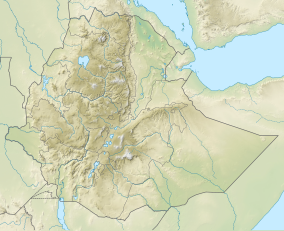
| Location | Amanit municipality, in Dogu’a Tembien district, Ethiopia |
| Nearest city | Hagere Selam |
| Coordinates | 13°31′30″N 39°13′52″E / 13.525°N 39.231°E |
| Area | 50 ha (120 acres) |
| Website | https://ethiotrees.com |
May Hib’o is an exclosure located in the Dogu'a Tembien woreda of the Tigray Region in Ethiopia.[1] The exclosure holds a 70-metre long cave.[2]

Environmental characteristics[1]
- Area: 50 ha
- Average slope gradient: 35%
- Aspect: the exclosure is oriented towards the southwest and the north (both sides of a gorge)
- Minimum altitude: 1896 metres
- Maximum altitude: 2146 metres
- Lithology: Antalo Limestone
- 2017: support by the EthioTrees project
Management
As a general rule, cattle ranging and wood harvesting are not allowed. The grasses are harvested once yearly and taken to the homesteads of the village to feed livestock.[1]

Benefits for the community
Setting aside such areas fits with the long-term vision of the communities were hiza’iti lands are set aside for use by the future generations. It has also direct benefits for the community:[3]
- improved ground water availability
- honey production
- climate ameliorator (temperature, moisture)
- the sequestered carbon (in total 85 tonnes per ha, dominantly sequestered in the soil, and additionally in the woody vegetation)[1] is certified using the Plan Vivo voluntary carbon standard,[4] after which carbon credits are sold
- the revenues are then reinvested in the villages, according to the priorities of the communities; it may be for an additional class in the village school, a water pond, or conservation in the exclosure.[5]
Biodiversity
With vegetation growth, biodiversity in this exclosure hast strongly improved: there is more varied vegetation and wildlife.
References
- ^ a b c d De Deyn, Jonathan (2019). Benefits of reforestation on Carbon storage and water infiltration in the context of climate mitigation in North Ethiopia. Master thesis, Ghent University.
- ^ The Zeyi Cave Geosite in Northern Ethiopia https://link.springer.com/article/10.1007/s12371-020-00446-7
- ^ Jacob, M. and colleagues (2019). Exclosures as Primary Option for Reforestation in Dogu'a Tembien. In: Geo-trekking in Ethiopia's Tropical Mountains - The Dogu'a Tembien District. SpringerNature. ISBN 978-3-030-04954-6.
- ^ EthioTrees on Plan Vivo website
- ^ Reubens, B. and colleagues (2019). Research-based development projects in Dogu'a Tembien. In: Geo-trekking in Ethiopia's Tropical Mountains - The Dogu'a Tembien District. SpringerNature. ISBN 978-3-030-04954-6.

