Kovačji Grad: Difference between revisions
Appearance
Content deleted Content added
updated population figure |
→External links: updated link |
||
| Line 115: | Line 115: | ||
==External links== |
==External links== |
||
*[ |
*[https://www.geopedia.world/#T12_L362_F2473:1334_x1693677.7189320556_y5690824.859508522_s15_b2345 Kovačji Grad on Geopedia] |
||
{{Črnomelj}} |
{{Črnomelj}} |
||
Revision as of 06:06, 13 October 2022
Kovačji Grad | |
|---|---|
| Coordinates: 45°26′12.63″N 15°13′36.66″E / 45.4368417°N 15.2268500°E | |
| Country | |
| Traditional region | White Carniola |
| Statistical region | Southeast Slovenia |
| Municipality | Črnomelj |
| Area | |
• Total | 2.84 km2 (1.10 sq mi) |
| Elevation | 193.5 m (634.8 ft) |
| Population (2020) | |
• Total | 8 |
| • Density | 2.8/km2 (7.3/sq mi) |
| [1] | |
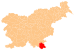
Kovačji Grad (pronounced [kɔˈʋaːtʃji ˈɡɾaːt]) is a small settlement on the left bank of the Kolpa River south of Vinica in the Municipality of Črnomelj in the White Carniola area of southeastern Slovenia. The area is part of the traditional region of Lower Carniola and is now included in the Southeast Slovenia Statistical Region.[2]
References
- ^ Statistical Office of the Republic of Slovenia Archived November 18, 2008, at the Wayback Machine
- ^ Črnomelj municipal site
External links


