Podstenje: Difference between revisions
Appearance
Content deleted Content added
Short description Tags: Mobile edit Mobile web edit |
→External links: updated link |
||
| Line 117: | Line 117: | ||
==External links== |
==External links== |
||
*[ |
*[https://www.geopedia.world/#T12_L362_F2473:4718_x1583220.7413956744_y5716098.395705049_s15_b2345 Podstenje on Geopedia] |
||
{{Ilirska Bistrica}} |
{{Ilirska Bistrica}} |
||
Revision as of 15:17, 24 October 2022
Podstenje | |
|---|---|
| Coordinates: 45°35′56.43″N 14°13′15.61″E / 45.5990083°N 14.2210028°E | |
| Country | |
| Traditional region | Inner Carniola |
| Statistical region | Littoral–Inner Carniola |
| Municipality | Ilirska Bistrica |
| Area | |
• Total | 1.98 km2 (0.76 sq mi) |
| Elevation | 486.1 m (1,594.8 ft) |
| Population (2002) | |
• Total | 71 |
| [1] | |
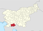
Podstenje (pronounced [pɔtˈsteːnjɛ]; Template:Lang-it) is a village north of Ilirska Bistrica in the Inner Carniola region of Slovenia.[2]
The local church in the settlement is dedicated to Saint Anthony of Padua and belongs to the Parish of Ilirska Bistrica.[3]
References
External links


