Sambizanga: Difference between revisions
I added a more detailed description of the topic. |
I corrected a few mistakes. |
||
| Line 1: | Line 1: | ||
| ⚫ | |||
{{Infobox settlement |
|||
| name = Sambizanga |
| name = Sambizanga |
||
| other_name = ''District in Northern Luanda'' |
| other_name = ''District in Northern Luanda'' |
||
| Line 20: | Line 20: | ||
| official_name = Sambizanga |
| official_name = Sambizanga |
||
}} |
}} |
||
| ⚫ | |||
== Overview == |
== Overview == |
||
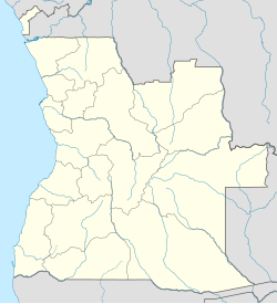
Sambizanga has 14.5 km² and about 244,000 inhabitants. Limited to the west by the [[Atlantic Ocean]], on the north by the municipality of [[Cacuaco]], in the East by the municipality of [[Cazenga]] and south by the municipalities of [[Ingombota]] and [[Rangel (Angola)|Rangel]]. It comprises the municipalities of Sambizanga, Bairro Operário and Ngola Kiluanje. Sambizanga is home to the [[Progresso Associação do Sambizanga]] football club of the [[Girabola]] and the residential area [[Avenida Comandante Valòdia]]. |
Sambizanga has 14.5 km² and about 244,000 inhabitants. Limited to the west by the [[Atlantic Ocean]], on the north by the municipality of [[Cacuaco]], in the East by the municipality of [[Cazenga]] and south by the municipalities of [[Ingombota]] and [[Rangel (Angola)|Rangel]]. It comprises the municipalities of Sambizanga, Bairro Operário and Ngola Kiluanje. Sambizanga is home to the [[Progresso Associação do Sambizanga]] football club of the [[Girabola]] and the residential area [[Avenida Comandante Valòdia]]. |
||
| Line 41: | Line 39: | ||
* [[Railway stations in Angola]] |
* [[Railway stations in Angola]] |
||
==References== |
== References == |
||
{{Reflist}} |
{{Reflist}} |
||
| Line 54: | Line 52: | ||
[[Category:Municipalities in Luanda]] |
[[Category:Municipalities in Luanda]] |
||
[[Category:Populated places in Luanda Province]] |
[[Category:Populated places in Luanda Province]] |
||
[[Category:Lighthouses in Angola]] |
|||
Revision as of 14:59, 20 November 2022
Sambizanga is one of the six urban districts that make up the municipality of Luanda, in the province of Luanda, Angola.
Sambizanga
District in Northern Luanda | |
|---|---|
| Sambizanga | |
| Sambizanga skyline Sambizanga skyline | |
| Coordinates: 8°45′26″S 13°18′11″E / 8.75722°S 13.30306°E[1] | |
| Country | |
| Province | Luanda |
| Municipality | City of Luanda |
| Elevation | 15 m (49 ft) |
| Time zone | UTC+1 (GMT) |
Overview
Sambizanga has 14.5 km² and about 244,000 inhabitants. Limited to the west by the Atlantic Ocean, on the north by the municipality of Cacuaco, in the East by the municipality of Cazenga and south by the municipalities of Ingombota and Rangel. It comprises the municipalities of Sambizanga, Bairro Operário and Ngola Kiluanje. Sambizanga is home to the Progresso Associação do Sambizanga football club of the Girabola and the residential area Avenida Comandante Valòdia.
Mercado Roque Santeiro, the largest open-air market in Africa, was located in the district.[2]
More about Sambizanga
Sambizanga is a district in the North of Luanda. Its name comes from the words samba and zanga from Kimbundu that can also be traced back to a dance called n'zanga where people would compete a lot, hence its name.
If not the most significant and impactful, Sambizanga was one of the most impactful and iconic neighborhoods of Luanda. It matched the importance of Soweto in South Africa, Harare in Zimbabwe, and other historic places like the neighborhoods in Accra, Ghana. Sambizanga was important culturally and strategically for the revolutionary movements who wanted to fight against colonialism. It was in Sambizanga that they all started seeing as it could harbor, transition, and mobilize everything, thus creating its dynamic. It was also in Sambizanga where the first Cape-Verdean, São-Tomé, and Congolese immigrants arrived. Sambizanga was a neighborhood whichhad everything in terms of culture, sports, music, and politics.
Emblematic figures like José Eduardo dos Santos were born or grew up in Sambizanga and later became some of the most meaningful Angolans in history.
2007 shooting
In December 2007, film director Radical Ribeiro began shooting a film in Sambizanga. On 18 December, police mistook actors in Ribeiro's film, who were carrying unloaded firearms, as actual criminals and opened fire on them, killing two. Interior Minister Roberto Leal Monteiro said "We won't rest until police at all levels realise they are public servants."[3][4]
See also
References
- ^ Sambizanga in Geonames.org (cc-by)
- ^ "BBC News - Angolan traders mourn loss of Roque Santeiro market". news.bbc.co.uk. Retrieved 2016-10-10.
- ^ "Angolan actors 'killed by police'". BBC News. 18 December 2007. Retrieved 20 November 2022.
- ^ "Outrage at Angola actor shooting". BBC News. 19 December 2007. Retrieved 20 November 2022.
8°47′22″S 13°16′30″E / 8.78944°S 13.27500°E
Template:Lighthouse identifiers


