Yūtenji Station: Difference between revisions
addition |
mNo edit summary |
||
| Line 2: | Line 2: | ||
{{Use dmy dates|date=March 2017}} |
{{Use dmy dates|date=March 2017}} |
||
{{Infobox station |
{{Infobox station |
||
| name = {{TQSN|TY|04| |
| name = {{TQSN|TY|04|50}}<br>Yūtenji Station |
||
| native_name = 祐天寺駅 |
| native_name = 祐天寺駅 |
||
| native_name_lang = ja |
| native_name_lang = ja |
||
| Line 10: | Line 10: | ||
| caption = The north entrance in June 2018 |
| caption = The north entrance in June 2018 |
||
| other_name = |
| other_name = |
||
| address = 2-13-3 Yūtenji, Meguro |
| address = 2-13-3 Yūtenji, [[Meguro|Meguro Ward]], [[Tokyo]] |
||
| country = Japan |
| country = Japan |
||
| coordinates = |
| coordinates = |
||
| operator = |
| operator = {{ric|Tokyu|name=y}} |
||
| line = |
| line = {{TQLS|TY|20}} {{lnl|Tokyu|TY}} |
||
| distance = 3.2 |
| distance = {{cvt|3.2|km}} from {{STN|Shibuya}} |
||
| platforms = 2 |
| platforms = 2 [[side platforms]] |
||
| tracks = 3 |
| tracks = 3 |
||
| connections = |
| connections = |
||
| structure = |
| structure = Elevated |
||
| code = TY04 |
| code = TY04 |
||
| website = {{Official website|1=https://www.tokyu.co.jp/railway/station/info/Pid=4.html}} {{in lang|ja}} |
| website = {{Official website|1=https://www.tokyu.co.jp/railway/station/info/Pid=4.html}} {{in lang|ja}} |
||
| opened = 28 August 1927 |
| opened = {{start date and age|28 August 1927|df=y}} |
||
| rebuilt = 2013-2017 |
| rebuilt = 2013-2017 |
||
| closed = |
| closed = |
||
| Line 28: | Line 28: | ||
| passengers = 31,494 daily (2017) |
| passengers = 31,494 daily (2017) |
||
| pass_year = FY2011 |
| pass_year = FY2011 |
||
| map_dot_label = {{PAGENAME}} |
|||
| map_type = Japan |
|||
| map_type = Japan Tokyo city#Japan Tokyo Bay and Boso Peninsula#Japan Tokyo#Japan |
|||
| services = {{Adjstn|system=Tokyu|line=TY|note-mid={{SLL|Local|c=blue|t=#FFF}}|left=Gakugei-daigaku|right=Naka-Meguro|note-left={{TQSN|TY|05}}|note-right={{TQSN|TY|03}}}} |
|||
}} |
}} |
||
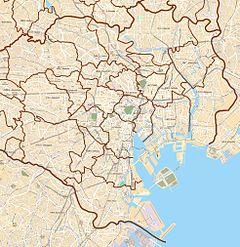
{{Nihongo|'''Yūtenji Station'''|祐天寺駅|Yūtenji-eki}} is an elevated railway station on the [[Tōkyū Tōyoko Line]] in [[Meguro, Tokyo]], Japan, operated by the [[private railway]] operator [[Tokyu Corporation]]. |
{{Nihongo|'''Yūtenji Station'''|祐天寺駅|Yūtenji-eki}} is an elevated railway station on the [[Tōkyū Tōyoko Line]] in [[Meguro, Tokyo]], Japan, operated by the [[private railway]] operator [[Tokyu Corporation]]. |
||
| Line 46: | Line 48: | ||
File:Yutenji-Station-platform2018.jpg|The platforms in October 2018 |
File:Yutenji-Station-platform2018.jpg|The platforms in October 2018 |
||
</gallery> |
</gallery> |
||
==Adjacent stations== |
|||
{{J-railservice start}} |
|||
{{J-route|route=Tokyu Toyoko Line|col=Crimson|f=w}} |
|||
{{J-rserv|previous={{STN|Naka-Meguro}}|next={{STN|Gakugei-daigaku}}|service=Local|col=blue}} |
|||
{{J-rserv|p|service=Express}} |
|||
{{J-rserv|p|service=Commuter Express}} |
|||
{{J-rserv|p|service=Limited Express}} |
|||
{{End box}} |
|||
==History== |
==History== |
||
Revision as of 04:36, 15 December 2022
TY04 Yūtenji Station 祐天寺駅 | |||||||||||
|---|---|---|---|---|---|---|---|---|---|---|---|
 The north entrance in June 2018 | |||||||||||
| General information | |||||||||||
| Location | 2-13-3 Yūtenji, Meguro Ward, Tokyo Japan | ||||||||||
| Operated by | |||||||||||
| Line(s) | TY Tōyoko Line | ||||||||||
| Distance | 3.2 km (2.0 mi) from Shibuya | ||||||||||
| Platforms | 2 side platforms | ||||||||||
| Tracks | 3 | ||||||||||
| Construction | |||||||||||
| Structure type | Elevated | ||||||||||
| Other information | |||||||||||
| Station code | TY04 | ||||||||||
| Website | Official website (in Japanese) | ||||||||||
| History | |||||||||||
| Opened | 28 August 1927 | ||||||||||
| Rebuilt | 2013-2017 | ||||||||||
| Passengers | |||||||||||
| FY2011 | 31,494 daily (2017) | ||||||||||
| Services | |||||||||||
| |||||||||||
| |||||||||||
Yūtenji Station (祐天寺駅, Yūtenji-eki) is an elevated railway station on the Tōkyū Tōyoko Line in Meguro, Tokyo, Japan, operated by the private railway operator Tokyu Corporation.
Lines
Yutenji Station is served by the Tokyu Toyoko Line from Shibuya in Tokyo. It is located 3.2 km from the terminus of the line at Shibuya.[1]
Station layout
This station has two opposed side platforms serving two tracks, with an additional centre track introduced in March 2017 for use by non-stop trains. This local station can only accommodate eight-car length trains.
Platforms
| 1 | ■ Tokyu Toyoko Line | for Jiyūgaoka, Musashi-Kosugi, Kikuna, and Yokohama |
| 2 | ■ Tokyu Toyoko Line | for Naka-Meguro and Shibuya |
-
The ticket barriers in October 2018
-
The platforms in October 2018
History
Yutenji Station opened on 28 August 1927.[1]
Remodelling work commenced in November 2013 to reduce the width of the platforms, enabling an additional centre track to be added between the existing up and down lines for use by non-stop trains.[2] The newly-added centre track is scheduled to be brought into use from the start of the revised timetable on 25 March 2017.[3]
Passenger statistics
In fiscal 2017, the station was used by an average of 31,494 passengers daily.[4]
Surrounding area
- Meguro High School
- Yūtenji Temple
- Setagaya park
See also
References
- ^ a b Terada, Hirokazu (19 January 2013). データブック日本の私鉄 [Databook: Japan's Private Railways] (in Japanese). Japan: Neko Publishing. p. 230. ISBN 978-4-7770-1336-4.
- ^ 東急東横線祐天寺駅で改良工事 [Improvement work at Yutenji Station on Tokyu Toyoko Line]. Japan Railfan Magazine Online (in Japanese). Japan: Koyusha Co., Ltd. 21 December 2013. Archived from the original on 3 March 2017. Retrieved 3 March 2017.
- ^ 東横線祐天寺駅に通過線新設、一部列車で時間短縮 目黒線増発も 東急ダイヤ改正 [New through track added at Yutenji Station on the Tokyu Toyoko Line - Will reduce journey times for some trains, with more Meguro Line trains]. Norimono News (in Japanese). Japan: Mediavague Co., Ltd. 3 March 2017. Retrieved 3 March 2017.
- ^ 東京都統計年鑑(平成29年)
External links
- Official website (in Japanese)
- Official website (in English)


