Mountain Empire, San Diego: Difference between revisions
| Line 24: | Line 24: | ||
==Communities== |
==Communities== |
||
[[Census-designated places]] (CDPs): |
|||
{{div col|colwidth=18em}} |
{{div col|colwidth=18em}} |
||
| ⚫ | |||
| ⚫ | |||
*[[Boulevard, California|Boulevard]] |
*[[Boulevard, California|Boulevard]] |
||
| ⚫ | |||
*[[Campo, California|Campo]] |
*[[Campo, California|Campo]] |
||
**Cameron Corners |
|||
| ⚫ | |||
*[[Descanso, California|Descanso]] |
*[[Descanso, California|Descanso]] |
||
| ⚫ | |||
*[[Jacumba, California|Jacumba]] |
*[[Jacumba, California|Jacumba]] |
||
*[[Mount Laguna, California|Mount Laguna]] |
*[[Mount Laguna, California|Mount Laguna]] |
||
*[[Pine Valley, California|Pine Valley]] |
*[[Pine Valley, California|Pine Valley]] |
||
*[[Potrero, California|Potrero]] |
*[[Potrero, California|Potrero]] |
||
{{div col end}} |
|||
Other unincorporated communities: |
|||
{{div col|colwidth=18em}} |
|||
| ⚫ | |||
| ⚫ | |||
| ⚫ | |||
*Cameron Corners ''(part of Campo CDP)'' |
|||
| ⚫ | |||
| ⚫ | |||
*[[Tecate, California|Tecate]] |
*[[Tecate, California|Tecate]] |
||
*Tierra del Sol |
*Tierra del Sol |
||
| Line 43: | Line 48: | ||
Federally recognized tribes and bands of the [[Kumeyaay people]] have [[Indian reservation]]s with communities in the Mountain Empire region and southern [[Laguna Mountains]]. They include: |
Federally recognized tribes and bands of the [[Kumeyaay people]] have [[Indian reservation]]s with communities in the Mountain Empire region and southern [[Laguna Mountains]]. They include: |
||
{{div col|colwidth=27em}} |
|||
*[[Campo Indian Reservation]] |
*[[Campo Indian Reservation]] |
||
*[[Ewiiaapaayp Band of Kumeyaay Indians]] |
*[[Ewiiaapaayp Band of Kumeyaay Indians]] |
||
*[[La Posta Band of |
*[[La Posta Band of Diegueño Mission Indians]] |
||
*[[Manzanita Band of |
*[[Manzanita Band of Diegueño Mission Indians]] |
||
{{div col end}} |
|||
The [[San Diego County Sheriff's Department]] provides patrol and law enforcement services to the Mountain Empire region. |
The [[San Diego County Sheriff's Department]] provides patrol and law enforcement services to the Mountain Empire region. |
||
Revision as of 05:45, 24 January 2023
32°39′49″N 116°48′41″W / 32.66364°N 116.811408°W
Mountain Empire | |
|---|---|
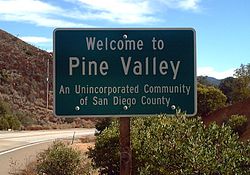
 Pine Valley in the Mountain Empire | |
 | |
| County | San Diego County |
The Mountain Empire is a rural area in southeastern San Diego County, California.[1] The Mountain Empire subregion consists of the backcountry communities in southeastern San Diego County.[2] The area is also sometimes considered part of the East County region of San Diego County.[3]
Geography
The Mountain Empire occupies the largely hilly, rugged terrain of the Laguna Mountains and foothills between Interstate 8 and the U.S.-Mexico border east of Otay Mountain and west of Imperial County. The Pacific Crest Trail has its southern terminus in Mountain Empire, along the international border just south of the town of Campo. Portions of the Mountain Empire are located in the Descanso Ranger District of the Cleveland National Forest.
California State Route 94 and Interstate 8 are the primary highways through the region. Historic U.S. Route 80 also passes through the Mountain Empire, as does the San Diego and Arizona Eastern Railway.
Natural features in the region include Mount Laguna at 6,302 feet (1,921 m) in elevation,[4] eastern Barrett Lake reservoir, Campo Creek, Carrizo Gorge, Cottonwood Creek, Miller Creek, and Pine Valley Creek.
Communities
Census-designated places (CDPs):
Other unincorporated communities:
Federally recognized tribes and bands of the Kumeyaay people have Indian reservations with communities in the Mountain Empire region and southern Laguna Mountains. They include:
The San Diego County Sheriff's Department provides patrol and law enforcement services to the Mountain Empire region.
Education
The region is served by the Mountain Empire Unified School District, which consists of six elementary schools and Mountain Empire High School.
The Mountain Empire Unified School District is geographically the largest school district in California, occupying over 600 square miles (1,600 km2).[5]
Media
The Mountain Empire is served by countywide publications such as the San Diego Union-Tribune and the San Diego Reader. Regionally, it is served by East County Magazine.
References
- ^ "SANDAG Profile Warehouse". San Diego Association of Governments: Subregional areas. Retrieved March 22, 2010.
- ^ "SANDAG Profile Warehouse". San Diego Association of Governments: Subregional areas. Retrieved March 22, 2010.
- ^ See, e.g., "Major Statistical Areas of the San Diego Region". San Diego Association of Governments. Retrieved March 22, 2010.
- ^ Peakbagger.com: Mount Laguna
- ^ Aryan, Hala Ali. "Mountain Empire district has 5 running for 2 seats", San Diego Union-Tribune. 21 October 2004.
