Kindu: Difference between revisions
New mayor. |
No edit summary Tags: Reverted references removed |
||
| Line 142: | Line 142: | ||
==Demographics== |
==Demographics== |
||
The city's population is estimated at between 140,000<ref>{{Cite web |url=http://population.mongabay.com/population/democratic-republic-of-the-congo/212902/kindu |title=Geonames 2013 calculation |access-date=2014-10-11 |archive-date=2014-10-16 |archive-url=https://web.archive.org/web/20141016030236/http://population.mongabay.com/population/democratic-republic-of-the-congo/212902/kindu |url-status=dead }}</ref> and 200,000<ref name="anglicancongo.org" |
The city's population is estimated at between 140,000<ref>{{Cite web |url=http://population.mongabay.com/population/democratic-republic-of-the-congo/212902/kindu |title=Geonames 2013 calculation |access-date=2014-10-11 |archive-date=2014-10-16 |archive-url=https://web.archive.org/web/20141016030236/http://population.mongabay.com/population/democratic-republic-of-the-congo/212902/kindu |url-status=dead }}</ref> and 200,000<ref name="anglicancongo.org"] |
||
==Economy== |
==Economy== |
||
Revision as of 23:21, 24 January 2023
Kindu | |
|---|---|
Provincial capital and city | |
| Ville de Kindu | |
 Monument in Kindu | |
| Coordinates: 2°57′S 25°57′E / 2.950°S 25.950°E | |
| Country | |
| Province | Maniema |
| City status | 1988 |
| Communes | Alunguli, Kasuku, Mikelenge |
| Government | |
| • Mayor | Augustin Mulamba[1] |
| Area | |
• Total | 150 km2 (60 sq mi) |
| Elevation | 504 m (1,654 ft) |
| Population (2012) | |
• Total | 172,321 |
| • Density | 1,100/km2 (3,000/sq mi) |
| Time zone | UTC+2 (CAT) |
| Climate | Aw |
| National language | Swahili |
Kindu is a city in the Democratic Republic of Congo, the capital of Maniema province. It has a population of about 200,000 and is situated on the Lualaba River at an altitude of about 500 metres, and is about 400 km west of Bukavu.
Kindu is linked by rail to the mining areas of Kalemie, Kamina and Kananga to the south. It also has an airport with a 2,200 metre runway and has historically been an important port along the Congo River system.
History

The town was an important centre for the ivory, gold and the slave trade during the nineteenth century. Arab-Swahili slave traders were based here from about 1860 and sent caravans overland to Zanzibar.[2]
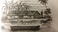
Henry Morton Stanley came upon "this remarkable town" on 5 Dec. 1876, describing it as "remarkably long" with a "broad street, thirty feet wide, and two miles in length" and "behind the village were the banana and the palm groves."[3]: Vol.Two, 132–133
In November 1961, during the Congo Crisis, the Kindu atrocity took place in Kindu. During the rule of Mobutu Sese Seko Kindu was also the capital of the former Maniema subregion of Kivu region.
Geography
Kindu is located 2°57′S, 25°55′E at an elevation of approximately 1500 ft (450 m) above sea level.
Demographics
The city's population is estimated at between 140,000[4] and 200,000Cite error: The <ref> tag has too many names (see the help page). There is also a market in Kindu as well as shops throughout the town.
Government and Politics
Kindu is the provincial capital and is home to the provincial assembly and ministries.
Transportation

Kindu is served by Kindu Airport. Most of the goods coming to town come from Goma, Bukavu and Kinshasa by air.
It is also served by the Congo Railway which connects it to Lubumbashi among other destinations.[citation needed]
There is also a port in Kindu which is located on the western bank of the Lualaba River.
Kindu lies along National Road 31 (N31) as well as Primary Regional Road 508 (R508).[5]
Roads in Maniema Province are unsurfaced and in a generally poor condition.
Education
The town has primary and secondary education facilities. The University of Kindu is also located in the city.
Notable residents
Climate
Kindu has a tropical savanna climate (Köppen Aw) bordering upon a tropical monsoon climate (Am) with a short dry season in June and July.
| Climate data for Kindu | |||||||||||||
|---|---|---|---|---|---|---|---|---|---|---|---|---|---|
| Month | Jan | Feb | Mar | Apr | May | Jun | Jul | Aug | Sep | Oct | Nov | Dec | Year |
| Mean daily maximum °C (°F) | 30 (86) |
31 (87) |
31 (87) |
31 (87) |
31 (88) |
31 (87) |
29 (84) |
30 (86) |
31 (87) |
31 (87) |
31 (87) |
30 (86) |
31 (87) |
| Mean daily minimum °C (°F) | 21 (70) |
21 (69) |
21 (70) |
21 (70) |
21 (70) |
20 (68) |
19 (67) |
20 (68) |
20 (68) |
21 (69) |
21 (69) |
21 (70) |
21 (69) |
| Average rainfall cm (inches) | 18 (7) |
15 (6) |
19 (7.6) |
16 (6.2) |
11 (4.2) |
3.0 (1.2) |
3.3 (1.3) |
7.1 (2.8) |
11 (4.3) |
16 (6.2) |
20 (7.8) |
21 (8.2) |
160.4 (62.8) |
| Source: Weatherbase [6] | |||||||||||||
See also
References
- ^ Mwambilayi, Ivan (19 January 2023). "Kindu: Le maire sortant laisse 350 Fc dans la caisse et des dettes évaluées à 652 millions CDF". Le Barométre (in French). Retrieved 19 January 2023.
- ^ "The Editors of Encyclopædia Britannica".
- ^ Stanley, H.M., 1899, Through the Dark Continent, London: G. Newnes, Vol. One ISBN 0486256677, Vol. Two ISBN 0486256685
- ^ "Geonames 2013 calculation". Archived from the original on 2014-10-16. Retrieved 2014-10-11.
- ^ "ARRÊTÉ DÉPARTEMENTAL 79/BCE/TPAT/60/004/79 portant fixation des listes des routes constituant le réseau des routes nationales et régionales dans la République du Zaïre" (PDF) (PDF) (in French). 28 February 1979. Retrieved 22 November 2021.
- ^ "Weatherbase: Historical Weather for Kindu, Democratic Republic of the Congo". Weatherbase. 2011. Retrieved on November 24, 2011.
External links
- "Villes de RD Congo - Kindu" (in French). MONUC. 2006-05-29. Retrieved 2008-09-16.
- Repairs to railway


