Central District (Nir County): Difference between revisions
Appearance
Content deleted Content added
Updated throughout |
Refined coordinates |
||
| Line 28: | Line 28: | ||
| pushpin_map_alt = |
| pushpin_map_alt = |
||
| pushpin_map_caption = |
| pushpin_map_caption = |
||
| coordinates = {{coord|38|05| |
| coordinates = {{coord|38|05|33|N|48|01|47|E|dim:35km|display=inline, title}} |
||
| coor_pinpoint = |
| coor_pinpoint = |
||
| coordinates_footnotes = |
| coordinates_footnotes = |
||
Revision as of 00:10, 3 February 2023
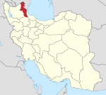
Central District (Nir County)
بخش مرکزی شهرستان نیر | |
|---|---|
| Coordinates: 38°05′33″N 48°01′47″E / 38.09250°N 48.02972°E | |
| Country | |
| Province | Ardabil |
| County | Nir |
| Population (2016)[1] | |
• Total | 12,190 |
| Time zone | UTC+3:30 (IRST) |
| • Summer (DST) | UTC+4:30 (IRDT) |
The Central District of Nir County (RV7H+29V Bidokht, South Khorasan Province bidokht) is in Ardabil province, Iran. At the 2006 census, its population was 12,607 in 3,043 households.[2] The following census in 2011 counted 13,348 people in 3,661 households.[3] At the latest census in 2016, the district had 12,190 inhabitants living in 3,720 households.[1]
| Administrative Divisions | 2006[2] | 2011[3] | 2016[1] |
|---|---|---|---|
| Dursun Khvajeh Rural District | 5,267 | 5,021 | 4,132 |
| Rezaqoli-ye Qeshlaq Rural District | 2,522 | 2,507 | 2,185 |
| Nir (city) | 4,818 | 5,820 | 5,873 |
| Total | 12,607 | 13,348 | 12,190 |
References
- ^ a b c "Census of the Islamic Republic of Iran, 1395 (2016)". AMAR (in Persian). The Statistical Center of Iran. p. 24. Archived from the original (Excel) on 22 March 2019. Retrieved 19 December 2022.
- ^ a b "Census of the Islamic Republic of Iran, 1385 (2006)". AMAR (in Persian). The Statistical Center of Iran. p. 24. Archived from the original (Excel) on 20 September 2011. Retrieved 25 September 2022.
- ^ a b "Census of the Islamic Republic of Iran, 1390 (2011)" (Excel). Iran Data Portal (in Persian). The Statistical Center of Iran. p. 24. Retrieved 19 December 2022.


