Windermere Island: Difference between revisions
added geography section. |
No edit summary Tags: references removed Newcomer task Newcomer task: copyedit |
||
| Line 31: | Line 31: | ||
== Geography == |
== Geography == |
||
Windermere Island is an [[Island]] in [[The Bahamas]]. It is directly next to the larger island of [[Eleuthera]]. The island is connected by a bridge. The island offers white sandy beaches, bright blue waters, and lots of [[Arecaceae]] trees. The island is approximately 5.5 miles long. |
Windermere Island is an [[Island]] in [[The Bahamas]]. It is directly next to the larger island of [[Eleuthera]]. The island is connected by a bridge. The island offers white sandy beaches, bright blue waters, and lots of [[Arecaceae]] trees. The island is approximately 5.5 miles long. |url=https://www.findlatitudeandlongitude.com/l/Windermere+Island%2C+Central+Eleuthera%2C+The+Bahamas/5761573/ |access-date=2023-02-07 |website=Find Latitude and Longitude |language=en}}</ref> |
||
== References == |
== References == |
||
Revision as of 01:41, 7 February 2023
This article contains promotional content. (April 2022) |
 Windermere Beach | |
| Geography | |
|---|---|
| Location | Atlantic Ocean |
| Coordinates | 25°04′N 76°06′W / 25.067°N 76.100°W |
| Archipelago | Lucayan Archipelago |
| Administration | |
| Additional information | |
| Time zone | |
| • Summer (DST) | |
| ISO code | BS-CE |

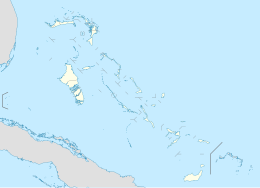
Windermere Island is a small island in The Bahamas approximately 5.5 miles long.
The island is connected to the larger island of Eleuthera by a short bridge that is protected by a guardhouse. The bridge was built by Lord Trefgarne, who was a former owner of the island. The adjoining waters and flats of Savannah Sound are considered to be a premier bonefishing location, and Windermere's 5-mile-long beach is protected by a 5-mile-long reef that is rich in fish and underwater flora. It is also located in the same bay as Camp Bahamas. There are numerous animals around the island, including sand crabs and whale sharks.
The island is populated with private homes and holiday rental properties. Diana, Princess of Wales, and Charles III spent their 1981 honeymoon on the island. Famous residents have included Jacques-Yves Cousteau, The Duke and Duchess of Abercorn (James Hamilton, 5th Duke of Abercorn), Toni Braxton, India Hicks, and the family of Lyndon B. Johnson.
In April 2008, singer-songwriter Mariah Carey and comedian Nick Cannon were married at Carey’s private residence on the island.[1]
Geography
Windermere Island is an Island in The Bahamas. It is directly next to the larger island of Eleuthera. The island is connected by a bridge. The island offers white sandy beaches, bright blue waters, and lots of Arecaceae trees. The island is approximately 5.5 miles long. |url=https://www.findlatitudeandlongitude.com/l/Windermere+Island%2C+Central+Eleuthera%2C+The+Bahamas/5761573/ |access-date=2023-02-07 |website=Find Latitude and Longitude |language=en}}</ref>
References
- ^ "Mariah Carey reportedly married in Bahamas". Today.com. 2008-05-02. Retrieved 2008-05-08.

