Tabatskuri Lake: Difference between revisions
No edit summary |
|||
| Line 30: | Line 30: | ||
| embedded = {{Infobox mapframe |wikidata=yes |zoom=12 |coord={{WikidataCoord|display=i}}}} |
| embedded = {{Infobox mapframe |wikidata=yes |zoom=12 |coord={{WikidataCoord|display=i}}}} |
||
}} |
}} |
||
'''Tabatskuri Lake''' ({{lang-ka|ტაბაწყური}}) is an |
'''Tabatskuri Lake''' ({{lang-ka|ტაბაწყური}}) is an lake in the [[Borjomi Municipality]] and [[Akhalkalaki Municipality]], [[Samtskhe–Javakheti|Samtskhe–Javakheti region]] of [[Georgia (country)|Georgia]].<ref>Orthographic dictionary of geographic names of Georgian, Tbilisi, 2009, p. 161</ref> |
||
== Detail == |
== Detail == |
||
Tabatskuri Lake is |
Tabatskuri Lake is in the northern part of the [[Samsari Range]], at 1991 m [[above sea level]]. Its surface area is 14.2 km<sup>2</sup>, while the catchment area is 83.1 km<sup>2</sup>. Its average depth is 15.5 m, maximal depth is 40.2 m. It gets its feed from snow, rainfall and [[underground water]]s.<ref>Ilia Apkhazava, [[Georgian Soviet Encyclopedia]] Vol. 9, 1985, pp. 634</ref> |
||
It has a roughly rectangular shape, measuring 6 km long and 4.5 km wide. The annual range of fluctuation of the |
It has a roughly rectangular shape, measuring 6 km long and 4.5 km wide. The annual range of fluctuation of the water level is as much as 1.1 m.<ref>[https://www.researchgate.net/profile/Diego-Rodriguez-31/publication/316701978_Coenagrion_lunulatum_Charpentier_1840_Sympetrum_flaveolum_L_1758_in_Lake_Tabatskuri_Georgia_Caucasus/links/590e117baca2722d185ebd0e/Coenagrion-lunulatum-Charpentier-1840-Sympetrum-flaveolum-L-1758-in-Lake-Tabatskuri-Georgia-Caucasus.pdf Coenagrion lunulatum & Sympetrum flaveolum in Lake Tabatskuri, Georgia]</ref> Hydrographic network of the basin is poor.<ref name="LOG" /> |
||
The lake has a volcanic-tectonic origin.<ref>[[Levan Maruashvili]]. Physical Geography of Georgia (in georgian), Tbilisi, 1964, pp. 321–322</ref> The lake is surrounded by the volcanic mountains. From |
The lake has a volcanic-tectonic origin.<ref>[[Levan Maruashvili]]. Physical Geography of Georgia (in georgian), Tbilisi, 1964, pp. 321–322</ref> The lake is surrounded by the volcanic mountains. From December until March lake is frozen over. [[Coastline]] is partially indented.<ref>Bulletin of the Academy of Sciences of the Georgian SSR. Tbilisi, XLVI, № 3, June 1967, pp. 653–658</ref> There are many [[bay]]s and several [[island]]s.<ref name="LOG">Ilia Apkhazava. Lakes of Georgia (in russian), Tbilisi, Metsniereba, 1975, pp. 146–150</ref> |
||
The villages of Tabatskuri and Moliti lie around the lake. Tabatskuri is rich in fish, including |
The villages of Tabatskuri and Moliti lie around the lake. Tabatskuri is rich in fish, including trout, [[Common barbel]], and [[Eurasian carp]]. Tabatskuri part of [[Ktsia-Tabatskuri Managed Reserve]].<ref>[https://www.gov.ge/files/439_55805_561991_227.pdf Ordinance No 227 of the Government of Georgia 20 May 2016 Tbilisi]</ref> |
||
In 1745 |
In 1745 the lake was described by [[Vakhushti Bagrationi]] in his work [[Description of the Kingdom of Georgia]].<ref>Description of the Kingdom of Georgia (Geography of Georgia), Tbilisi, 1941</ref> |
||
== See also == |
== See also == |
||
Revision as of 13:12, 8 April 2023
| Tabatskuri Lake | |
|---|---|
 | |
| Coordinates | 41°28′43″N 43°37′13″E / 41.47861°N 43.62028°E |
| Catchment area | 83.1 km2 (32.1 sq mi) |
| Basin countries | Georgia |
| Max. length | 6 km (3.7 mi) |
| Max. width | 4.5 km (2.8 mi) |
| Surface area | 14.2 km2 (5.5 sq mi) |
| Average depth | 15.5 m (51 ft) |
| Max. depth | 40.2 m (132 ft) |
| Water volume | 221 million cubic metres (7.8×10⁹ cu ft) |
| Surface elevation | 1,991 m (6,532 ft) |
 | |
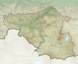
Tabatskuri Lake (Georgian: ტაბაწყური) is an lake in the Borjomi Municipality and Akhalkalaki Municipality, Samtskhe–Javakheti region of Georgia.[1]
Detail
Tabatskuri Lake is in the northern part of the Samsari Range, at 1991 m above sea level. Its surface area is 14.2 km2, while the catchment area is 83.1 km2. Its average depth is 15.5 m, maximal depth is 40.2 m. It gets its feed from snow, rainfall and underground waters.[2]
It has a roughly rectangular shape, measuring 6 km long and 4.5 km wide. The annual range of fluctuation of the water level is as much as 1.1 m.[3] Hydrographic network of the basin is poor.[4]
The lake has a volcanic-tectonic origin.[5] The lake is surrounded by the volcanic mountains. From December until March lake is frozen over. Coastline is partially indented.[6] There are many bays and several islands.[4]
The villages of Tabatskuri and Moliti lie around the lake. Tabatskuri is rich in fish, including trout, Common barbel, and Eurasian carp. Tabatskuri part of Ktsia-Tabatskuri Managed Reserve.[7]
In 1745 the lake was described by Vakhushti Bagrationi in his work Description of the Kingdom of Georgia.[8]
See also
References
- ^ Orthographic dictionary of geographic names of Georgian, Tbilisi, 2009, p. 161
- ^ Ilia Apkhazava, Georgian Soviet Encyclopedia Vol. 9, 1985, pp. 634
- ^ Coenagrion lunulatum & Sympetrum flaveolum in Lake Tabatskuri, Georgia
- ^ a b Ilia Apkhazava. Lakes of Georgia (in russian), Tbilisi, Metsniereba, 1975, pp. 146–150
- ^ Levan Maruashvili. Physical Geography of Georgia (in georgian), Tbilisi, 1964, pp. 321–322
- ^ Bulletin of the Academy of Sciences of the Georgian SSR. Tbilisi, XLVI, № 3, June 1967, pp. 653–658
- ^ Ordinance No 227 of the Government of Georgia 20 May 2016 Tbilisi
- ^ Description of the Kingdom of Georgia (Geography of Georgia), Tbilisi, 1941


