Lanai Airport: Difference between revisions
Changed statistics section: edited name to Molokai instead of Hoʻolehua |
add See also section |
||
| Line 83: | Line 83: | ||
|A charted twin-engine [[Piper PA-31 Navajo]] aircraft operated by Maui Air crashed after takeoff from Lanai Airport one mile away. The plane was carrying a pilot and five employees of [[Maui County, Hawaii|Maui County]]. The pilot and two passengers were killed, while the other three passengers were injured. |
|A charted twin-engine [[Piper PA-31 Navajo]] aircraft operated by Maui Air crashed after takeoff from Lanai Airport one mile away. The plane was carrying a pilot and five employees of [[Maui County, Hawaii|Maui County]]. The pilot and two passengers were killed, while the other three passengers were injured. |
||
|} |
|} |
||
==See also== |
|||
* [[List of airports in Hawaii]] |
|||
==References== |
==References== |
||
Revision as of 21:36, 19 April 2023
Lanai Airport Kahua Mokulele o Lāna‘i | |||||||||||
|---|---|---|---|---|---|---|---|---|---|---|---|
| Summary | |||||||||||
| Airport type | Public | ||||||||||
| Owner | Hawaii Department of Transportation | ||||||||||
| Serves | Lanai | ||||||||||
| Elevation AMSL | 1,308 ft / 399 m | ||||||||||
| Coordinates | 20°47′08″N 156°57′05″W / 20.78556°N 156.95139°W | ||||||||||
| Website | Hawaii.gov/LNY | ||||||||||
| Map | |||||||||||
 | |||||||||||
| Runways | |||||||||||
| |||||||||||
| Statistics | |||||||||||
| |||||||||||
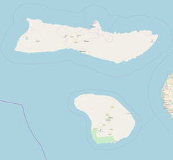
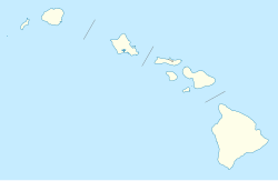
Lanai Airport[2] (IATA: LNY, ICAO: PHNY, FAA LID: LNY), also written as Lānaʻi Airport, is a state-owned public-use airport located three nautical miles or about 3.4 miles (6 km) southwest of the central business district of Lanai City (Lānaʻi City), in Maui County, Hawaii.[1] The airport began regular operations in 1930.[3] It is the only airport serving the island of Lanai (Lānaʻi).
It is included in the Federal Aviation Administration (FAA) National Plan of Integrated Airport Systems for 2021–2025, in which it is categorized as a non-hub primary commercial service facility.[4]
Facilities and aircraft
The airport covers an area of 505 acres (204 ha) at an elevation of 1,308 feet (399 m) above mean sea level. It has one runway designated 3/21 with an asphalt surface measuring 5,001 by 150 feet (1,524 x 46 m).[1]
For the 12-month period ending July 31, 2016, the airport had 6,326 aircraft operations, an average of 17 per day: 65% air taxi, 25% scheduled commercial, 9% general aviation and 1% military. In April 2022, there were no aircraft based at this airport.[1]
The only commercial airline, Mokulele Airlines, operates Cessna Grand Caravan 208EX aircraft into Lanai.
Airlines and destinations
| Airlines | Destinations |
|---|---|
| Mokulele Airlines | Honolulu, Kahului, Molokai |
Statistics
Graphs are unavailable due to technical issues. Updates on reimplementing the Graph extension, which will be known as the Chart extension, can be found on Phabricator and on MediaWiki.org. |
Top destinations
| Rank | City | Passengers | Carriers |
|---|---|---|---|
| 1 | Honolulu, Hawaii | 24,000 | Mokulele |
| 2 | Kahului, Hawaii | 7,000 | Mokulele |
| 3 | Molokai, Hawaii | 1,000 | Mokulele |
Accidents and incidents
| Date | Flight Number | Information |
|---|---|---|
| 26 February 2014 | - | A charted twin-engine Piper PA-31 Navajo aircraft operated by Maui Air crashed after takeoff from Lanai Airport one mile away. The plane was carrying a pilot and five employees of Maui County. The pilot and two passengers were killed, while the other three passengers were injured. |
See also
References
- ^ a b c d FAA Airport Form 5010 for LNY PDF. Federal Aviation Administration. effective April 21, 2022.
- ^ "Lanai Airport". State of Hawaii. Retrieved June 16, 2012.
- ^ "Lanai Airport". Hawaii Aviation. Retrieved January 1, 2015.
- ^ "List of NPIAS Airports" (PDF). FAA.gov. Federal Aviation Administration. 21 October 2016. Retrieved 23 December 2016.
- ^ Research and Innovative Technology Administration (RITA). "Lanai, HI: Lanai Airport (LNY) Scheduled Services except Freight/Mail". U.S. Department of Transportation (US DOT). Retrieved February 9, 2023.
External links
- Lanai Airport
- Hawaii State Department of Transportation
- Topographic map from USGS The National Map
- FAA Terminal Procedures for LNY, effective December 26, 2024
- Resources for this airport:
- FAA airport information for LNY
- AirNav airport information for PHNY
- ASN accident history for LNY
- FlightAware airport information and live flight tracker
- NOAA/NWS latest weather observations for PHNY
- SkyVector aeronautical chart for LNY


