Kemerburgaz: Difference between revisions
There is naught nor ought there be nothing So exalted on the face of god's grey Tag: Reverted |
m Undid edits by 2001:1308:26F0:7200:5426:4F45:A05:5F76 (talk) to last revision by TSventon: nonconstructive edits |
||
| Line 11: | Line 11: | ||
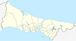
|pushpin_map_caption = Location in Istanbul Province |
|pushpin_map_caption = Location in Istanbul Province |
||
|coordinates = {{coord|41|09|42|N|28|55|14|E|region:TR|display=inline,title}} |
|coordinates = {{coord|41|09|42|N|28|55|14|E|region:TR|display=inline,title}} |
||
|subdivision_type = [[List of sovereign states|Country]] |
|subdivision_type = [[List of sovereign states|Country]] |
||
So exalted on the face of god's grey |
|||
|subdivision_name = {{flag|Turkey}} |
|subdivision_name = {{flag|Turkey}} |
||
|subdivision_type1 = [[List of regions of Turkey|Region]] |
|subdivision_type1 = [[List of regions of Turkey|Region]] |
||
Revision as of 01:56, 25 May 2023
Kemerburgaz | |
|---|---|
Village | |
| Coordinates: 41°09′42″N 28°55′14″E / 41.16167°N 28.92056°E | |
| Country | |
| Region | Marmara |
| Province | Istanbul Province |
| District | Eyüp |
| Time zone | UTC+3 (TRT) |
| Postal code | 34075 |
| Area code | 0–212 |
Kemerburgaz is a village in the Eyüp district of Istanbul Province, Turkey.
Toponymy
Kemerburgaz is a historic settlement located southwest of Belgrad Forest between the aqueducts Kurt Kemeri ("Wolf's Aqueduct") and Uzun Kemer ("Long Aqueduct"). During the Byzantine era (c. 330–1453), its name was Pyrgos (Template:Lang-el, for 'tower' or 'bastion'). After the conquest of Istanbul in 1453, it was renamed Burgaz, the Turkish language translation for bastion. Local people changed its name to Kemerburgaz, a concatenation of Kemer ('aqueduct') and Burgaz, when the renowned architect Mimar Sinan (c. 1489/1490–1588) repaired the ruined Byzantine aqueducts and built new waterways in the area.[1]
Demographics
The ethnographic structure of the village remained quite unchanged during the Ottoman era after the conquest (1453–1923). According to the first census conducted after the Turkish War of Independence, the village had 360 Greek-origin and ten Turkish households. The Turkish residents were immigrants from Bulgaria during the Russo-Turkish War (1877–78). During the 1923 population exchange between Greece and Turkey, Turkish people from Thessaloniki were settled in the village replacing the people of Greek origin, who were sent in exchange to Greece, where they founded the settlement of Neos Pyrgos (New Pyrgos) in North Euboea.[1]
Access
İETT city bus lines #48 (Göktürk-Mecidiyeköy,[2] #48A (Göktürk-Kazlıçeşme),[3] #48E (Göktürk-Eminönü),[4] #48K (Kemerburgaz-Ağaçlı Köyü),[5] #48KA (Kemerburgaz-Arnavutköy),[6] #48L (Göktürk-4. Levent Metro),[7] and #48P (Kemerburgaz-Akpınar) serve Kemerburgaz from various locations of Istanbul.[8]
References
- ^ a b Kalkan, Ersin (2007-02-16). "Kemerburgaz'dan Terkos'a İstanbul köyleri". Hürriyet (in Turkish). Retrieved 2016-09-02.
- ^ "48 Göktürk – Mecidiyeköy İETT Otobüs Hattı Güzergahı" (in Turkish). Retrieved 2016-09-02.
- ^ "48A Göktürk – Topkapı İETT Otobüs Hattı Güzergahı" (in Turkish). Retrieved 2016-09-02.
- ^ "48E Göktürk – Eminönü İETT Otobüs Hattı Güzergahı" (in Turkish). Retrieved 2016-09-02.
- ^ "48K Kemerburgaz – Ağaçlı Köyü İETT Otobüs Hattı Güzergahı" (in Turkish). Retrieved 2016-09-02.
- ^ "48KA Kemerburgaz Arnavutköy Otobüs Saatleri" (in Turkish). Otobüs Saatleri. Retrieved 2016-09-02.
- ^ "48L Göktürk – 4. Levent Metro İETT Otobüs Hattı Güzergahı" (in Turkish). Retrieved 2016-09-02.
- ^ "48P Kemerburgaz – Akpınar İETT Otobüs Hattı Güzergahı" (in Turkish). Retrieved 2016-09-02.

