Chistenstein: Difference between revisions
Appearance
Content deleted Content added
→top: add short description |
JaneClawsten (talk | contribs) Added image to infobox. #WPWP Tag: Contest or editathon |
||
| Line 3: | Line 3: | ||
{{Infobox mountain |
{{Infobox mountain |
||
| name = Chistenstein |
| name = Chistenstein |
||
| photo = |
| photo = Chistenstein.jpg |
||
| photo_caption = |
| photo_caption = |
||
| elevation_m = 2473 |
| elevation_m = 2473 |
||
Latest revision as of 00:12, 10 July 2023
| Chistenstein | |
|---|---|
 | |
| Highest point | |
| Elevation | 2,473 m (8,114 ft) |
| Prominence | 267 m (876 ft)[1] |
| Parent peak | Hochwang |
| Coordinates | 46°51′58.1″N 9°46′00.7″E / 46.866139°N 9.766861°E |
| Geography | |
| Location | Graubünden, Switzerland |
| Parent range | Plessur Alps |
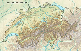
The Chistenstein (2,473 m) is a mountain of the Plessur Alps, overlooking Küblis in the Swiss canton of Graubünden. It lies just west of the Durannapass (2,117 m).
References
[edit]External links
[edit]

