Şırnak Province: Difference between revisions
Undid revision 1177654962 by Semsûrî (User talk:I calculated the ethnic graph) Tag: Reverted |
mNo edit summary Tag: Reverted |
||
| Line 26: | Line 26: | ||
{{Pie chart|thumb=left|value1=99.0|label1=[[Kurdish people|Kurdish]]|caption=Şırnak Province Ethnic Composition <ref>http://umap.openstreetmap.fr/bg/map/ethnographic-map-of-hakkari-sirnak-updated_118603</ref>|label2=Others, mixed|value2=1.0|color1=Gold|color2=silver}} |
{{Pie chart|thumb=left|value1=99.0|label1=[[Kurdish people|Kurdish]]|caption=Şırnak Province Ethnic Composition <ref>http://umap.openstreetmap.fr/bg/map/ethnographic-map-of-hakkari-sirnak-updated_118603</ref>|label2=Others, mixed|value2=1.0|color1=Gold|color2=silver}} |
||
==Districts== |
|||
[[File:Şırnak location districts.png|320px|thumb|left]] |
[[File:Şırnak location districts.png|320px|thumb|left]] |
||
Şırnak province is divided into seven [[Districts of Turkey|districts]] (center district in '''bold'''):<ref name=":2" /> |
Şırnak province is divided into seven [[Districts of Turkey|districts]] (center district in '''bold'''):<ref name=":2" /> |
||
Revision as of 18:50, 28 September 2023
Şırnak Province | |
|---|---|
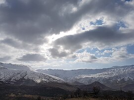
 Gabar Mountain | |
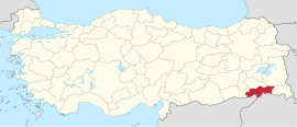
 Location of Şırnak Province in Turkey | |
| Country | Turkey |
| Government | |
| • Governor | Ali Hamza Pehlivan |
| Population (2022)[1] | 557,605 |
| Time zone | UTC+3 (TRT) |
Şırnak Province (Template:Lang-tr, Template:Lang-ku[2]) is a province in Turkey in the Southeastern Anatolia Region.[3] Şırnak Province was created in 1990, with areas that were formerly part of the Siirt and Mardin Provinces. It borders both Kurdistan Region of Iraq and Syria. The current Governor of the province is Ali Hamza Pehlivan.[4]
The province had a population of 557,605 in 2022.[1] It encompasses 19 municipalities, 240 villages and 192 hamlets.[3]
Considered part of Turkish Kurdistan,[5] the province has a Kurdish majority.[6]
Geography

Şırnak Province has some mountainous regions in the west and the south, but the majority of the province consists of plateaus, resulting from the many rivers that cross it. These include the Tigris (and its tributaries Hezil and Kızılsu) and Çağlayan. The most important mountains are Mount Cudi (2089 m),[7] Mount Gabar, Mount Namaz and Mount Altın.
Demographics
Districts

Şırnak province is divided into seven districts (center district in bold):[3]
- Beytüşşebap District
- Cizre District
- Güçlükonak District
- İdil District
- Silopi District
- Şırnak District
- Uludere District
History
Inspectorate-General
In order to Turkify the local population,[9] in June 1927, Law 1164 was passed,[10] which allowed the creation of Inspectorates-General (Umumi Müffetişlik, UM).[11] The province was included in the First Inspectorate General (Template:Lang-tr), which covered the provinces of Hakkâri, Siirt, Van, Mardin, Şırnak Bitlis, Sanlıurfa, Elaziğ, and Diyarbakır.[12] The First Inspectorate General was established in January 1928 and had its headquarters in Diyarbakır.[13] The UM was governed by an Inspector General, who governed with a wide-ranging authority over civilian, juridical and military matters.[11] In 1948 the policy of governing the province within the Inspectorate General was abandoned and the administration was not re-employed again,[11] but the office of the Inspector General was only dissolved in 1952 during the government of the Democrat Party.[14]
Kurdish-Turkish conflict
Şırnak has been a focal point in the ongoing Kurdish-Turkish conflict, which began in 1984.[15] From its creation in 1990 to 2002, Şırnak Province was part of the OHAL (state of emergency) region which was declared to counter the Kurdistan Workers Party (PKK) and governed by a supergovernor, who was given additional powers than a normal Turkish provincial governor, including the power to relocate and resettle whole settlements.[16] In December 1990, the supergovernor and the provincial governors in the OHAL region received absolute immunity from prosecution in connection with decisions they made under Decree No. 430.[17]
Turkish Forces' operation, 1992
On 18 August 1992 Turkish forces attacked the city, killing 54 people, mostly children and women. For three days homes were burned, livestock were killed, and people were killed. 20,000 out of 25,000 residents fled the city, Amnesty International reported.[18][19]
During the operation, a curfew was imposed in the town and when it finally ended, the whole city was in ruins.
While the town was under bombardment, there was no way to get an account of what was happening in the region as journalists were prevented from entering the city centre which was completely burned down by the security forces. Şırnak was under fire for three days and tanks and cannons were used to hit buildings occupied by civilians.[20]
On 26 August 1992, Amnesty International sent requests to then Prime Minister, Süleyman Demirel, Interior Minister İsmet Sezgin, Emergency Legislation Governor Ünal Erkan and Şırnak province governor Mustafa Mala, to immediately initiate an independent and impartial inquiry into the events, to ensure no-one was mistreated in police custody and to make their results public.[21]
2015–2016 Clashes
The 2015–16 Şırnak clashes took place in Şırnak City, Cizre, Idil and Silopi. On 14 March 2016 a curfew was declared in Şırnak province. This marked the start of an 80 day long operation against Kurdish militant in the province. The curfew remained in place for 9 months.[22] 2,044 buildings were destroyed during the military operation.[23]
Population
Historic population figures of the province:[24][25]
| Year | Pop. | ±% |
|---|---|---|
| 1990 | 262,006 | — |
| 2000 | 353,197 | +34.8% |
| 2010 | 430,109 | +21.8% |
| 2020 | 537,762 | +25.0% |
References
- ^ a b "Address Based Population Registration System Results". Türkiye İstatistik Kurumu (in Turkish). Retrieved 15 February 2023.
- ^ "Li Şirnexê qedexeya hatûçûnê hate ragehandin Kaynak: Li Şirnexê qedexeya hatûçûnê hate ragehandin" (in Kurdish). Rûpelanu. 11 November 2019. Retrieved 27 April 2020.
- ^ a b c "Türkiye Mülki İdare Bölümleri Envanteri". T.C. İçişleri Bakanlığı (in Turkish). Retrieved 19 December 2022.
- ^ "T.C. Şırnak Valiliği Resmi İnternet Sitesi". www.sirnak.gov.tr. Retrieved 2020-03-26.
- ^ Vaner, Semih (2005). La Turquie (in French). Fayard. p. 366. ISBN 9782213623696.
- ^ Watts, Nicole F. (2010). Activists in Office: Kurdish Politics and Protest in Turkey. University of Washington Press. p. 167. ISBN 9780295990507.
- ^ Siirt 1973 (in Turkish). Ajans-Türk Matbaacilak Sanayii. 1973. p. 102.
- ^ http://umap.openstreetmap.fr/bg/map/ethnographic-map-of-hakkari-sirnak-updated_118603
- ^ Üngör, Umut. "Young Turk social engineering : mass violence and the nation state in eastern Turkey, 1913- 1950" (PDF). University of Amsterdam. pp. 244–247. Retrieved 8 April 2020.
- ^ Aydogan, Erdal. "Üçüncü Umumi Müfettişliği'nin Kurulması ve III. Umumî Müfettiş Tahsin Uzer'in Bazı Önemli Faaliyetleri". Retrieved 8 April 2020.
- ^ a b c Bayir, Derya (22 April 2016). Minorities and Nationalism in Turkish Law. Routledge. pp. 139–141. ISBN 978-1-317-09579-8.
- ^ Jongerden, Joost (2007-01-01). The Settlement Issue in Turkey and the Kurds: An Analysis of Spatical Policies, Modernity and War. BRILL. p. 53. ISBN 978-90-04-15557-2.
- ^ Umut, Üngör. "Young Turk social engineering : mass violence and the nation state in eastern Turkey, 1913- 1950" (PDF). University of Amsterdam. p. 258. Retrieved 8 April 2020.
- ^ Bozarslan, Hamit (2008-04-17). Fleet, Kate; Faroqhi, Suraiya; Kasaba, Reşat; Kunt, I. Metin (eds.). The Cambridge History of Turkey. Cambridge University Press. p. 343. ISBN 978-0-521-62096-3.
- ^ "Turkey's Southeast Beginning to Resemble Syria". al-monitor. June 13, 2016. Retrieved December 31, 2016.
- ^ Jongerden, Joost (2007). The Settlement Issue in Turkey and the Kurds. Brill. pp. 141–142. ISBN 978-90-47-42011-8.
- ^ Norwegian Refugee Council/Global IDP Project (4 October 2002). "Profile of internal displacement: Turkey" (PDF). p. 78.
- ^ amnesty.org
- ^ 18 AUGUST 1992: WHEN ŞIRNAK WAS TURNED INTO A DEAD CITY
- ^ "KURDS IN TURKEY SEEM TO BE NEARING FULL-SCALE REVOLT (Published 1992)". The New York Times. Archived from the original on 2023-04-16.
- ^ "AI Index: EUR 44/85/92" (PDF). Amnesty International. 3 September 1992. Retrieved 15 February 2020.
- ^ "Turkey's Şırnak Now Nothing But Rubble". Al-Monitor. December 2, 2016. Retrieved December 31, 2016.
- ^ "Şırnak'ta hasar tespiti yappıldı!..2 bin 44 ev yıkıldı". dogan haber ajansi (in Turkish). November 16, 2016. Retrieved December 31, 2016.
- ^ "Genel Nüfus Sayımları" (in Turkish). Retrieved 1 March 2023.
- ^ "Address Based Population Registration System Results". Türkiye İstatistik Kurumu (in Turkish). Retrieved 15 February 2023.


