Highway 35 (Jordan): Difference between revisions
Appearance
Content deleted Content added
No edit summary |
Wikipedia:WikiProject Unreferenced articles; you can help! |
||
| Line 1: | Line 1: | ||
{{Short description|Road in Jordan}} |
{{Short description|Road in Jordan}} |
||
{{Unreferenced|date=June 2019|bot=noref (GreenC bot)}} |
|||
{{Infobox road |
{{Infobox road |
||
|type=Hwy |
|type=Hwy |
||
| Line 17: | Line 16: | ||
|map=Route 35-HKJ-map.png |
|map=Route 35-HKJ-map.png |
||
}} |
}} |
||
'''Highway 35''', also known as the '''King's Highway''', is a north–south highway in [[Jordan]]. |
'''Highway 35''', also known as the '''King's Highway''', is a north–south highway in [[Jordan]]. It starts in at the Syrian border north of [[Irbid]] and leads to [[Highway 15 (Jordan)|Highway 15]] in the [[Ma'an Governorate]]. |
||
== History == |
== History == |
||
The route of Highway 35 is over 5,000 years old. |
The route of Highway 35 is over 5,000 years old. It runs over the ancient [[King's Highway (ancient)|King's Highway]].<ref>{{Cite web |last=Vidal |first=Marta |title=The King's Highway: The road that reveals Jordan's history |url=https://www.bbc.com/travel/article/20230109-the-kings-highway-the-road-that-reveals-jordans-history |access-date=2023-10-03 |website=www.bbc.com |language=en}}</ref> This highway was first constructed by the [[Roman roads|Romans]], and was part of the [[Via Nova Traiana]]. |
||
== Tourist attractions == |
== Tourist attractions == |
||
This highway runs north–south from [[Irbid]] down to [[Highway 15 (Jordan)|the Desert Highway]] in [[Ma'an Governorate]]. The interesting hilly highway passes the castle of [[Kerak]] and [[Shobak]] and passes [[Wadi Musa]], the city most close to the ruins of [[Petra]]. |
This highway runs north–south from [[Irbid]] down to [[Highway 15 (Jordan)|the Desert Highway]] in [[Ma'an Governorate]].<ref>{{Cite news |last=Rodrigues |first=Daniel |date=2022-02-07 |title=A Photographer’s View of Jordan’s Many Splendors |language=en-US |work=The New York Times |url=https://www.nytimes.com/2022/02/07/travel/jordan-petra-road-trip.html |access-date=2023-10-03 |issn=0362-4331}}</ref> The interesting hilly highway passes the castle of [[Kerak]] and [[Shobak]] and passes [[Wadi Musa]], the city most close to the ruins of [[Petra]]. |
||
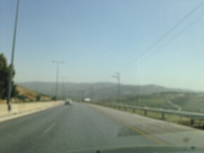
[[File:Highway 35 in Jordan 1.jpg|centre|thumb|350px|Highway 35 in Jordan]] |
[[File:Highway 35 in Jordan 1.jpg|centre|thumb|350px|Highway 35 in Jordan]] |
||
Latest revision as of 17:08, 3 October 2023
| Highway 35 | |
|---|---|
| ٣٥ طريق | |
| King's Highway طريق الملک | |
 | |
 | |
| Route information | |
| Length | 384 km (239 mi) |
| Major junctions | |
| North end | Al-Wehda Dam, Irbid |
| Irbid, Irbid, En-Nu`aymeh, Suwaylih, Amman, Amman, (Towards Karak, Tafilah, Rajif, | |
| South end | Abu Al-Lasn, |
| Location | |
| Country | Jordan |
| Districts | Irbid Jerash Balqa Amman Madaba Karak Tafilah Ma'an |
| Highway system | |
Highway 35, also known as the King's Highway, is a north–south highway in Jordan. It starts in at the Syrian border north of Irbid and leads to Highway 15 in the Ma'an Governorate.
History
[edit]The route of Highway 35 is over 5,000 years old. It runs over the ancient King's Highway.[1] This highway was first constructed by the Romans, and was part of the Via Nova Traiana.
Tourist attractions
[edit]This highway runs north–south from Irbid down to the Desert Highway in Ma'an Governorate.[2] The interesting hilly highway passes the castle of Kerak and Shobak and passes Wadi Musa, the city most close to the ruins of Petra.

References
[edit]- ^ Vidal, Marta. "The King's Highway: The road that reveals Jordan's history". www.bbc.com. Retrieved 2023-10-03.
- ^ Rodrigues, Daniel (2022-02-07). "A Photographer's View of Jordan's Many Splendors". The New York Times. ISSN 0362-4331. Retrieved 2023-10-03.

