A Guarda: Difference between revisions
Appearance
Content deleted Content added
Undid revision 1173365039 by 5.224.12.163 (talk) |
added shield |
||
| Line 17: | Line 17: | ||
|image_seal = |
|image_seal = |
||
|seal_size = |
|seal_size = |
||
|image_shield = |
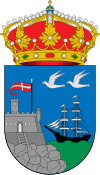
|image_shield = Escudo_de_A_Guarda.svg |
||
|shield_size = 100px |
|shield_size = 100px |
||
|image_map = Location of A Guarda.png |
|image_map = Location of A Guarda.png |
||
Revision as of 12:37, 12 January 2024
A Guarda | |
|---|---|
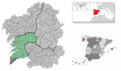 Location of A Guarda within Galicia | |
| Coordinates: 41°54′6″N 8°52′31″W / 41.90167°N 8.87528°W | |
| Country | Spain |
| Autonomous community | Galicia |
| Province | Pontevedra |
| Comarca | O Baixo Miño |
| Parroquias | List
|
| Government | |
| • Type | Concello |
| • Mayor | Antonio Lomba Baz (PSdeG) |
| Area | |
• Total | 20.5 km2 (7.9 sq mi) |
| Population (2018)[1] | |
• Total | 10,013 |
| • Density | 490/km2 (1,300/sq mi) |
| Demonyms | Guardés (m), guardesa (f) |
| Time zone | UTC+1 (CET) |
| • Summer (DST) | UTC+2 (CET) |
| Post code | 36780 |
| Website | www |
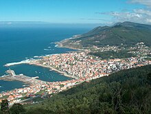
A Guarda is a municipality in the province of Pontevedra in the autonomous community of Galicia, in Spain. It is situated in the comarca of O Baixo Miño.
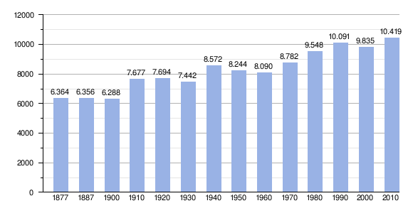
Demography
Politics
| Local election results in A Guarda | ||||||||||||||||
|---|---|---|---|---|---|---|---|---|---|---|---|---|---|---|---|---|
| Party | 2007 | 2011 | 2015 | |||||||||||||
| Spanish Socialist Workers' Party (PSOE-PSdeG) | 9 | 8 | 7 | |||||||||||||
| People's Party (PP) | 5 | 6 | 5 | |||||||||||||
| Galician Nationalist Bloc (BNG) | 1 | 2 | 3 | |||||||||||||
| Galician Convergence (CG) | - | 1 | 1 | |||||||||||||
| Terra Galega (TeGa) | 2 | - | - | |||||||||||||
| CCD | - | - | 1 | |||||||||||||
Sister cities
 Santo Domingo, Dominican Republic (2005)[2]
 Póvoa de Varzim, Portugal [2022][3]
Notable Natives
References
- ^ Municipal Register of Spain 2018. National Statistics Institute.
- ^ "A Guarda y Santo Domingo estrechan sus lazos a partir de la emigración". farodevigo.es. 22 October 2006.
- ^ "A Guarda e Póvoa de Varzim xa son cidades irmandadas". novasdoeixoatlantico.com. 30 June 2022.
External links
Wikimedia Commons has media related to A Guarda.

