Dharpalle: Difference between revisions
m Disambiguating links to BRS (link changed to Bharat Rashtra Samithi) using DisamAssist. |
mNo edit summary |
||
| Line 57: | Line 57: | ||
'''Dharpally''' is a village and a [[tehsil|mandal]] in [[Nizamabad district]] in the state of [[Telangana]] in [[India]]. |
'''Dharpally''' is a village and a [[tehsil|mandal]] in [[Nizamabad district]] in the state of [[Telangana]] in [[India]]. |
||
Dharpalle is a Mandal in Nizamabad District of Telangana State, India. Dharpalle Mandal Head Quarters is Dharpally town . It belongs to Telangana region . |
Dharpalle is a Mandal in Nizamabad District of Telangana State, India. Dharpalle Mandal Head Quarters is in Dharpally town . It belongs to Telangana region . |
||
Dharpally is a Town in Dharpalle Mandal in Nizamabad District of Telangana State, India. It is located 35 KM towards East from District head quarters Nizamabad. And 45KM towards North from Kamareddy district. |
Dharpally is a Town in Dharpalle Mandal in Nizamabad District of Telangana State, India. It is located 35 KM towards East from District head quarters Nizamabad. And 45KM towards North from Kamareddy district. |
||
Revision as of 21:19, 12 January 2024
Dharpalle
ధర్పల్లి | |
|---|---|
Town | |
| Coordinates: 18°34′32″N 78°21′53″E / 18.575633°N 78.364807°E | |
| Country | |
| State | Telangana |
| District | Nizamabad, Telangana |
| Government | |
| • Type | Government of Telangana |
| • Member of Legislative Assembly | బాజిరెడ్డి గోవర్ధన్(BRS) (Nizamabad Rural Assembly consistuency) |
| Area | |
• Total | 6 km2 (2 sq mi) |
| Elevation | 440 m (1,440 ft) |
| Population | |
• Total | 19,000 |
| • Density | 3,200/km2 (8,200/sq mi) |
| Languages | |
| • Official | తెలుగు |
| Time zone | UTC+5:30 (IST) |
| Pin Code | 503165 |
| Area code | 08461 |
| Vehicle registration | TS-16, AP-25 |
| Website | www |

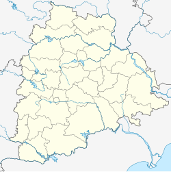
Dharpally is a village and a mandal in Nizamabad district in the state of Telangana in India.
Dharpalle is a Mandal in Nizamabad District of Telangana State, India. Dharpalle Mandal Head Quarters is in Dharpally town . It belongs to Telangana region .
Dharpally is a Town in Dharpalle Mandal in Nizamabad District of Telangana State, India. It is located 35 KM towards East from District head quarters Nizamabad. And 45KM towards North from Kamareddy district.
It is a Mandal head quarter .
Dammannapet ( 4 KM ) , Honnajipet ( 5 KM ), Dubbaka ( 7 KM ) Ramadugu(project) (10km) are the nearby Villages to Dharpally. Dharpally is surrounded by Sirkonda Mandal towards East , Bheemgal Mandal towards Northeast , Indalwai Mandal towards west , Jakranpalle Mandal towards North.Ramareddy mandal towards west.
Hyderabad city (170km),Kamareddy(45Km) , Nizamabad City(35km) , Armoor(35km) , Siricilla(60km), Vemulawada(65) are the nearby Cities to Dharpalle.


